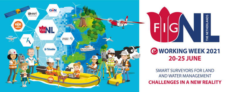
It was our pleasure to welcome you to the FIG e-Working Week 2021. We look back at a succesfull event, thanks to your enthusiasm!
We hope that you enjoyed it just as much we did and feel inspired and (re)connected. We hope you had the opportunity to catch up with friends and colleagues and made new contacts.
On behalf of FIG, LOC and our sponsors we would like to offer you a digital conference bag.
This event bag is full with videos, links, vouchers, leaflets and recordings.
Enjoy and we hope to see you soon!
 |
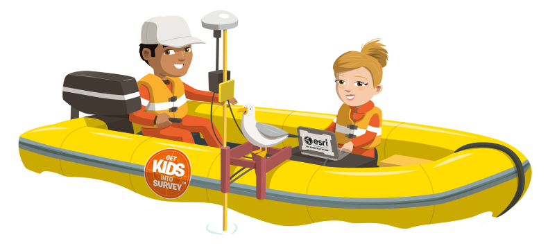
Get Kids Into Survey: encourage kids into surveying. FIG President, Rudolf Staiger (left) and the surveyor (right) are hiding something. Click, print, colour and share.
|
 |
 |
On behalf of Esri we are happy to share with you the ArcGIS and Land Administration white paper. Scan the QR code - please click on the banner.
|
|
Enjoy the session Trimble Business Center (TBC) at the epicenter of all of your surveying operations
|
 |
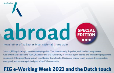
KadasterKadaster International publises each month their magazine Abroad. Last months edition focused on Kadaster and their contribution for the FIG e-Working Week 2021. Interested in Abroad une 2021, the newsletter of Kadaster International? Click on the photo on the right.
|
 |
|
A thank you for attending the e-Working Week 2021 from Leica Geosystems.
|
.jpg) |

|
|
|
|
- manufacturer of boundary piles from recycled plastic - wants to say thank you! |
INTERGEO 2021 goes HYBRID - DVW invites you to the event for future-oriented geo applications from September 21 to 23, 2021.
Be part of it - a top-class conference program awaits you, which will address the current and future-oriented topics. For further information please visit www.intergeo.de/en/conference DVW offers FIG e-Working Week members reduced participation conditions - Click on the INTERGEO banner for the voucher.
| See you in September - LIVE in Hanover and DIGITAL at the same time! |
|
|
|
 |
 |
 |

Are you ready to relive, rewatch and re-experience the first FIG digital Working Week? We want to share with you the special links to the sessions. Be the first to rewatch the Keynote Sessions.

Benjamin Davis, Director, Inclusive Rural
Transformation and Gender Equality Division, FAO
Steven Ramage, Group on Earth Observations (GEO)
Léa Bodossian, Secretary General and Executive Director
of EuroGeographics
Chair: Kate Fairlie,
Land Administration Specialist, Former
Chair of FIG Young Surveyors Network
Jack Dangermond, Founder and President Esri -
Environmental Systems Research Institute
Rudolf Staiger, FIG President, Professor at the
University of Applied Sciences Bochum, Dept. of Surveying Engineering
and Geoinformatics
Emmanuel Nkurunziza, Director General of the
Regional Centre for Mapping of Resources for Development (RCMRD)
Stig Enemark, Honorary FIG President, Senior Consultant
and Professor Emeritus of Land Manaement, Aalborg University Denmark.
Amy Coughenour, CEO of Cadasta Foundation
Chair: Jaap Zevenbergen,
Head of Department of the Urban and Regional Planning and
Geoinformation Management University of Twente ITC Faculty
Greg Scott, Inter-Regional Advisor, UN-GGIM
Environment Statistics and Geospatial Information Branch United Nations
Statistics Division Department of Economic and Social Affairs
Rosamond Carter Bing, Chief Executive Officer for the
Ministry of Lands and Natural Resources for the Government of the
Kingdom of Tonga
Chair: Anders Sandin,
Director, Lantmäteriet The Swedish mapping cadastral and land
registration authority
Narelle Underwood, Surveyor-General of NSW,
Australia
Chitra Weddikkara, Dean, Colombo School of
Construction Technology Colombo Srilanka
Paul Olomolaiye, Pro Vice-Chancellor -
Equalities and Civic Engagement at Univercity of the West of
England
Victoria Stanley, Senior Land Administration
Specialist at World Bank
Chair: Diane A Dumashie, FIG Vice President;
Director Dumashie Ltd; Trustee Lionheart Benevolent Fund.
Frank Tierollf,
Chair Executive Board Kadaster
Sisi Zlatanova,
Professor, Head of GRID, Faculty of Built Enviroment, UNSW
Sydney
Noud Hooyman, Chief Geo-information Officer
Directorate for Spatial Planning Ministry of the Interior and
Kingdom Relations Netherlands
Henk Scholten, Director Research and
Innovations Geodan Netherlands
Jan Bruijn, Condultant at Geonovum
Katriona Lord-Levins,
Chief Success Officer, SVP at Bentley
Paula Dijkstra,
Director a.i. of Kadaster International - co-conference director e-Working Week 2020
Louise Friis-Hansen,
FIG Director
With over 70 technical sessions, participants from over 100 countries and an average online time of 18 hours and 44 minutes you where part of an online FIG transition.
Did you miss any sessions? We have stored the recordings especially for you. With this link you get access to the back-end playlist of FIG’s YouTube.
MONDAY - 21 JUNE 2021 |
||
|
FIG Member Association and Regional Bodies Forum
No recording |
Practical Digital Twin cases in the Netherlands
|
Valuation of unregistered land – a practice manual
|
|
|
||
|
Regional Academic Networks: Lessons from
COVID-19 for SDG Goal 4 (education)
|
Geospatial impact of COVID-19
|
YSN Mentoring Session |
|
|
||
|
ESRI: Why GIS is the Foundation of your Cadastre |
LAND-at-scale programme |
Unleash the power of location, with HERE |
|
|
||
|
New GNSS technologies for faster and more accurate surveying |
Netherlands and Land Administration: Best Practice and Vision
for the Future |
The Role of the Geospatial Information in Responding to Crises and Accelerating the Progress on Achieving the SDGs |
|
|
||
|
Reimagining the future of the Surveying Profession Post 2020
|
Spatial Planning, Land Use, and Land and Water Management
|
Integrated Geospatial Information Management |
|
|
||
|
Responsible PPPs in Land Administration |
Round Table – Introduction to the Tool Kit for the Valuation
of Unregistered Land |
Vertical Datums Defined by GNSS and a Geoid |
|
|
||
TUESDAY - 22 JUNE |
||
|
Smart Surveying in the Netherlands: Totally 3D
|
Geospatial Analytics Use Cases
|
Sustainability, Land Tenure and Land Administration
|
|
|
||
|
Water Governance – Facing the Effects of Climate Change |
Book Corner Session- Presenting the book: Real Estate Registration and Cadastre. Practical Lessons and Experiences
|
UN-GGIM Framework for Effective Land Administration (FELA)
|
|
|
||
|
Innovation in Professional Education during COVID-19 -
Session 1 |
Emerging Technologies for Geospatial Analysis
|
Hydrography in Support of Land and Water Management
|
|
|
||
|
GNSS Augmentation Services
|
Quality Management in Cadastral Surveying |
FIG Director Generals Forum - The importance of IT governance in your organisation
No recordings |
|
|
||
|
FRENCH SPEAKING SESSION 1 |
Fit for Purpose (FFP) for Land and Water Management –The Relationship of the Water and Land Tenure Nexus |
Managing the Land/Water Interface: WGS84 vs. the ITRS
|
|
|
||
|
Discussion Session on Ethics |
FRENCH SPEAKING SESSION 2 |
Launch of “Urban-Rural Land Linkages: Concept and Framework for Action |
|
|
||
|
Coordination of Global to Regional Geodetic Efforts through
the United Nations |
Trimble Business Center (TBC) at the epicenter of all of your
surveying operations |
ESRI: Modernizing Your Mapping |
|
|
||
|
Why everybody should learn GIS? |
Turnkey solution for the establishment of regional and national GNSS RTK networks |
Experiences with SDG’s, HAS University of Applied Sciences |
|
|
||
|
Integrated Geospatial Information for Transformational Change at the Country-Level |
Cadastral Maintenance and Modernisation |
Urban Challenges – strategies for sustainable and inclusive
cities |
WEDNESDAY - 23 JUNE |
||
|
ESRI: Getting Started with Valuation with GIS |
Book Corner: Introduce FIG 76 Publication - International Boundaries on Unstable Ground |
Smart (AI) Solutions from the Netherlands for Global
Challenges
|
|
|
||
|
Innovation in Professional Education during COVID-19 -
Session 2
|
Participatory Geospatial Approaches
|
Achieving Sustainable Development Goals by Cadastral
Solutions
|
|
|
||
|
Land Consolidation: from Plan to Implementation
|
Digital Twinning - The Past and The Future |
Geospatial solutions to support a rapidly changing world |
|
|
||
|
Fit-For-Purpose Data Collection with Trimble Field Solutions
|
The Dutch Spatial Data Landscape - System of Key Registers and Environmental Planning Act
|
The Role of Land Banking in Support of Land Consolidation
|
|
|
||
|
Historical Surveying – Dutch roots to the profession
|
Cost Effective, Multi-Sensor Positioning and Data Acquisition
Technique
|
De-carbonising Construction for Surveyors
|
|
|
||
| 100 years of innovation in Heerbrugg |
Artificial Intelligence (AI) & (Sub)National Mapping
|
Oceans and Seas = SDG14 and a Smart Future
|
|
|
||
|
Responsible Land Administration Teaching Essentials (ReLATE)
Structured Knowledge Base
|
Geospatial technologies in structural monitoring
|
GIS for Monitoring and Evaluation of Sustainable Land Use
|
|
|
||
|
Valuation Supporting Better and Transparent Decision Making
|
||
THURSDAY - 24 JUNE - WORKSHOP DAY |
||
|
The ArcGIS Parcel Fabric – Modern solution for Land Administration |
||
|
50 High-Resolution Laser Scans/Hour – Workflow Description of Extensive TLS Projects with a RIEGL VZ-400i Laser Scanner |
||
|
9th FIG Workshop on the Land Administration Domain Model / 3D Land Administration |
||
|
Decade of FFPLA: Key Lessons and Future Directions |
||
|
Surveying and BIM Classroom |
||
|
Augmented Reality in the Construction World |
|
|
|
Generic Tool for Land Consolidation |
|
|
|
Blended Learning: lessons from our responses to COVID-19 |
||
|
Workshop on e-Volunteering to Address Environmental Challenges - A Real-life Example with a Real-time Project |
||
|
FIG General Assembly: Session 1 - agenda items
|
FIG General Assembly: Session 2 - Election - presentation of candidates
|
|
FIG General Assembly: Session 3 - FIG Governance |
FIG General Assembly: Session 4 - The work of FIG |
 #FIG2021 |