|
Dear friends and colleagues,
… the FIG Young Surveyors European Network continue with surprises, this
time we are revisiting Portugal, but in its 2nd capital, Porto.
The 6th Young Surveyors European Meeting (6YSEM) is a two-days event
that provides an environment for Young Surveyors from different
cultures, countries, academic qualifications, and professional
experience to discuss the issues facing their region, and plan for a
resilient future. 6YSEM will be held alongside Geodecision for
Sustainable Communities Meeting.
“Over the years Geospatial Information has increased its importance and
organizations are adding location services to support citizens, business
and policy makers. Location is a fundamental attribute and decisions
based on geospatial information – Geodecisions – are becoming the core
of new opportunities and improved strategies.” oin us to connect and learn the importance of geospatial information
and how it can be used to create harmony among the spatial, social,
economic and environmental aspects of a city and inhabitants.
FIG Foundation Grant
The FIG Foundation Grant is available, thanks to the full support from
the Fédération Internationale des Géomètres and the FIG Foundation. A
total of 4 grants will be available for deserving Young Surveyors,
students and professionals, not just in Europe, but also from around the
world:
We are looking forward to welcome you in Porto with the European Young
Surveyors together for tomorrow’s challenges!
The meeting is organised in cooperation with Ordem dos Engenheiros -
Portugal
A preliminary program and registration form will soon be available here.
Organising Team 6YSEM
top
The 6th Young Surveyors European Meeting (6YSEM) is a two-days event
that provides an environment for Young Surveyors from different
cultures, countries, academic qualifications, and professional
experience to discuss the issues facing their region, and plan for a
resilient future. 6YSEM is held alongside the Geodecision for
Sustainable Communities Meeting.
Join us to connect and learn the importance of geospatial information
and how it can be used to create harmony among the spatial, social,
economical and environmental aspects of a city and inhabitants.
Programme in pdf
|
|
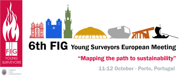
PRELIMINARY PROGRAMME
6th FIG YSEM
11 12 October 2019
|
|
Day 1 |
Friday 11th October 2019
|
| |
|
|
8:30-9:00 |
Registration |
|
9:00-9:50 |
Welcoming Addreses |
| |
The welcoming addresses of the 6th European Young Surveyors
Meeting will provide the opportunity for young surveyors to hear
from distinguished guests from Geodecision, FIG, FIG Foundation,
and the FIG Young Surveyors Network. These welcoming and
associated presentations will set the agenda for the one day
meeting and focus on the theme: Mapping the Path to
Sustainability.
- Rudolf Staiger: FIG President
- Mairolt Kakko: CLGE Vice-President
- João Agria Torres: Ordem dos Engenheiros - Colégio de
Engenharia Geográfica President
- Kwabena Obeng Asiama: FIG YSN Vice-Chair
|
|
10:00-10:30 |
Session 1: Part 1 Geodecision at #6YSEM |
|
|
- Rudolf Staiger: FIG President
- Nigel Sellars: RICS Associate Director
|
|
10:30-11:00 |
Coffee Break + Network Activity |
| |
|
|
11:00-12:30 |
Session 1: Part 2 Geodecision @ #6YSEM |
|
|
- Ozan Koseoglu: Digital Living Services CEO
- Carlos Antunes: University of Lisbon
Professor
|
|
12:30-13:30 |
Lunch @ “Sei lá” Restaurant |
|
13:30-14:30 |
Session 2: Developing Surveyors within Society |
|
|
The key to maintaining sustainability within the geospatial
industry lies in the engagement and making opportunities for the
next generation. In this session we will hear from young
surveyors from around the world on subjects ranging from
grassroots engagement, to mentoring, and much more. Several
presenters will speak about their professional paths, inspiring
and giving the best tips on how a young professional can grow
their career.
- Martine Eelderinke & Simone Emens ::
FIG :: FIG Working Week 2020
- Kwabena Obeng Asiama :: FIG YSN :: YS
Workplan 2019-2020
- Ferah Pirlanta Koksal: CLGE FIG Young Surveyors European
Representative
- Gozde Kavas: FIG Foundation Grant Winner ::
Construction
of 1915 Çanakkale Bridge The 1915 Çanakkale Bridge when constructed will be the
world’s longest suspension bridge, spanning 2023 meters and
will make the seventh connection between Asia and Europe;
Godze will give an overview of the project.
- Ilesanmi Adewale: FIG Foundation Grant Winner:
Practical
ways of promoting women’s participation in the field of
surveying
Technological advancement has made surveying processes to
become more simplified, thus, changing the landscape of the
industry. Despite this development, researches have revealed
that women around the world have less presence in spatial
sciences which has resulted in a low level of participation
in policy implementation and decision-making as an essential
part of sustainable development strategies within the global
surveying community. Ilesanmi will explore some research in
this area, and discuss some practical solutions.
|
|
14:45-15:15 |
Afternoon Tea |
|
15:15-16:50 |
Session 3: HERE XYZ and Developer Portal Workshop |
|
|
- Richard
Sueselbeck: Principal Developer Evangelist @ Here
Technologies Berlin
On the first part participants will be introduced to HERE
XYZ, a cloud-based, real-time location data management
service that enables developers and map makers to create web
maps and manage location data.
On the second part the focus will be HERE Developer Portal
with our APIs and SDKs for maps, location-aware web and
mobile apps. Also it will be touched the HERE Freemium, a
plan where you'll have everything you need to build
location-aware applications. Our expansive range of APIs and
SDKs are intuitive and reliable, with high transaction
thresholds.
|
|
16:50 |
Cultural Activity: Cálem Port Wine Cellars - Wine Tasting and
Fado Show |
|
20:00 |
Dinner |
|
|
|
|
DAY 2 |
Saturday 12th October 2019
|
|
9:00-9:15 |
Charity Walking Tour Sneak Peek |
|
|
- Inês Vilas Boas: Activity Introduction
- Vera Santos:
Forestis: Organization presentation and charity activity
purpose
|
|
9:15-10:40 |
Session 4: Evolutions in geospatial Technology |
|
|
We are a profession in the midst of constant technological
evolution, and it is essential for the geospatial industry to
keep abreast the opportunities that this evolving environment
provides. A selection of companies and individuals will share
why they are embracing new technologies and ideas, and how they
are utilising them to work towards a more sustainable futu
- Matteo Tagliani: Studio Tecnico MT ::
Speleology and
Laser Scanning
The Speleologist, when exploring caves, has first impulse to
understand their size, measure and geo-localize it. This
paper presents case studies conducted by “Studio Tecnico MT”
and “Persephone Exploring Association” in the Republic of
Macedonia territory, where, through the integration of
“Lidar techniques”, ”Digital Photogrammetric” and “Panoramic
Virtual Tour”, caves were surveyed, analyzed
and reported.
- Anca Pavaloiu: FIG Foundation Grant
Winner :: Digital Orthophoto/Aerial Images from U.A.V UAV
methodologies are explored for topographical and cadastral
surveys, and several real-world examples provided.
- Merve Keskin: FIG Foundation Grant Winner:
Eye-tracking
technology in Cartography This paper focuses on the design of a cartographic user
experiment that employs both eye tracking (ET) and
electroencephalogram (EEG) to explore the cognitive
strategies of expert and novice map users.
- Merve Keskin: Interactive Activity - Eye-Tracking
Workshop using EyeTribe
|
|
10:40-11:00 |
Coffee break |
|
11.00-12:30 |
Session 5: Surveying our Changing Environment |
|
|
Our global environment is changing at an ever increasing
rate, and measuring this change is the mandate of our
profession. Prepare to be inspired as we gain insight into
several impressive projects our presenters have been working on.
- Lia Duarte: University of Porto:
QGIS Applications for
Modelling Environmental Risk Geographical Information Systems (GIS) provide the tools
required to correctly identify, quantify and evaluate the
risk intensity and mapping functions to support the
decisions commonly in ecological, environmental, geological
and other areas. A set of GIS open source applications were
developed under QGIS software incorporating environmental
risk models, specifically the evaluation of groundwater
vulnerability to pollution, mapping the soil erosion, the
creation of dynamic temperature maps to monitor the
temperature variations in a self-burning coal waste pile,
and the estimation of vegetation phenology metrics.
- Dora Roque: LNEC: SAR data to monitor a changing world -
from floods to structures Climate change impacts
our world in both direct and indirect ways. On one hand,
natural disasters are occurring more often. On the other
hand, extreme meteorological events apply larger loads on
structures that were not designed for those scenarios. In
this presentation, examples of how different types of data
obtained from SAR images can be used to monitor disasters
and the response of structures to those changes will be
shown.
- Inês Vilas Boas: FIG YSN: ArcGIS Online Follow-up
The ArcGIS Online account for YSN was created last year
after the successful first set of sessions done by YSN on
Esri User Conference in San Diego, California. After almost
one year of having this account, we will show how was the
process to select users and how they have been using the
account.
- Mapillary technology showcase and workshop
|
|
12:30-13:30 |
Lunch @ “Sei lá” Restaurant |
|
13:30-14:30 |
Session 6: Mapping for Sustainable Communities |
|
|
Making geospatial technology available to everyone has the
ability to empower. This session covers some exemplary
initiatives in community mapping and land tenure in developing
nations.
- Cidália Fonte: University of Coimbra: The potential role
of Volunteered Geographic Information (VGI) for mapping A
wide variety of Volunteered Geographic Information (VGI) is
now available, such as photographs, georeferenced text and
vector maps. Some of these data enables the extraction of
valuable information that may be used for mapping. However,
the use of VGI raises several problems. In this presentation
the potential and limitations of using VGI for the creation
and validation of Land Use /
Land Cover Maps (LULCM) are explained.
- Anna Schnaidman: University of Delft: Modern Land
Administration Systems
The presentation will address the following topics: aspects
of the modern land administration systems, various
components and stakeholders that play a significant role in
the way land related processes are being conducted; the
importance of standardization, LADM and LADM revision and
some features of fit-for-purpose and 3D Cadastre.
- Divyani Kohli: University of Twente:
Seeing the Slum from Above: Informality, Slums and Mapping
The presentation will be about mapping informal areas and
slums using remote sensing based methods. It will include
examples of identification and characterization of informal
areas that could also potentially support land
administration.
|
|
14:30-15:00 |
Closing Session |
|
15:00-15:15 |
Afternoon Tea |
|
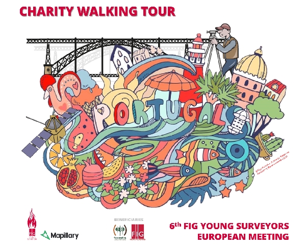
15:15-17:30 |
Charity Walking Tour with Mapillary |
|
|
The Charity Walking Tour has the purpose of showing the city
centre and the most interesting places in the beautiful city of
Porto to all the participants, while acquiring data using
Mapillary’s mobile app. FIG YSN will donate the profits of this
activity to two non-profit organizations: FIG Foundation
(international non-profit organization) and Forestis (national
non-profit organization).
|
Top
Thank you to the sponsors who are supporting
thist 6th Young Surveyors European Meeting:
Gold sponsor
|
|

HERE Technologies |
|
Silver Sponsors
|
|
 |
 |
Bronze sponsor
|
Support/Giveaways
|
 |
 |
Top
You can register for only the YSEM event or for a combined ticket to
both YESM and Geodecision for Sustainable Communities Meeting (https://www.mygeodecision.com/).
How to register:
When you register you start with a pre-registration form. When you have
registered you wil receive an email in which you will be asked to
provide proof that you are either a student or a young professional.
When you have been approved you will receive a link to finalise your
registration. Payment is required at the final registration. You can pay
either by bank transfer or with credit card.
Student: Bachelor or Master Student
Young Professional: Ph.D. students or young professionals under 35 or
within 10 years of graduation.
Top
 |
ADDRESS: Rua Ofélia Diogo Costa, 115 - 6º, Bloco B
4149-022 Porto Portugal
PHONE: +351 22 001 14 00
|
 |
Top
Check accommodation possibilities
here
Top
If you have any questions please contact us
at
fig.youngsurveyors@gmail.com
|
