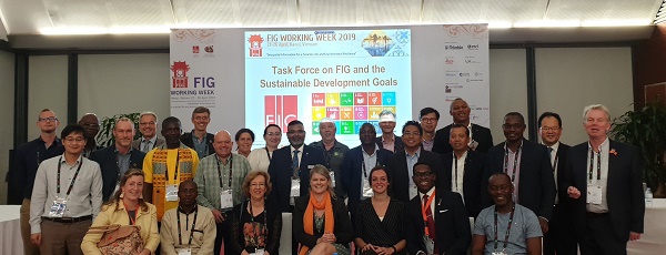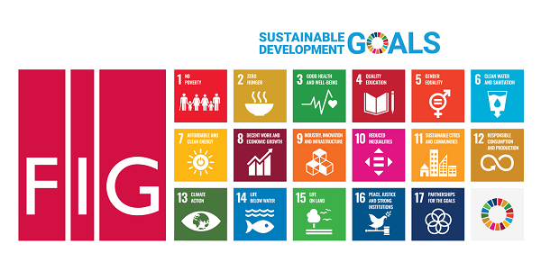
Ten Years to go to Achieve the Sustainable Development GoalsUnlocking valuable contributions of the FIG Working Week 2020by Paula Dijkstra, Koen Schroten, Simone Emens, Christiaan Lemmen (Kadaster International, the Netherlands) "The countdown begins, only one decade to go to accomplish the Sustainable Development Goals (SDGs). The SDGs are the blueprint to achieve a better and more sustainable future for all and surveying professionals have a key role to play. It is therefore of crucial importance that FIG member organisations and surveyors are aware and prepared on how their work contributes to the achievement of the SDGs and vice versa.The SDGs were appointed as one of the central themes during the FIG Working Week 2020. Many colleagues from the FIG community shared their experiences at practical and strategic level. In this article you read about how the FIG community is helping to achieve and monitor the SDGs and what the role of the surveying community will be in the coming 10 years. Aspects that were highlighted in the papers range from land rights for all, to women's access to land, sustainable land use, cities livelihood and strengthened partnerships. "Task Force SDGAt the General Assembly during the FIG Working Week in Hanoi in 2019, the Task Force ‘FIG and the SDGs’ was launched. In the 1st year the focus has been on the alignment with the other FIG and global initiatives, identification of relevant SDGs, and a preliminary assessment of needs and opportunities. An overview of solutions, approaches, curricula and tools to boost the achievement of the SDGs has been generated. The Task Force will work towards a synthesis publication in 2022. In the coming years dedicated sessions with the FIG Community will support in analyses and setting realistic milestones and deliverables. Further inputs are expected from targeted cooperation with UNGGIM, FAO, UN-Habitat, World Bank, JBGIS and other recognized key stakeholders.
Plenary speakers on the SDGsWhat the role of the surveyor towards achieving the SDGs? Three influential plenary speakers share their views: Land regularization is at the heart of achieving the SDGs. Rwanda was a showcase in the FIG Publication No 60 on Fit-For-Purpose Land Administration (FFPLA). Plenary speaker Emmanuel Nkurunziza (Rwanda) points out the importance of Land Regularization. From his present position as Director General of the Regional Centre for Mapping of Resources for Development he is a strong supporter of the visible boundary approach based on imagery where possible. In order to work towards achieving the SDGs, the challenge still remains to ensure that the services of surveyors can reach the greater masses, particularly the poor. Janet Edeme from African Union stresses the land-water nexus and how the surveying profession plays a key role in all aspects of development in both domains and at all levels of society. This idea has resonated with the young surveyors for years with their networking and capacity building on the Social Tenure Domain Model (STDM). UN Habitat, the Global Land Tool Network (GLTN) and the Young Surveyors Network co-organized an ‘Interactive Introduction to Alternative Land Rights Recognition and Recordation Approaches’. Many of the maps and diagrams about the SDG
indicators are produced without awareness of
established cartographic design guidelines. Flawed
and misleading designs often result. Under the title
‘Save the World with Maps: Visualizing SDG
Indicators’, Prof. Menno-Jan Kraak from ITC
University of Twente in the Netherlands,
demonstrates the problems and shares the challenges
faced to avoid them. Land Rights for AllSix years have passed since the publication on Fit-For-Purpose Land Administration (FFPLA). The FFPLA approach is embraced by many different stakeholders around the globe. However, implementation of FFPLA still brings the land sector into discussion. Amsterdam 2020 was considered to be a perfect platform for stakeholders to discuss FFPLA implementations. Various case studies and promising papers show the potential for FFPLA. A case from South Africa demonstrates that there is “much positive energy in the country and nothing is insurmountable”, whereas a case from Colombia deals with boundary conflicts between indigenous land reserves and cattle ranchers. The method used here does not attempt to agree on common boundaries - what the claims are is indicated individually, and overlap is searched for in overlapping parts. Another case in the Nigerian local context concludes that the FFPLA model, if employed, offers a promising strategy for sustainable systematic land titling and registration in the country. Women’s access to land and women in surveyingEnding gender inequalities is an important part of the SDGs. The importance of gender inclusive land administration is a recurring theme. Women often belong to the more vulnerable groups in society, especially in developing countries. Not having their rights secured will have women at a disadvantaged position in land-disputes which can increase their vulnerability. Increased landownership for women can have positive effects on their socio-economic status. It will not only benefit the women, but it can also benefit the economic development of a whole country. Gender equality plays a role within the surveying profession. The FIG2020 content provides insightful findings on the causes and solutions regarding the gender disbalance in the profession. Questions on how we can engage the female land surveyors of tomorrow and how we can work towards an inclusive surveying community are being addressed. The 'Science Technology Engineering and Math' (STEM) programmes for girls, for example, shares experiences of promoting inclusiveness of women in the surveying curricula, as well as how to ensure the transition after graduation into the profession (TS04D: TS04D: Women in Surveying). Capacity and educationBoth the surveying profession and the education sector are developing fast with new technologies and new methods and ways of working. The societal changes require for changes in the curriculum or the way of teaching. Multiple sessions are of specific interest to learn more about the relation between the changes in our profession and the developments in education, contributing to SDG 4 (quality education). A session on 'Responsible Land Administration Teaching Essentials structured knowledge base' from GLTN provides insights on research clusters on land administration. Practical experiences on the mismatch between curricula and professional practice, the role of professional organisations are shared. Besides, a method worth mentioning is the 'Value Creator': it aims to ensure that stakeholders discuss the challenge at hand from different perspectives, making us of collective knowledge and experiences and refocusing the attention from different interests to shared value creation (TS02A: Innovation in Professional Education in Europe). Land ConsolidationLand Consolidation is about reallocation of land, traditionally serving the improvement of the agronomic structure of an area with attention to concentration of farmlands, improved infrastructure and water management, tourism and landscape. Irrigation and water management are more and more relevant in food production (SDG 2) in the context of climate change. New roles and challenges such as climate adaptation, CO2 Reduction and more nature in rural areas and sustainable land use are analysed in the FIG2020 content. Legal practices, challenges, and approaches for solar farming development (SDG 7) are shared. They could serve as a foundation to standardize the solar farming development approval in accordance to sustainable land use management. During the FAO presentation on the new Legal Guide on Land Consolidation, the outcomes of a study on good European practices for land consolidation legislation were to be shared. The session is now scheduled to take place end of May. In an additional session, FAO programmed a discussion on the role of Land Consolidation and other land management instruments in the development of agricultural land markets. Cities LivelihoodCities are the places where innovation happens,
where creative ideas develop and where commerce
flourish. It is also the type of locality where
social, ecologic and economic challenges are
increasingly evident. Accurate and accessible
geo-information is at the heart of inclusive
decision-making for sustainable urban development,
especially with regard to SDG 11. Public-Private PartnershipIt is clear that collaboration can enhance
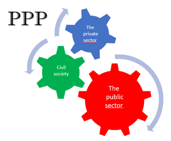
sustainable development (SDG 17). Simultaneously,
access to public information, and having effective,
accountable and transparent institutions in place
(SDG 16) is a condition to provide reliable access
to information about land. Many contributions to the
FIG2020 share experiences on partnerships, ranging
from countries with developed Land Administration
Systems to countries where a FFPA approach is
implemented. By using each other's strengths you are
able to contribute faster to securing land rights
and achieving the SDGs.
Conclusion10 years are left to achieve the Sustainable Development Goals. The first years after the adoption of the 2030 Agenda there was a focus on creating awareness and understanding on how the goals are linked to our profession, followed by a phase to find common ground on how to measure the indicators. Now the time has come to look ahead, to align our policies, such as Fit-For-Purpose Land Administration and projects towards achieving the SDGs. To think, act, share and visualize about how our daily work, at local, national and global level, can contribute to a more sustainable world. The FIG 2020 Working Week has given an overview of the role of the surveying profession towards achieving the SDGs. They have inspired us with practical know-how, insightful recommendations and challenging statements on what we all can do to make this world a better place. The Taskforce on FIG and the SDGs considers this as a fruitful source of solutions, approaches, experiences and tools to boost the achievement of the SDGs. The Task Force will use the materials to encourage the FIG community to take their responsibility as individual, employee and professional to contribute to the SDGs and ‘to leave no one behind’.
|
|||||
 |
Paula Dijkstra, Co-Congress Director. Kadaster International, the Netherlands |
 |
Koen Schroten, Kadaster International, the Netherlands |
||
 |
Simone Emens, Kadaster International, the Netherlands |
 |
Christiaan Lemmen, Kadaster International, the Netherlands |
||
 #FIG2020 /font> |