News in 2014

|
Report on the Pacific Surveyors Meeting and Pacific GIS / RS
Users Conference
24 - 28 November 2014, Suva, Fiji
On 24 and 28 November 2014 Geospatial Specialists and Surveyors from the
Pacific Island Countries (PICs) met in Suva, Fiji to further the objective
of improving coordination of Geospatial and Surveying activities in the
Pacific. It was recognised that Geospatial and Surveying Information when
applied to real world problems can help reduce persistent poverty and create
opportunities to support social and economic development.
With support from the Australian Aid funded Climate and Oceans Support
Program in the Pacific (COSPPac), and the Geoscience Division - Secretariat
of the Pacific Community (SPC), the meeting was attended by representatives
from the Cook Islands, Fiji, Federated States of Micronesia, Kiribati, Niue,
Palau, Solomon Islands, Papua New Guinea, Tonga, Vanuatu, Republic of
Marshall Islands, Tuvalu, Samoa as well as Australia, and New Zealand.
The facilitators of this meeting were the United Nations Global
Geospatial Information Management for Asia and the Pacific (UN-GGIM-AP) – Dr
John Dawson and the International Federation of Surveyors (FIG) – Mr Rob
Sarib. Mr Jens Kruger, Manager of the Ocean and Coastal Geoscience Sector in
SPC’s Geoscience Division was the host of this strategic meeting.
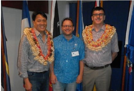
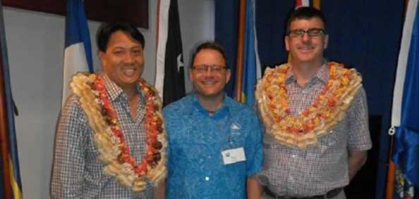
Mr
Rob Sarib (left), Mr Jens Kruger (middle) and Dr
John
Dawson (right).
There were two days of discussions and work-shopping pertaining to the -
- Status of geospatial infrastructure and data management
- Building the capacity of geospatial practitioners and surveyors
- Recognition of the importance of geospatial infrastructure
- Analysis of existing like professional and regional organisations
- Strengths, weaknesses, threats and opportunities of forming a
regional body.
It was subsequently resolved that an interim group known as the Pacific
Geospatial and Surveying Council (PGSC) be formed so as to finalise a
Charter, and Strategy, that will adhere to the FIG Suva Statement on
Spatially Responsible Governance. Please note, this statement was prepared
and endorsed by participants at the FIG Pacific Small Island Developing
States Symposium - “Policies and Practices for Responsible Governance” held
at the Novotel Lami Bay Conference Centre, Suva, on 20th September 2013.
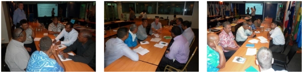
Hard working Pacific Island Surveyors discussing and work-shopping the
issues.
The interim PGSC agreed that the Vision should be –
Sustainable development in the Pacific enabled by world class
geospatial information and surveying services.
The interim PGSC agreed that the Mission should be –
The PGSC will provide a regional network and forum for the geospatial
information and survey authorities of Pacific Island Countries and
Territories to address regional challenges, such as building the capacity of
surveyors, improving and standardising geospatial information gathering and
dissemination, maximising economic growth, alleviating poverty, improving
natural resource management, disaster risk management and climate change
adaptation. This will be achieved by coordinating, communicating, and
collaborating activities, sharing resources and applications of location
information through regional and global partnerships.
The interim PGSC acknowledged that the potential benefits of a regional
body are –
- Greater recognition, visibility and linkage to national and
international organization priorities, activities, and development
partner’s interest and support
- A way to connect and align national level priorities to regional
incentives and development opportunities
- Give Officials of geospatial agencies and /or Office of the Surveyor
General greater recognition and visibility, and enable them to have
better control of priorities and direction on capacity development for
the Pacific geospatial and survey industry
- A stronger, collaborative, unified and more coordinated regional
approach to the geospatial and surveying challenges, with support from
the Secretariat of the Pacific Community and development partners.
- Influence the regional academic or educational institutions and
funding-partners to be aligned with the needs of the geospatial and
surveying industry on the development of curriculums and scholarships
The Interim PGSC agreed to form working groups to undertake following
actions –
- Finalise the PGSC Charter by 1 February 2015.
- Ensure the PGSC is officially endorsed by Core members and
operational by 2 April 2015
- Develop a DRAFT Strategy for adoption by October 2015
At the completion of the meeting the Interim PGSC elected Mr Faatasi
Malologa (Tuvalu) as the Interim PGSC Chair and Mr Paserio Samisoni (Fiji)
as the Interim Vice Chair.

Mr Faatasi (left) and Mr Samisoni (right)

The 15th Pacific GIS / RS Users Conference was convened at the University
of the South Pacific (USP) Suva campus, at the Japan Pacific ICT Centre,
25-27 November 2014. The theme of the conference was “Empowering the Pacific
Communities through Improved Geospatial Data”.
The conference show cased the various GIS / RS related projects being
developed or undertaken and the associated applications being used in the
Pacific region. There were almost 300 participants in attendance and 80
technical presentations delivered over 3 days.
From a positioning and measurement perspective, there were numerous
remote sensing presentations on satellite imagery, LIDAR, and UAV projects.
There were also several presentations on the use of GNSS positioning
techniques for environmental data collection or analysis purposes. It was
evident from these and other presentations that the Pacific region is not
only experiencing on-going capacity building and resourcing challenges but
also the issues of understanding, articulating and adopting a common
geodetic datum and / or reference frame for the region. However, a local
Fijian surveyor Mr Andrick Lal, who works for SPC in the Geoscience
Division, gave a standout presentation titled “Nadi Topographic Surveys”. Mr
Lal’s presentation highlighted the use of several traditional and modern
surveying techniques to reference or control the topographic and remote
sensing data collected. In fact, Mr Lal’s project was selected by the UN
GGIM AP to be a feature article in their next UN GGIM - GGRF newsletter. To
read this article please refer to the website
http://ggim.un.org/UN_GGIM_wg1.html.
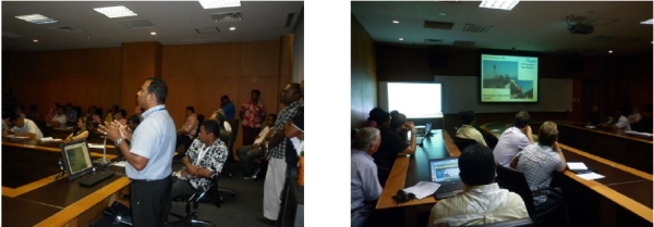
Mr
Lal presenting on “Nadi Topographic Surveys.
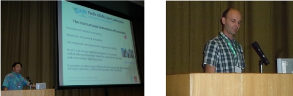
FIG also supported this event through active participation in the
technical proceedings. Mr Rob Sarib provided an overview of the FIG
organisation and its activities. He also gave FIG Commission 5’s perceptions
on a modernised geodetic reference frame and infrastructure. Mr Graeme Blick
and Dr Matt Amos, who are also FIG Commission 5 Reference Frame working
group members, introduced the publication Reference Frame in Practice Manual
to the Pacific community, and provided technical advice on regional datums
and projections at the “Pacific Projections” open discussion forum
 Mr
Rob Sarib (left) and Dr Matt Amos (right). Mr
Rob Sarib (left) and Dr Matt Amos (right).
FIG’s sister organisation, the UN GGIM AP, was also well represented at
this technical symposium by Dr John Dawson. Dr Dawson spoke to the delegates
about a Global Geodetic Reference Frame (GGRF) and the progress of a
resolution on this topic being tabled at the next UN General Assembly in
2015. Throughout the conference Dr Dawson also contributed to several open
technical forums on geodetic and geospatial infrastructure. Dr Dawson also
showed a promotional digital video on the GGRF, which is media that the FIG
Commission 5 highly recommends to all land, survey, and geospatial decision
makers to view, especially those who need to better understand reference
frames and their importance to a nations social, economic and sustainability
objectives. This digital video can be found at website
http://ggim.un.org/GGRF.html
under the heading “Supporting Material”.
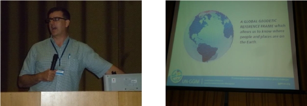
Dr
John Dawson speaking on the GGRF.
Dr Dawson also revealed that Fiji, on behalf of UN member countries, will
put forth and talk to the GGRF resolution at the next UN General Assembly in
New York.
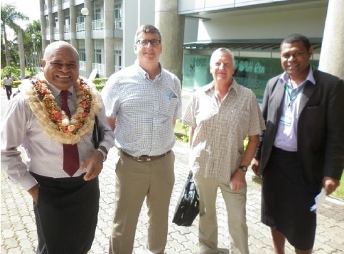
From right to left - Mr Tevita Boseiwaqa (Permanent Secretary of the Fijian
Lands and Minerals Department, Dr John Dawson, Mr Bob Twilley (Geoscience
Australia) and Mr Malakai Vakautawale
Rob Sarib
Vice Chair Admin
FIG Commission 5
11 December 2014
|