Highlights  


FIG PUBLICATION NO. 73

New Trends in Geospatial Information:
The Land Surveyors Role in the Era of Crowdsourcing and VGI

CURRENT STATE AND PRACTICES WITHIN
THE LAND SURVEYING, MAPPING AND GEO-SCIENCE COMMUNITIES
FIG Commission 3

FIG REPORT

Editor: Yerach Doytsher
Contributing Authors: Vlado Cetl, Charalabos Ioannidis, Sagi Dalyot, Yerach Doytsher, Yaron Felus, Muki Haklay, Hartmut Mueller, Chryssy Potsiou, Enrico Rispoli and David Siriba


This publication as a .pdf-file (120 pages - 6.5 Mb)

FOREWORD

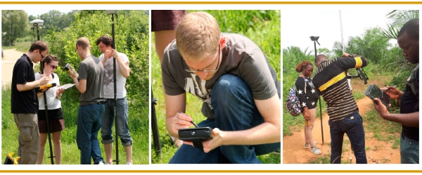
The geographic data and knowledge collection and dissemination via authoritative professionals only – characterized as the top-down scheme – has been shifting in the past few years to the bottom-up scheme, in which citizens and laymen generate data they later use as information in various applications and services. This is a new era in the history of human mapping efforts, mainly in terms of data collection, but also for knowledge production.

This neogeography revolution is fundamentally transforming how geographic data are acquired, maintained, analyzed, visualized, and consequently – used. With today’s technology, availability, access and ease of use there is a potential of a geographer within everybody.

In view of these changes in the mapping and land surveying domain over the past few years, Commission 3 has undertaken the mission to prepare this publication within the framework of FIG, aiming to emphasize the accessibility, the potential, and the use of crowdsourcing and VGI as a basic tool for land surveyors and mappers professionals.

During the 2011–2014 and 2015–2018 periods, FIG Commission 3 has addressed this phenomenon of shifting from the top-down mapping scheme to the bottom-up one. Its particular focus has been on SIM Infrastructure, Technical Aspect of SIM, and on Crowdsourcing and VGI.

In this effort, FIG Commission 3 has established valuable collaborations in an effort to adopt a multi-sector approach, and bring together people with relevant expertise, such as academics, experts from the public sector as well as from the private sector, to share experience and knowledge on crowdsourcing and VGI. FIG Commission 3 cooperates closely with UN-agencies (UN ECE WPLA, and UN-HABITAT and GLTN), UNESCO, the World Bank, ISPRS and other sister associations.

This publication integrates the output of research studies done by Commission 3 working groups and resolutions from the past annual workshops (Paris 2011, Athens 2012, Skopje 2013, Bologna 2014, Malta 2015, Iasi 2016, Lisbon 2017 and Napoli 2018).  

Prof. Dr. Yerach Doytsher
Chair of FIG Commission 3, 2011–2014
Prof. Dr. Chryssy Potsiou
FIG President, 2015–2018
Dr. Enrico Rispoli
Chair of FIG Commission 3, 2015–2018


 Read the full FIG Publication 73 in pdf


Copyright © The International Federation of Surveyors (FIG),  March 2019.

All rights reserved.

International Federation of Surveyors (FIG)
Kalvebod Brygge 31–33
DK-1780 Copenhagen V
DENMARK
Tel. + 45 38 86 10 81
E-mail: FIG@FIG.net
www.fig.net

Published in English
Copenhagen, Denmark
ISSN 1018-6530 (printed)
ISSN 2311-8423 (pdf)
ISBN 978-87-92853-85-1 (printed)
ISBN 978-87-92853-86-8 (pdf)

Published by
International Federation of Surveyors (FIG)
Layout: Lagarto


FIG PUBLICATION No 73

New Trends in Geospatial Information: The Land Surveyors Role in the Era of Crowdsourcing and VGI
Published in English
Published by The International Federation of Surveyors (FIG), March 2019, Copenhagen, Denmark
ISSN 1018-6530 (printed)
ISSN 2311-8423 (pdf)
ISBN 978-87-92853-85-1 (printed)
ISBN 978-87-92853-86-8 (pdf)

  Home  
  News  
  Organisation  
  Members  
  Resources  
  Partners  
  Foundation  
  Events  
  About FIG  
 
General
Publications
Proceedings
Peer Review Journal
Surveyors Reference Library
Databases
Articles about FIG
Article of the Month
Newsletter
 
General
Publications
Proceedings
Peer Review Journal
Surveyors Reference Library
Databases
Articles about FIG
Article of the Month
Newsletter
 
General  
FIG publications  
Position Papers  
United Nations Publications  
World Bank Publications  
FAO Publications  
GLTN / UN-Habitat Publications  
UNGGIM Publications  
UNECE/UNECA Publications  
Geospatial Societies Publications  
Other Publications  
FIG Annual Review  
FIG General Assembly Minutes  
 
List of Publications
FIG Policy Statements
FIG Guides
FIG Reports
FIG Regulations
Guidelines
 
No. 8 - Hydrography in Ports and Harbours 
No. 10 - FAO and FIG Future Collaboration in Cadastral Reform in Rural Economics in Transition
No. 13 - Land Tenure, Land Management and Land Information Systems
No. 13B - Report of the United Nations Inter-Regional Meeting of Cadastral Experts
No. 14 - Working Towards Liberalisation in Trade in Services
No. 22 - Co-operation Between FIG and the UN Agencies 2000-2003
No. 36 - Administering Marine Spaces: International Issues
No. 38 - The Contribution of the Surveying Profession to Disaster Risk Management
No. 42 - Informal Settlements: The Road towards More Sustainable Places
No. 44 - Improving Slum Conditions through Innovative Financing
No. 46 - Enhancing Surveying Education through e-Learning
No. 48 - Rapid Urbanization and Mega Cities
No. 49 - Cost Effective GNSS Positioning Techniques
No. 49 - 2nd edition
No. 50 - History of Surveying
No. 52 - The Social Tenure Domain Model - A Pro-Poor Land Tool
No 52 - Arabic version
No. 53 - Sydney Agenda for Action
No. 55 - Spatial Planning in Coastal Regions 
No. 56 - Guidelines for the Planning, Execution and Management of Hydrographic Surveys in Ports and Harbours 
No. 57 - Report on the Economic Benefits of Hydrography
No. 58 - Spatially Enabled Society 
No. 59 - International Boundary Making 
No. 61 - CADASTRE 2014 and Beyond 
No. 63 - The Africa Task Force
No. 65 - The Surveyor’s Role in Monitoring, Mitigating, and Adapting to Climate Change
No. 67 - Property Taxation for Developing Economies
No. 68 - The Christchurch Declaration 
No. 70 - Africa Regional Network - 2015-2018
No. 72 - Best Practices 3D Cadastres
No. 73 - The Land Surveyors Role in the Era of Crowdsourcing and VGI
No. 74 - Cost Effective Precise Positioning with GNSS
No. 75 - FIG and Me
No. 76 - International Boundaries on Unstable Ground
No. 77 - Good Practice for Resilience Planning to Address Water Governance Challenges in Africa
No. 78 - Geospatial Data in the 2020s - Transformative Power and Pathways to Sustainability
No. 79 - Land Consolidation - The Fundamentals to Guide Practice
No. 81 - Enhancing Surveying Education through Blended Learning
No. 82 - Mapping the World a Better Place: The FIGs Volunteer Community Survceyor Program (VCSP)