Second Session of the United Nations Committee of Expert on
Global Geospatial Information Management
New York, 13 – 15 August 2012
The United Nations Committee of Experts on Global Geospatial Information
Management was established to be the official United Nations consultative
mechanism on place, locality and geography. UNCE-GGIM plays a leading role
in setting the agenda for the development of global geospatial information,
while promoting its use to meet key global challenges.
The second session of the UNCE-GGIM was convened at the United Nations
Headquarters in New York by the Secretariat of the UN Committee of Experts
on GGIM, United Nations Statistics Division, Department of Economic and
Social Affairs. In his opening remarks, United Nations
Under-Secretary-General for Economic and Social Affairs, Mr. HongBo WU
said that understanding and analysing geospatial information has become a
key driver of competition and underpins new waves of productivity growth,
innovation and services. He also said that the recent Rio+20 (the United
Nations Conference on Sustainable Development) has recognized that solid
geospatial information is crucial for both sustainable development and
humanitarian assistance and this provided a clear mandate for the future
work of UNCE-GGIM.
|
 |
At the first meeting on 13th August 2012, the Committee elected
Ms
Vanessa Lawrence (United Kingdom) and Mr. Mansoor Ahmed Al Malki
(Qatar) as co-chairs with Mr. Derek Clarke (South Africa) as the
rapporteur. Members of the Committee are all representatives of UN Member
States. FIG has consultative status with the Department of Economic and
Social Affairs and President CheeHai TEO attended the meeting.
The Working Group on future trends in geospatial information management
tabled its analysis and report and was congratulated for its efforts within
a short period of time. In the ensuing discussion, member states discuss the
desire for options in their respective evolution to create national
geospatial information authorities and request mechanisms for governments to
engage each other in learning and sharing. The need to review the impact on
member states with limited access to technology was discussed especially in
an era of rapid technological changes. It was opined that there is a need to
reduce this technological divide. The importance of geodesy and global
geodetic reference system has emphasized.
On this particular subject, a report by the United Nations sponsored
Permanent Committee on GIS Infrastructure for Asia and the Pacific was well
received. It was recognised that geodetic reference system is a highly
technical issue but necessary and Member states were urged to take this into
serious consideration including the need to maintain a national geodetic
reference system and infrastructure as well as the commitment to contribute
towards the regional and global geodetic reference system. It was resolved
that there shall be further consultation and an informal consultation
involving both FIG and International Association of Geodesy (IAG) on the
margins of the upcoming United Nations Regional Cartographic Conference for
Asia Pacific (UNRCC-AP) be organized by the secretariat. The informal
consultation will discuss the technical issues related to the global
geodetic reference system. It was also resolved that a questionnaire be sent
to member states to ascertain the current status in the adoption and
maintenance of a globally referenced geodetic reference system.
Additionally, the Secretariat is requested to organize a special session
on global geodetic reference system during the Second GGIM High Level Forum
in Doha, Qatar scheduled for 4th – 6th February 2013 as well as to chart a
road map towards the eventual endorsement of a global geodetic reference
frame.
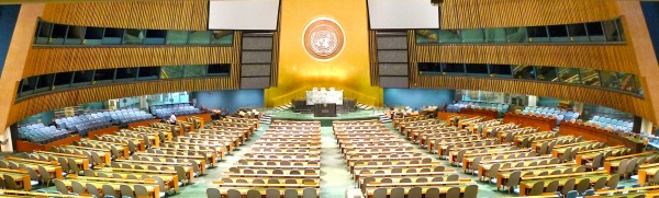
The Second Session of the United Nations Committee of Experts on
Global Geospatial Information Management (UNCE-GGIM) |
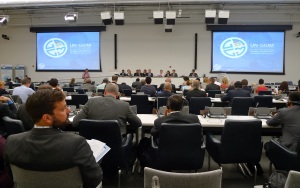
Ms Helen Kerfoot (Canada), outgoing Chair of UNGEGN, addressing the
closing meeting of the 27th Session of UNGEGN |
The Committee also discussed on its contribution to the UN Conference on
Sustainable Development (Rio+20) and its implications, the development of a
knowledge base for geospatial information and develop a global map for
sustainable development.
The proposal to develop a statement of ethics and code of conduct for the
geospatial information community was also considered by the Committee.
Member states opined that there are in existence various rules and codes
within governments and national geospatial information communities,
particularly those promoted and maintained by professional organization.
Many opined that a statement of ethics may be too strong and suggested
instead a statement of shared principles. It was resolved that further
consultation is necessary in developing a statement of ethics and code of
conduct.
FIG is of the opinion that whereas cultures, political systems, awareness
and understanding of professional practice differ from jurisdiction to
jurisdiction, there are certain fundamental principles that should apply to
all. FIG is supportive of a consultative process that will lead to a set of
core (or shared) values and statement of ethical principles.
Prior to the second session of UNCE-GGIM, FIG President observed the
closing meeting of the Tenth United Nations Conference on Standardization of
Geographical Names (UNCSGN) as well as the closing meeting of the
Twenty-seventh Session of the Group of Experts on Geographical Names
(UNGEGN) that was held at the UN Headquarters in New York between 31st July
and 10th August 2012. UNGEGN’s outgoing chair, Ms Helen Kerfoot
(Canada) was recognized for her twenty years of contributions as Vice Chair
and Chair of UNGEGN with a commendation from the United Nations Secretary
General that was read out to all delegates at the closing meeting of the
27th Session of UNGEGN.
|
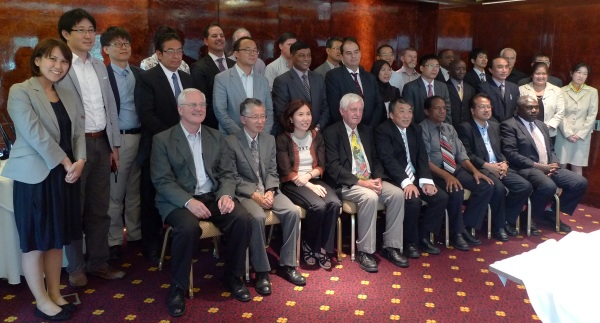
Group photograph of participants at the 19th Meeting of
the International Steering Committee on Global Mapping |
The President also observed the 19th Meeting of the International
Steering Committee on Global Mapping (ISCGM) held at the Millennium Plaza
Hotel, New York on 12th August 2012.
CheeHai TEO
September 2012
5 October 2012
|


