Working Group 3.2
Geospatial Big Data: collection, processing, and presentation
Policy Issues
The definition of “Big Data” is complex and constantly changing,
mainly based on the three Vs definition of their characteristics, such
as “Big data represents the information assets characterized by such a
high Volume, Variety and
Velocity to require specific technology and analytical methods
for its transformation into value”, or “data sets characterized by huge
amounts (Volume) of frequently updated data (Velocity) in various
formats, such as numeric, textual, or images/videos (Variety)”.
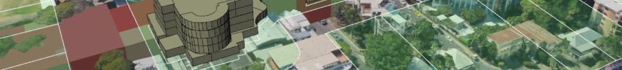
A significant portion of big data is actually geospatial data, and
the size of such data is growing rapidly at least by 20% every year due
to the rapid technological development. Geospatial big data (GBD)
collection methods include surveying, photogrammetry, remote sensing,
LIDAR/Laser scanning, VGI, Mobile mapping systems, GNSS tracking, real
time sensor observations, geo-sensor networks, IoTs, etc. The various
types of GBD include raster data (e.g., geoimages-aerial, satellite,
etc-, 3D objects), vector data (e.g., points, lines, polygons), and
graph data (e.g., road networks, topological coverage, grid data).
The “Volume” characteristic of the GBD deals with issues related to
data storage and massive analysis; the “Variety” deals with issues
related to data management models and structures as well as indexes;
while “Velocity” refers to issues such as matching the speed of data
generation and processing. However, the three Vs definition is further
expanded with more characteristics, such as the one called “Veracity”
which refers to quality assessment of source data, data improvement,
etc.
The increasing volume and varying format of collected GBD presents
challenges in storing, managing, processing, analyzing, visualizing and
verifying the quality of data.
The target of Working Group 3.2 will be to investigate the
opportunities and challenges and to propose a framework for
understanding the ways that GBD may be obtained, processed, presented,
shared and best used together with data derived from traditional
surveying methods to provide richer datasets, and to be used in ways
that are complementary.
Workign Group 3.2 will contribute to UN SDG 11 (Sustainable Cities)
but also to SDG 1 (No Poverty) and SDG 2 and 3 (Zero Hunger) and 13
(Climate Action).
Working Group 3.2 will focus to motivate researchers in academia and
industry, students, as well as delegates from the state sector to
partner and join efforts to improve the value of GBD for the society as
well as to take advantage of this value for improving the surveying
profession. Intercommission activity as well as collaboration with other
FIG Com3 WGs in this field will be encouraged.
Chair
Prof. Charalabos Ioannidis (Greece)
email: cioannid[at]survey.ntua.gr
Specific topics
Topics of interest of Working Group 3.2 include the following:
Topics of general interest/raising awareness:
Good practice applications of GBD in land administration,
economy, health, planning, 3d modelling, climate change, disaster
response, monitoring infrastructure, transportation, agriculture for
the Sustainable Development Agenda 2030
GBD in GIS (import, analysis, processing tools, presentation)
Case studies using GBD
Platforms for sharing GBD
Policies/legislation
Technical topics:
Hardware and Software for GBD collection and processing
IoT and surveying activity
Spatial computing techniques/methodologies
Algorithms of GBD processing
Visualization of GBD
GBD and mobile devices
GBD handling methods in storing, managing, processing, analyzing,
visualizing, verifying the quality of data, data security
Cloud computing and cloud storage for efficient access and process
of GBD
Methodological/Theoretical/Technical developments in modelling,
processing, analyzing, visualizing GBD
Data mining for decision support
Knowledge discovery from GBD
Cluster-based systems for processing GBD
What we are working on -
FIG publication on Smart Cities (2022) - contribute to
the publication with Working Group 3.1