News in 2016

|
FIG President Chryssy Potsiou participated to the GIM International
Summit
10-12 February 2016, Amsterdam, The Netherlands
The first GIM International Summit – took place on 10-12 February
2016 in Amsterdam, The Netherlands. It was a very successful initiative
of GIM International to bring together important speakers from inside
and outside the geomatics community to address the topic of global
challenges (such as evidence-based policies for poverty reduction,
climate change, water scarcity, fit for purpose planning and experience
sharing among developed and developing regions), as well as to link all
participants together into four interactive workshops on urban planning,
social justice, food security & agriculture, and infrastructure for
geo-IT, and challenge them to think beyond their own field of
professional activities, link geospatial technologies and expertise to
contribute to fit for purpose solutions on aspects like climate change,
migration, water & energy and property rights. Social events included a
boat trip on Amsterdam’s canals and a delegate dinner. FIG President
Chryssy Potsiou as well as Vice President Diane Dumashie participate to
the GIM International Summit and contributed to the discussions.

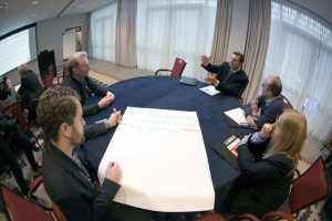
FIG President Potsiou participating in one of the round table
discussions at the GIM Summit, Photo courtecy of GIM Magazine
Among the most interesting speeches was the one of Prof Morten
Jerven, Associate Professor in Global Change and International Relations
International Environment and Development Studies at the Norwegian
University of Life Sciences in Oslo, Norway. Morten Jerven is the author of the
very interesting book: Poor Numbers. In his speech: Africa by numbers,
Knowledge and Governance, he emphasized the importance of the
availability and reliability of official statistics and metrics mainly
for monitoring GDP and developing knowledge about a country’s economic
growth, the success or failure of the applied governmental policies, and
the country’s need for support.
Morten Jerven presented examples of poor official statistical data in various
countries of the Africa region (mainly due to the existence of a large
informal sector that causes gaps in data capturing and to inefficiency
in frequent data updating) derived from his current research. Due to
those difficulties, the missing data are usually filled-in by almost
non-professional “gap-filling methods” by the local administrators in
Africa region, or are “manipulated” for political reasons; in several
cases official data delivered within a time-period of two successive
days may differ significantly. When recycled by the international
agencies (e.g., the World Bank) and used to develop the various country
ranking lists, such data do create great confusion. Morten’s clear
message is that in such cases, international experts in their effort to
develop “evidence-based policy” they actually end up using “policy-based
evidence”.
To avoid this, his advice to the stakeholders is that before using any
official statistical data to estimate a country’s GDP change over time
more information should be investigated, such as some kind of meta data
(e.g., who did the observation, when, and by what method, etc); in many
cases the accuracy in data recording may not be as critically important
as are the inconsistent and non-professional “gap filling methods” used.
Finally, Morten Jerven also commented on the MDGs and the newly adopted
Sustainable Development Goals with the numerous indicators that the
statistical offices in the various countries are expected to record, and
noted that the existing practical difficulties in such recording simply
make the whole task look totally unsustainable…
Among the many other interesting speakers who participated to the summit
were Daniel Steudler, scientific associate from the Swiss Federal Office
of Topography, who identified various current trends in technology such
as the Internet of Things, crowdsourcing, augmented reality and social
media; Ed Parsons from Google who demonstrated that by engaging end
users in the mapping procedure using their smartphones we may create
personalized maps; James Kavanagh from the Royal Institution of
Chartered Surveyors (RICS) who presented examples and challenges of
adopting BIM in the geospatial industry; and Steven Ramage who explained
the concept of what3words, a new addressing tool that facilitates
addresses for over four billion people who do not currently have an
address, by pre-allocating three common words to each grid of 3 by 3
metres on Earth.
Chryssy Potsiou,
27 June 2016