News in 2016
|
From Volume to Quality: Bridging the Gap for Spatial Data Infrastructure
Commission 3 meeting and Geomat 2016
3-7 November 2016, Iasi, Romania
FIG Commission 3 Annual Meeting
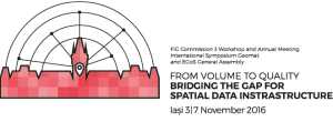
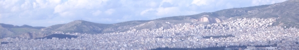
FIG Commission 3 was particularly honored to organize its Annual
Workshop in Iasi, Romanian city candidate as the European Capital of
Culture for the year 2021.
Iasi, an important and friendly city, was also chosen for its
architectural beauty that “charms the eye and seduces the heart”,
particularly by visiting the places of Orthodox worship. In this context
the Workshop "From Volume to Quality: Bridging the Gap for Spatial Data
Infrastructure" (3-7 November 2016)was organized . The workshop was
organized jointly with the International Symposium Geomat 2016 and with
the EGoS General Assembly by the Department of Surveying and Cadastre,
Faculty of Hydrotechnics, Geodesy and Environmental Engineering from
Technical University of Iasi and co-organized by the Romanian
Association of Romanian Surveyors.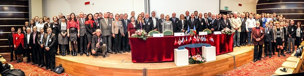
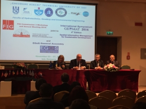
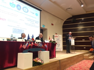
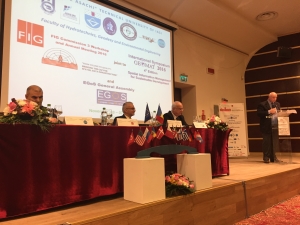
At the Joint Opening Ceremony of FIG Commission 3 WorkShop and
of the International Symposium “GEOMAT” the following authorities were
present: the Vice Ministry of Finances of Romania; Prof. Florian
Stătescu - the Dean of Faculty of Hydrotechnics, Geodesy and
Environmental Engineering; Mihai Busuioc - the Gen. Secretary MDRAP
(Ministry of Regional Development and Public Administration); Radu
Codruț Ștefănescu - President General Director of ANCPI (National Agency
for Cadastre and Land Registry, Romania); the President of INIS Board
for Romania; Maricel Popa - President of IASI County Council; Marian
Grigoraș – Prefect’s Institution of Iasi County; Mihai Chirica - Mayor
of IASI CITY; Prof. Dan Cașcaval - Rector of “Gheorghe Asachi” Technical
University of Iasi; Prof. Cornel Păunescu - President Romanian
Association of Surveyors; Chryssy Potsiou, - President of the
International Federation of Surveyors; Nikolaos Zacharias -
President of EGoS (European Group of Surveyors); Vasile Chiriac -
Secretary General of CLGE (Council of European Geodetic Surveyors).
The workshop was an opportunity for delegates and partners to present
their research and experiences in the field of development and use of
VGI, GIS systems and SIM and SDI procedures.
The program included three days of technical sessions with a wide
variety of presentations focusing on the latest news and was a good
opportunity to meet colleagues and exchange knowledge in the field of
satellite tracking and of Spatial Information Management.
The workshop aimed to focus on the role of Geographic Information
Systems in relation to the correct forms of managing spatial data over
the Internet. The gap is resulting from processing of large volumes of
spatial data (quantity) in the informatics environment, often
uncontrollable, and thus must be filled by an appropriate approach to
ensure to users the reliability of information and to prevent incorrect
decisions. The exchange of knowledge between the various members will
also facilitate the synergy between public administrations that fulfill
specific activities on the territory: from urbanism to spatial planning,
from the environment to civil defense, from roads to construction, from
agriculture to forestry, from tourism to culture.
This workshop explored ideas and methods on how we can engage
citizens through crowdsourcing within reliable new models of
collaboration.
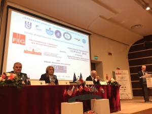
The delegates of Commission 3 who were present in Iasi were about 30
while participants in the International Symposium Geomat were about 200.
Participants included professionals, cadastral managers, university
teachers and young surveyors.
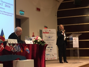
The President of FIG, Chryssy Potsiou, presented the current
initiatives of FIG Council, focusing on the politics about how involving
more and more delegates representing the members associations, the task
Forces and the different Networks.
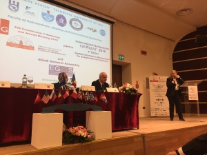
The Secretary General of CLGE and the President of EGoS were present
in all sessions of Commission 3 Workshop and International Symposiun
together with the representatives from Germany, Greece, Italy, Moldova,
Romania, Israel, UK, Malta, ecc.
On Saturday morning the EGoS GA took place.
The program of Commission 3 included 7 technical sessions with a
total of 20 papers, all about the topic of the Workshop and of
Commission 3.
As it usually happens during the FIG Commission Annual Meetings and
Workshops, during the Closing Ceremonies there is the proclamation of
the Best Paper. This year in Iasi as Best Paper was elected “
Rectilinear Approach to 3D Generalization of Building Models” by Alexey
NOSKOV and Yerach DOYTSHER (Israel).
Hereto, the paper written by Cromwell MANALOTO, Daniele BRANCATO,
Alessandro DALMASSO, Luca DAL BUONO, Angelo CRESCENZI, Italy:
Project BDI: the Socioeconomic Impact of Comparable Property Analysis
through GIS was seceted as FIG Article of the month for December
2016.
The initiative to organize Commission 3 Workshop joint with other
events of high scientific and professional interest was very successfull
cause it attracted the participation of all representatives within the
field of Spatial Information Management.
Enrico Rispoli, Chair of Commission 3
Programme -
download
Website:
http://com3fig.wix.com/fig-commission3-2016
Report on “International Symposium Geomat 2016 – 4th Edition –
Spatial Information Management for Sustainable Development” – 3-6
November 2016, Iasi - Romania
Management of spatial information for a sustainable development” was
the topic proposed by GEOMAT – 2016 for all over 250 participants.
GEOMAT is an international annual event, being at its fourth edition,
organized by Faculty for Hidrotechnics and Geodesy and Environmental
Engineering, Technical University of Iasi in cooperation with Romanian
Surevyors’ Union(UGR) and National Agency for Cadastre and Land
Registration(ANCPI).
The symposium was opened by exhbition of modern technologies in
surveying and geospatial information processing and management where
romanian private sector companies could present their new services and
latest solutions for the local market with special participatioon of Mr.
Valeriu Manolache – President of Private Surveyor Association and Prof.
Cornel Paunescu President of Romanian Surveyors’ Union.
The national event has offered a proper frame for discussions pannels
and debates about surveyors’ role and their contribution form technical
and legal perspective within the National Programem for Cadastre and
Land Registration with outstanding participation of the ANCPI
representants, Ileana Sprioiu - Deputee General Director and Victor
Grigorescu Director of Systematic Land Registration Departament. The
debates have been highlighted the significance for the completion
of the countrywide systematic land registration in Romania in line with
national strategy and EU cooperation partnership agreement. The changes
in legislation related to land administration are much faster under
pressure of citizens and society that becomes more open and oriented to
social media than it use to be before, due to EU regulations compliance
and as well as to the technology that it is upgrading faster
than before too. Public institutions requires a new approach in relation
with society where collaboration has to take the leading role in place
of mutual information exchange. Academic and private sector participants
have had the chance to discuss and debate in a separate pannel leaded by
Vice Dean of the Faculty for Hidrotechnics and Geodesy and Environmental
Engineering Assoc. Professor Constantin Bofu about possible ways and
means for further cooperation when talking about future of the
profession. The debates along the frame of National Porgram for
systematic cadastre and land regitration revealed important
institutional challanges and possible technical approaches that could
contribute to faster and more reliable achivments of the objectives.
During the symposium days, within technical sessions, participans
have been included in their over 40 presentations discussions
topics related to latest developments within sptial information
management but also within other fields of interest as such geodesy and
positioning, land surveying, mapping, modelling, and GIS,
photogrammetry, engineering surveying, land administration and land
valuation.
Joining GEOMAT with FIG Commision 3 activities in Iasi has been an
excellent chance for increasing the international participation and this
fact has helped every participant to exchange and enhance their
experiences enableing all people to exchange new ideas and initiating
new common projects. All these will help the development of the geodetic
profession role in the society.
Ionut Savoiu
21 December 2016