News in 2022
|
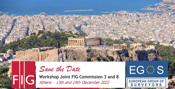
Commission 3 + 8 workshop, 13-14 December in Greece
13-14 December 2022, Athens, Greece
Please, join us an take part in the joint Workshop on the theme:
"Spatial Information and planning in a world facing multiple crises -
a surveyors' perspective"
PARTICIPANTS AND FOCUS
The workshop will be the 1st edition of the "International
Scientific Conferences of European Surveyors", organized by
EGoS - European Group of Surveyors.
FIG Commission 3 (spatial information management) and 8 (spatial
planning and development) together with EGOS cordially invite you to
attend the conference.
The organization by this important European Association of Surveyors
will make it possible to address both professional and academic issues
of great interest and relevant themes in view of contemporary
developments.
Two days packed with workshops and meetings will certainly be a great
opportunity to meet with your peers in the field of land management and
planning to discuss the latest themes and developments.
Two days packed with workshops and meetings will certainly be a great
opportunity to meet with your peers in the field of land management and
planning to discuss the latest themes and developments.
The theme of the workshop "Spatial information and planning
in a world facing multiple crises - a surveyors' perspective"
builds on the research carried out in previous years and illustrates new
aspects of Voluntary Geographic Information and the role of geospatial
information in the challenges we face, such as climate change,
international conflicts, pandemic, and sustainable development. We
therefore invite you to participate and share, in this moment of
"multiple crises", how the management of spatial information contributes
to further development, especially in relation to the ways in which the
geographical and territorial data are collected, elaborate and
distributed.
Today, climate change, extreme weather phenomena and the loss of
biodiversity are risks and occupy the first three places on the list of
threats to sectors of the global economy and to the well-being of
populations. Also, we are still in the aftermath of the Covid-19
pandemic and facethe impact of the war in Ukraine (food security and
scarcity of electricity, gas and oil).
All this has triggered a serious impact in all countries in Europe,
leading inevitably to further economic, social and environmental
challenges.
The urgent need to improve the habitat to better deal with multiple
crises leads governments to support more strongly the interventions to
protect the environment and the territory.
But what are the design models and the scientific contribution that
academics and professional surveyors can offer to be decisive for
overcoming these crises?
REGISTRATION
TO
REGISTER, PLEASE FILL IN THE REGISTRATION FORM AND EMAIL IT TO:
egos.events@veduta.com.mt
AND
margrasco@yahoo.it
(NOTE: IT'S
IMPORTANT TO USE BOTH EMAIL ADDRESSES).
Download the registration forms here:
REGISTRATION FORM FOR DELEGATES (LINK)
REGISTRATION FORM FOR GREEK PARTICIPANTS (LINK)
| Programme |
| Tuesday
13 December |
| 9:30 |
Opening Ceremony and Plenary
Session |
| |
Rudolf Staiger - President of FIG
The role of UNGGIM and the geospatial societies
John Hohol - President of FIG Foundation
The FIG Foundation
|
| 11:00 |
Coffee Break |
| |
|
| 11:30 |
Technical Session I - SDI's and
the way forward |
| |
Chair Markus Schaffert
Helge Onsrud 25 years as
consultant of western Balkans observations, reflection and
viewpoint of land administration
Nick Land - ESRI Next
generation SDI for a world in crises
Marjan Čeh Integration
of SDI and interoperability of LIS
Panos Lolonis - Head of the
Geospatial Information Department Hellenic Cadastre The
Spatial Data Infrastructure of the Hellenic Cadaster: Current
State of Play and Prospects
Evangelia Balla Re-thinking the
implementation of land management tools in spatial planning from a policy transfer perspective to "the case of land readjustment in Greece"
|
|
13:00 |
Lunch |
| |
|
| 14:00 |
Technical Session II - Extending
the LADM model for spatial planning |
|
Chair Marije Louwsma
Abdullah Kara, Peter van Oosterom, Christiaan Lemmen,
Marije Louwsma, Agung Indrajit
Extending Land Administration Domain Model with Spatial Plan
Information (ISO 19152-5)
Cemal Özgür Kivilcim
How Surveyors Can Contribute to Project Management Systems for
the Resilient City Public Projects, Case of Istanbul
|
|
15:00 |
Break |
| |
|
| 15:30 |
Technical Session III - Current
Land Management Issues I |
| |
Chair Randolph Camilleri
Cidália C. Fonte, Alberto Cardoso
The FireLoc Project: Whereʼs the Fire? - Identification,
positioning and monitoring forest
fires with crowdsourced data
Dimitrios Kitsakis, Eftychia Kalogianni and Efi
Dimopoulou
Public Law Restrictions in a Spatial Planning Context
Nikos Zacharias
The solution of the disputes in the cadastral registries with
alternative ways
Rik Wouters
Formalizing and building back better informal Settlements-the
way forward
Rahmi Nurhan Celik - Istanbul Technical
University & EGOS
Towards the Digital Twins
Katerina Fotiou, Flora Chalakatevaki, Sofia Fydani
Remote Sensing Project Examples in Urban Environment – the Greek
Examples (on behalf of Geosystems Hellas) S.A.
Stathakis Dimitris - President of
Hellenic Cadastre
Present status of the Hellenic Cadastre
|
| 17:30 |
Closure of the day |
| |
|
| 20:00 |
Dinner at Attikos Restaurant |
| |
Located in 7 Garivaldi str, Acropolis |
| Wednesday
14 December |
| 9:00 |
Technical Session IV - Fostering applications and the use of
geospatial data |
| |
Chair Hartmut Mueller
Hartmut Mueller, Marije Louwsma, Cemre Sahinkaya,
Chryssy Potsiou, Enrico Rispoli, Maria Grazia Scorza,Cemal Özgür
Kivilcim, Markus Schaffert
FIG publication Geospatial data in the 2020ʼs
Cemre Şahinkaya
Understanding the changing "give away" and shopping habits as a
part of urban practices in germany: the case of neustadt
district, dresden
Cemal Özgür Kivilcim, Leonardo Franchi, Cromwell
Manaloto et Al.
Collaboration and Synergy across generations: Young
Surveyors in FIG Commission 3
Cromwell Manaloto et Al.
Agenda 2030 for Geometra 2030: challenges and insights
in spatial planning for the Italian Young Surveyors
|
|
10:30 |
Break |
| |
|
| 11:00 |
Technical Session V - Current Land Management Issues II
|
| |
Chair Chryssy Potsiou
Apostolopoulos K., Kavadas J., Potsiou C.
Time to discuss improving the quality of crowdsourced
cadastral surveys
Gkeli M., Bakalos N., Doulamis N., Sofia Soile,
Potsiou C.
Machine learning and indoor mapping in support of a Fit For
Purpose 3D cadastre
Eleftheriou, V., Kyriakidis C., Potsiou C.
Is access to housing & tenure security a critical factor for the
social integration of refugees in Greece?
Boris Tundzev, Sonja Dimova, Tatjana Cenova Nitrevska
- President of Cadastre North Macedonia
Analisys of the Process of Building Legalization
Bashkim Idrizi, Lyubka Pashova, Neriman Selimi,
Driton Imeri
Using geoinformation and VGI in formal education
|
| 12:15 |
Conclusion and Closing |
| |
Chair Rudolf Staiger
Panelists Hartmut Mueller, Marije Louwsma,
Nikos Zacharias, Chryssy Potsiou
The panel will look back and reflect on the contributions to
this conference through the lens of
this event "on the role of the surveyor, geo-data and spatial
planning facing multiple crises”
|
| 13:00 |
Lunch |
| |
|
| 14:30 |
Visit of the Acropolis |
Downoad the programme in pdf here
|
ORGANIZING COMMITTEE |
SCIENTIFIC
COMMITEE |
| Nikos
Zacharias |
Rahmi Nurhan Çelik
|
| Randolpf
Camilleri |
Eugene Chignu |
| Maria G.
Scorza |
Sagi Daylot |
|
Enrico Rispoli |
Marije
Louwsma |
|
Malcolm Lelliott |
Hartmut
Müller |
| |
Cornel Paunescu |
|
Chryssy
Potsiou |
| |
Enrico Rispoli |
| |
Pietro Grimaldi |
| |
Markus Schaffert |
 |
Registration fees (incl. 2 lunches, 3 coffee breaks and
welcome reception:
|
Delegates |
€180,00 |
| Young Surveyors |
€ 90,00 |
Locals
(incl. 1 lunch, 3 coffee breaks and welcome reception)
|
€150,00 |
|
| |
|
Location
 |
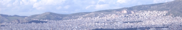
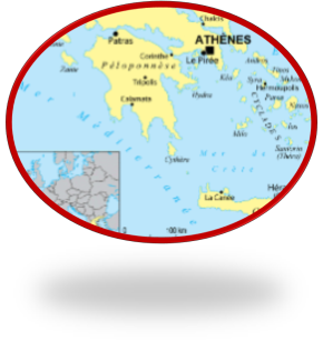
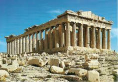
Athens is the capital of Greece as well as the heart of
ancient Greece, great civilization and powerful empire. The city
is still dominated by the monuments of the fifth century BC,
including the acropolis, a citadel on top of a hill where
ancient buildings arise such as the Temple of Parthenon with its
columns. The Museum of the Acropolis and the National
Archaeological Museum retain sculptures, vases, jewels and other
finds of ancient Greece. |
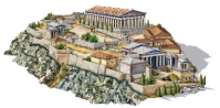 |
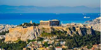
the Acropolis of Athens can be considered the most
representative of the Greek Acropolis. It is a fortress, leveled
at the top, which rises 156 meters above sea level above the
city of Athens. [1] The plateau is 140 m wide and almost 280 m
long. It is also known as Cecropia in honor of the legendary
snake-man Cecrops, the first Athenian king. |
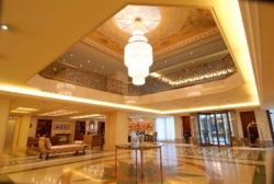 |
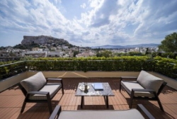
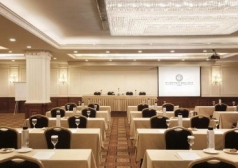
Venu of the Workshop
+ELECTRA PALACE HOTEL OF ATHENS
(PLAKA / OLD CITY) |
|
 |
 |
 |
 |
SEE YOU SOON! |
REGISTRATION
TO
REGISTER, PLEASE FILL IN THE REGISTRATION FORM AND EMAIL IT TO:
egos.events@veduta.com.mt
AND
margrasco@yahoo.it
(NOTE: IT'S
IMPORTANT TO USE BOTH EMAIL ADDRESSES).
Download the registration forms here:
REGISTRATION FORM FOR DELEGATES (LINK)
REGISTRATION FORM FOR GREEK PARTICIPANTS (LINK)
Maria Grazia Scorza
October 2022