The 3rd International and Professional Training Course for
Young Surveyors
3-14 October 2011 Athens, Greece
|
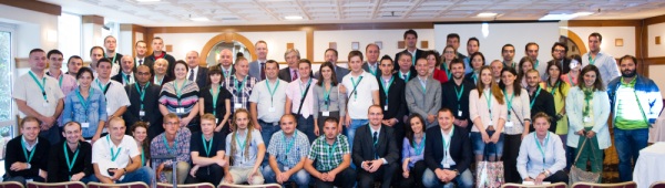
All participants at the Training Course |
The 3rd International and Professional Training Course for Young
Surveyors was held in Athens between 3 and 14 of October 2011. The training
course was an excellent and memorable event, organized and sponsored by the
Consiglio Nazionale (the National Association of the Italian
Surveyors) and Geoweb (the technical company which belongs to
Consiglio and provides all information about the Italian Cadastre to the
Italian surveyors), in collaboration with HARSE (Hellenic Association
of Rural and Surveying Engineers). All participants, young surveyors,
lecturers and local organizers expressed their thanks and appreciation to
Consiglio Nationale and Geoweb for this unique initiative, and their wish to
see this event been organized regularly in future.
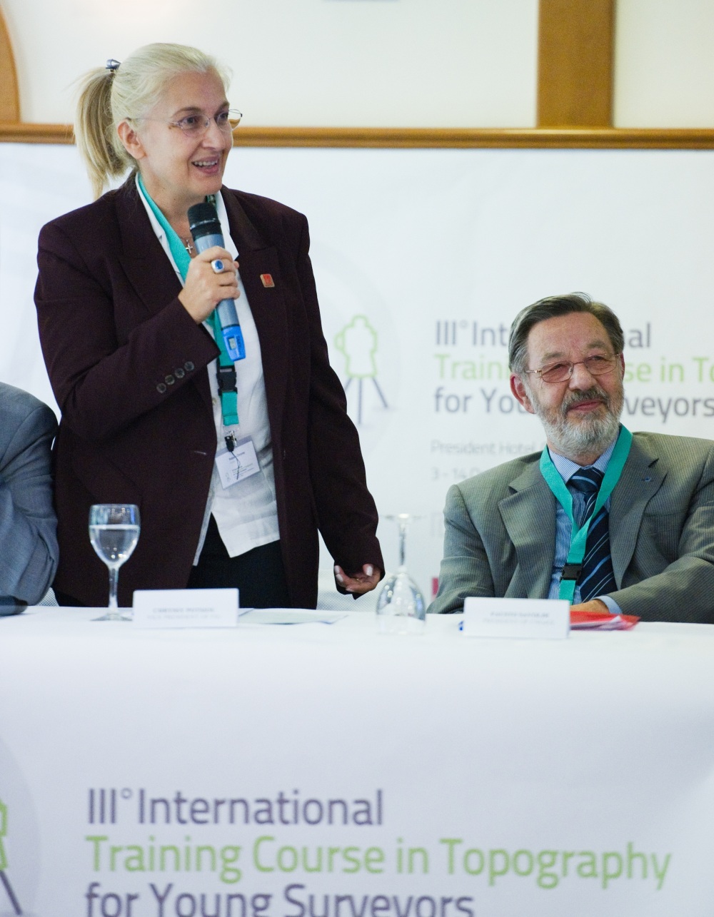
The training course was supported by FIG, EGoS, and CLGE. FIG was
represented by Vice President Chryssy Potsiou, CLGE by President Jean-Yves Pirlot, EGoS by President
Randolph Camilleri, HARSE by
President Stefanos Xekalakis, Consiglio Nazionale Geometri and
Geometri Laureati by President Fausto Savoldi and Geoweb by Manager
Giuseppe Simeone. The decisions and all works were fulfilled by the
International Office of CNGeGL, whose responsable is Maria Grazia Scorza,
in strict cooperation with the Secretary General of CNGeGL, Enrico
Rispoli. The teaching activities and the topics were followed by Bruno Razza, member of CNGeGL. The local representatives in Athens
assured the maximum availability and cooperation. The overall work was
fulfilled with the excellent supervision of the Pesident Fausto Savoldi.
In total 50 young surveyors from 21 European and non European countries
have participated in the course; the 66 hour-course schedule consisted of
lectures and technical visits; in total 23 professors from Italy, Greece,
Turkey and the United Kingdom have participated. You may read more at the
following report provided by Consiglio Nazionale.
The programme took into consideration that nowadays we have to face and
solve crucial problems: environment preservation, reduction of the air and
water pollution, global heating, research on renewable power sources, waste
collection and recycling, and so on. In short, we are talking of the
protection of the World where we are living and where we want our children
to live.
Therefore, the topics and matters of the Course were the following:
- Topographical and geomatic surveys, with application of the various
instruments and techniques;
- Surveys of artistic and heritage assets;
- GNSS surveys, data processing and transformation, for the
preparation of new digital mapping, assessment of the precision of GNSS
survey, necessary transformations between geodetic reference systems;
- Deformation of GNSS signals, atmospheric effects on RTK
applications;
- hydrography and offshore positioning, survey results and
opportunities in the waters of the Mediterranean area, techniques and
methods;
- Identification of the coastal line in Greece-special aspects;
- Visit to KTIMATOLOGIOSA (CADASTRAL SERVICE - in 2 groups);
- the Action Plan of the Hellenic Cadastre;
- The information System of the Hellenic Cadastre;
- Informal Urban Development in Europe-Tools for formalization;
- Structural monitoring and soil deformation survey, techniques,
opportunities and results which may be obtained;
- Geo-referencing of cadastral map;
- photogrammetric and LIDAR survey of artistic and heritage assets;
- HEPOS, mapping, GIS and effects of surveys on cadastral mapping;
- Real Estate Market needs in Europe;
- Methods, opportunities and results and experience of aerial surveys;
- The weaknesses of Real Estate Market in Greece- Real Property
Taxation;
- Laser Scanner and 3D photogrammetric survey;
- archaeological surveys guided tour for surveys at historical,
cultural and archaeological sites (Acropolis) (in 2 groups, 1 of the 2
groups will also split into 2 groups);
- LPIS land parcel identification system for agricultural development,
Geomatics and new surveying techniques;
- Visit to the Hellenic Military Geographical Service.
We mentioned only a few challenges that our society has to accept.
Nevertheless, these topics are all linked together by something they have in
common: the need of a deepest and more accurate knowledge of our territory,
of the air we breath and of the water surrounding and running through all
the Continents.
Land, air and water are common heritage for all the human beings. Their
knowledge and representation (nowadays more digitalised than cartographic)
are the basis for their preservation and for their exploitation within a
sustainable economic growth. Therefore, the very way we represent the
territory is interwoven with the life, the history, the traditions and the
rules of the people who inhabits it.
Traditionally, topography just measured a portion of land in order to
answer to the question “Where?”. Today its task has increasingly become to
collect, to put in order and to manage all the metric, environmental,
historic and cultural data that make it possible a growth of the society, a
fair distribution of food and resources, and an orderly way of life.
Every “measurement, every data, every representation of a detail is a
piece in the big puzzle of the global cartography that we use to find our
way, to meet each other, to effectively face the emergencies. In a word, to”
live”.
The modern topographer should be able to do all this. That’s why he needs
a specialist training and the ability to operate devices more and more
sophisticated, whose utilisation requires high-level computer skills. Most
of all, the modern professional needs that kind of “curiosity” that can push
forward the research and helps to find solutions to the various problems.
CNGeGL thinks that these topics have a strategic importance for the
future and that their knowledge have to be faced with scientific rigour from
the youth who have more interests towards the future wellbeing.
In this spirit the Italian Surveyors have undertaken the initiative of
this Course.
The course was addressed to European Young Surveyors and was held in English
language. The teachers involved in this event were from Italy, Greece,
Turkey and United Kingdom.
The venue of the Course was the President Hotel in Athens (43 Kifissias
Avenue, 11523 Athens) where the participants had also their accommodation in
single rooms.
In order to take part in the Course all participants had to satisfy the
following:
- Age up to 35 years old;
- Good knowledge of English language;
- Expertise in the field of topography (curriculum);
- Moral and psycho-physical requirements that are valid to work in the
Public Administration and to practise the free profession.
The III International Trainng Course for Young Surveyors ended with full
satisfaction of the participants, teachers, representatives of the greek
associations that contributed to the organization and of Geoweb.
50 young surveyors coming from 21 European and non European Nations
participated in the workshop.
All participants studied with good results and interests the lessons of
the calendar as approved by CNGeGL for a total amount of 66 hours including
also the technical visits. Very instructive was the visit to the Hellenic
Military Geographical Service, to the Minister of National Defense Mr. Panos
Beglitis and to the Deputy Minister of National Defense Mr. Konstantinos
Spyliopoulos.
The teachers, altogether 23, came from Italy, Greece, Turkey and United
Kingdom and were all equal to the task assigned to them in relation to the
intensification topics on topography according to the most modern scientific
aspects. At the end of the course all participants received a questionnaire
aimed to obtain comments on all aspects of the course (location, topics,
avaibility of the teachers, some suggestions for the future). All
participants fulfilled the questionnaire.
According to the result of the questionnaire, the course obtained a great
success. In particular very positivewere the content of the topics and the
full avaibility of the teachers involved. The organization required a huge
effort so that all activities (teaching and staying) were devoid of
obstacles and annoying conditions.
On 13 October the Italian delegation together with the Greek met the
General Director of the Greek Cadastre in his office in Athens. During this
meeting information regarding the functioning of both cadastral systems were
exchanged. Very interesting for the Greek delegation were the functions and
telematic activities of Geoweb society in Italy. The Greek cadastral
managers declared that the information exchanged were very useful for them
and expressed the intention to ask to their state authorities to follow the
italian model of Geoweb in Greece too.
On 14 the closing ceremony was held in a very touching and convivial
atmoshere between students, teachers and organizers. FIG Vice President
Chryssy Potsiou declared that the initiative of CNGeGL to organize and
sponsor such a good and successful event for its scientific content and for
the numerous participation from several Nations represented a fact already
known and well considered in all the world as concrete action of exchange of
experience between the populations and common effort for the scientific
research and peaceful living.
Nikos Zacharias, representative of EGoS, who was already involved
in the 2 previous courses, declared that the experience in Athens was a
considerable improvement in comparison with the previous experiences and
that it constituted the best presupposition to repeat and attract new and
numerous participations next year.
All representatives thanked CNGeGL and Geoweb for their economic and
practical commitment and for having choose Athens as venue of the III
International Training Course for Young Surveyors.
|
The opening of the Training Course |

FIG Vice President Chryssy Potsiou together with President Fausto
Savoldi |
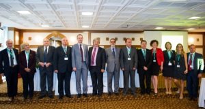
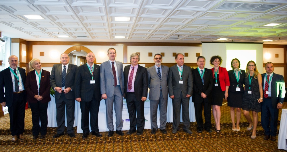
All organisors of the Training Course |
16 December 2011
|