News in 2023
|
13th Session
of the
UN Committee of Experts on UN-GGIM
31 July - 4 August 2023, New York USA
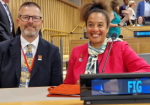
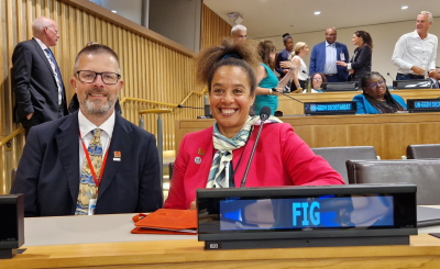
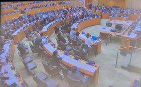
FIG President Diane Dumashie and the FIG Community at the 13th Session
of the
UN Committee of Experts on Global Geospatial Information Management
(UN-GGIM)


UN Headquarters, New York |
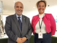
President Diane Dumashie, Vice President Mikael Lilje |
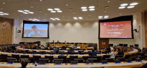
Since its establishment, the UN Committee of Experts on Global
Geospatial Information Management (UN-GGIM) holds an annual meeting.
This year, the 13th session was convened at the UN headquarters in New
York, and organised by United Nations Statistics Division (UNSD) of the
Department of Economic and Social Affairs.
Programmed over five days it also includes two days of substantive side
events and pre- meetings. President Diane Dumashie was invited to
participate and importantly, many of our FIG community are also active
including FIG Vice President and FIG chairs, as detailed below, were
also involved in these related side events and network meetings.
The UN-GGIM Committee of Experts are mandated to provide leadership to
ensure that geospatial information and resources are coordinated,
maintained, accessible and able to be leveraged by member states and
society to find sustainable solutions for social, economic and
environmental development. The annual meeting is a formal mechanism
under the UN auspices for the key players, i.e. member States to discuss
and coordinate geospatial information activities.
In addition, observers from international organizations, academia,
regional organisations and networks and the private sector are also
invited to participate.
FIG is a UN and World Bank recognized non-governmental organization, and
has an observer status role. This means that FIG is given space to
provide verbal interventions during the member states’ plenary
discussions to inform the agenda topic under discussion.
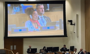
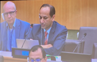
Diane Dumashie and Ryan Keenan plenary interventions |
|
It is clear that there is a need and relevance for a global mechanism
such as UN-GGIM and that FIG has much to offer. Noting that the
Committee of Experts is a subsidiary body of the Economic and Social
council that is in charge of all matters relating to geospatial
information, geography, land administration and related topics.
Accordingly, FIG President Diane Dumashie emphasised the relevance of
FIG and UN GGIM partnership working with the various UN-GGIM
initiatives. In particular, and because UN GGIM is addressing the
critical issues that FIG is also focusing on during over the next few
years. Namely, the future geospatial information ecosystem (FIG
Geospatial Task Force); FELA, LADM (Comm 7); geospatial information for
sustainable development (Comm 3); climate resilience (FIG Climate
Compass Task Force); authoritative data and integrated marine geospatial
information management (Commission 4); SDG (FIG Agenda 2030 Task
Force).
Given FIG observer status the pre- meeting days (31st July to 1st
August) confirmed the need and relevance of FIG involvement, particular
in the side events and meetings related to the substantive work of the
Committee of Experts.
President Diane Dumashie was invited to actively participate in:
1. The Global Geodesy Forum with the
theme “Towards a Sustainable Global Geodetic Reference Frame GGRF”
Organised by the Subcommittee on Geodesy, this committee includes FIG
Chair Ryan Keenan (Commission Geodesy). The session covered topics
presented by Nichols Brown (Co- chair of the GGRF) highlighting the
geodesy supply chain and the need for continuing measurement of the
earth; Allison Craddock (JPL) outlined the subcommittees seven strategic
actions to sustain the GGRF; FIG collaborative partnership working was
presented by FIG President Diane Dumashie (see handouts) and
highlighted the many FIG inputs, e.g FIG role and participation in the
recently opened UN Global Geodetic Centre of Excellence, Bonn, Germany.
The final presentation by Ryan Keenan focused on the context of geodesy
in Africa.
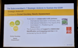 |
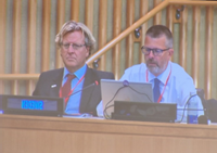
Presenters slides: Left Allison Craddock, Right Diane Dumashie
|
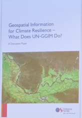
2. Geospatial information for
Climate resilience- What does UN-GGIM do.
A discussion paper was prepared by the UK Ordnance Survey and the Bureau
and Secretariat of UN-GGIM, which highlights actions that UN-GGIM could
take to enhance the role of geospatial information within climate change
mitigation and resilience efforts.
Slides presented by ordnance Survey Great Britain
Moderated by James Norris (OS), the opening by David Henderson (OS) set
the scene for discussion along with invited comments from Yana Gevorgyan
(Group on Earth Observations) and Diane Dumashie (FIG). Diane
highlighted FIG work to elevate the awareness first that the global
survey profession is already at the forefront of measuring change in our
natural and built environment to ensure our planet remains sustainable
and resilient; and that through the activities of the FIG task force on
climate and the Agenda 2030 Task Force, surveyor professionals are well
positioned to make contributions to a wide range of land and water
related climate issues.
3. UN GGIM Geospatial Societies
Network
FIG is a member of the Geospatial Societies network, a collation of
international recognised organisations involved in coordinating,
developing, managing and standardising geospatial information and
related matters. Organized on a rotating Chair basis (FIG held
this until 2022), the group convenes formally once a year typically
during the session of the Committee of Experts and informally on
specific projects. Diane Dumashie in attendance contributed to the
groups two meetings during the five- days, to consider and discuss a
strategic way forward to best contribute and leverage the work of the
Committee of experts. Further information on the group may be
found on the FIG hosted web site
http://www.fig.net/unggimgs
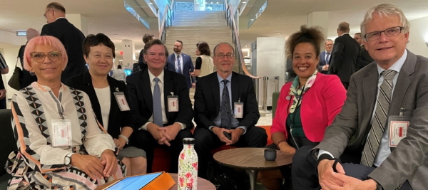
Attending members of the UN-GGIM Geospatial Societies network
With many opportunities to collaborate this
is a forum and community that aims to be innovative. In this context the warmly
welcomed announcement made by member states to take the agenda forward
were:
- The offer from the
government of the Kingdom of Saudi Arabia, through its General Authority
for Survey and Geospatial Information (GEOSA), to host and establish a
United Nations Global Geospatial Ecosystem Centre of Excellence in
Riyadh, Kingdom of Saudi Arabia.
- The offer from the
Government of Mexico to host the Seventh High-level Forum on Global
Geospatial Information Management in Mexico City in October 2024, with
the theme ‘Accelerating Implementation: Achieving Resilience’,
It was a pleasure to see the cross over with so many FIG people in this
UN GGIM community underscoring the clear collaboration that benefits the
ultimate goal that professionals serve society.
Janak Raj Joshi, Director General Nepal, Mikael Lilje Sweden, Dr M Al
Sayel President General Authority for SGI Kingdom of Saudi Arabia.
In a range of ways the importance of individual engagement is a clear
and meaningful contribution to UN-GGIM and the wider UN global agenda. Thanks for the work to the many in the past and present and those
active at this year’s sessions, including:
- Expert Groups: Ryan
Keenan
- Networks: Academic
Abbas Rajabifard and Rosario Casanova; Private Sector Ryan Keenan;
Geospatial Societies Diane Dumashie.
- Regions (that each
conducts annual meetings at continent level): Americas, Dan Roman.
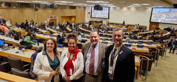
Left to right: Rosario Casanova, Diane Dumashie, Rosar Abbas Rajabifard
and Ryan Keenan
It is also noteworthy that FIG individual members may attend as their
respective, member state representatives, on this occasion this included
FIG Vice President, Mikael Lilje, Sweden, and Janak Raj Joshi, Director
General Nepal.
The 13th Session reached its conclusion on the final day. All
documents and proceedings may be read here.
web site:
https://ggim.un.org/meetings/GGIM-committee/13th-session/
Dr D A Dumashie, FRICS,
August 2023