Figure of the Earth
By the figure of the earth is meant the
set of parameters that define the size and shape of the earth. In its
simplest form if considered as a true sphere that would be the radius. As
the accepted figure is more complicated than that so there are more
parameters. Included in this is also the range of methods and equipment that
over the years have been used to determine the parameters.
Among these methods are
arc measurements and the use of baselines
in triangulation schemes. In addition particular
personalities
have played important roles in the gradual refining of the results.
A listing and details of the methods used
is being accumulated. From the earliest measures such as that attributed to
Eratosthenes
c230 BC to the numerous ones made since the introduction of triangulation by
Snellius and others in the early 17th century up to the introduction
of electromagnetic methods from the early 1950s.
Among the useful references are:
Erdgestalt, Kosmologie und Weltanschauung. V Bialas. 1982. Konrad
Wittwer, Stuttgart. ISBN 3-87919-135-2
Ellipsoidischeparameter der Erdfigur (1800-1950). G Strasser. 1957.
Deutsche Geodätische Kommission. München.
From Plane to Spheroid. Determining the figure of the Earth from 3000 BC to
the 18th century Lapland and Peruvian survey expeditions. J R Smith.
1986. Landmark Enterprises, California. ISBN 0-910845-29-8
The History of the theories of attraction and the Figure of the Earth. 2
vol. I Todhunter. 1873. Macmillan and Co.
Practical geodesy. M Hooijberg.
1997. Springer-Verlag, Berlin. ISBN 3-540-61826-0
Figure of the Earth. G B Airy. 1845.
Encyclopaedia Metropolitana. Vol. 5 pp 165-240
Introduction to geodesy. The
history and concepts of modern geodesy. J R Smith 1996. John Wiley &
Sons. ISBN
0-471-16660-X
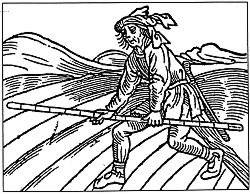 |
From Geometrei. J Kobel, 1556. Courtesy
Jan de Graeve. |
|