Research
Research is very much of an individual
nature rather than by the Institution as a whole. Among those we are aware
of are:
-
Bjorn Harsson (Norway) is researching the Struve arc points in
Northern Norway.
-
Vitali Kaptjug (Russia) is researching the conversions between
units of measure on the Struve arc.
-
Jim Smith (UK)
(deceased) focussed his work on the history of geodesy.
He was also interested in the connection between the Struve
geodetic arc and that of the 30th meridian in Africa. He welcomed input
from any interested readers. He was also interested
in the arc measurements of c1735 made in Peru and Lapland.
-
Jane Insley (UK) has been looking into the locations and
condition of the 3 ft diameter theodolites.
-
Mike Cooper (UK) (deceased) was
researching the work of Robert Hooke and has recently obtained a
Doctorate on the topic.
-
Jan de Graeve (Belgium)
continues to take a passionate interest in sundials.
-
Thomas Glatthard (Switzerland) is researching into the locations
of illustrations in literature that pertain to surveying.
-
Harold Nelson (USA) has a
continuing interest in the relocation of early USA baselines and corner
stones together with the early days of transatlantic telegraph.
-
Erik Tobé (Sweden) has for a
long while researched the individuals who worked on the Lapland geodetic
arc of 1736-7.
-
Tomasz Zaciewicz (S Africa)
has a close interest in all aspects of the arc of the 30th meridian in
Africa.
-
John Brock
(Australia). Research and compilation of surveying as depicted in
Hollywood style movies, TV shows and advertisements.
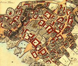 |
Map from Bornholm, Denmark, 1818.
Courtesy Kort & Matrikelstyrelsen, Denmark, KMS and Den danske
Landinspektørforening DdL. |
Latest research projects
"The States of a Nation" - the history of the politics and surveys of
the
Australian State borders
About the Author:
David John Taylor is an Account Manager within the Business
Development Services Branch, Land and Property Information NSW, a Government
Business Enterprise within the NSW Department of Information Technology and
Management.
He completed the Cartography (Fulltime) Certificate in 1973, the Surveying
Certificate in 1974 and the Associate Diploma in Cartography in 1975 - all
from Sydney Technical College. He went on to undertake further tertiary
studies after a break from studying (1975-1986), completing the Associate
Diploma in Information Services (Computer and Communication Technologies) in
1989 - graduating from Capricornia Institute of Advanced Education,
Rockhampton, Queensland in 1990.
He went on to complete a Bachelor of Arts degree (Communication, Tourist and
Recreational Planning) from the University of Central Queensland, graduating
in 1993 (now Central Queensland University). He is an active Member of the
Mapping Sciences Institute, Australia (MMSIA) and an Associate Member of the
Institute of Public Administration Australia Inc. (AMIPAA).
Abstract:
A search of all literature relating to Australian history revealed that
very little information is recorded in encyclopedias, etc about the history
of the politics and surveys of the Australian state borders. The last
comprehensive document attempting to record this aspect of surveying history
was done in 1895 - Campbell, W. D., 1895, "An Account of the Boundaries of
Australasian Colonies" in "The Surveyor", Vol VIII, No. 1 January 7, 1895.
This research is to be seen as an attempt to fill a void in Australian
history and hopefully serve as a research document for students, educators
or anyone else interested in learning how The States of A Nation came into
existence.
The research document commences with Captain Phillip's Commission in
1788, which defined New South Wales and its dependencies as: ".. appoint you
the said Arthur Phillip to be our Captain-General and Governor-in-chief in
and over our territory called New South Wales extending from the Northern
Cape or extremity called Cape York in the latitude of ten degrees
thirty-seven minutes south to the southern extremity of the said territory
of New South Wales or South Cape in the latitude of forty-three degrees
thirty-nine minutes south and of all the country inland westward as far as
the one hundred and thirty-fifth degree of east longitude reckoning from the
meridian of Greenwich including all islands adjacent in the Pacific Ocean
within the latitudes aforesaid of ten degrees thirty-seven minutes south and
forty-three degrees thirty-nine minutes south.."
The document then traces the history of the politics and surveys of all
Australian state borders since this Commission to present day. It mentions
the politicians and surveyors and the work they have done. The surveyors are
the "quiet achievers" as they undertook most of the early surveys of these
borders at the time when the explorers were gaining kudos for their
explorations. The politicians laid the rules for the placement of these
borders.
The document concludes with an investigation of the New States movement
within Australia and how this affects the placement of state borders. This
section includes:
- Riverina agitation
- New England agitation
- Agitation in Queensland
- "Princeland" succession movement in Victoria/South Australia
- "Albert"
- Hutt River Province (Western Australia)
Enquiries on any aspect of above material can be addressed to:
David Taylor
PO Box 1716,
Bathurst NSW 2795
Australia
Email:
David.Taylor@ditm.nsw.gov.au
|