|
Plenary and Technical Sessions |
| Friday, 8 May |
Friday,
8 May
09:00–17:00
| FIG Council Meeting
Organiser: Prof. Dr. Rudolf Staiger, FIG President, Germany
|
| Saturday, 9 May |
Saturday,
9 May
09:00–17:00
|
FIG ACCO Meeting
Organiser: Mr. Mikael Lilje, FIG Vice President, Sweden
|
Saturday,
9 May
|
5th FIG Young Surveyors Conference - Social Distancing
Edition
Organiser: FIG Young Surveyors Network
FIG Young Surveyors managed in one day to organise 4
webinars, all on different continents, and all with different
content. These events were competently facilitated by a
dedicated group of Young Surveyors – who all need a very big
thanks for making this happen. This shows a truly global
approach and outreach!
View the sessions here:
|
| Sunday, 10 May |
Sunday,
10 May
09:00–15:30
| FIG General Assembly - part 1
Organiser: Prof. Dr. Rudolf Staiger, FIG President, Germany
FIG General Assembly 2020 has been cancelled and postponed to 2021.
FIG Council has decided that there will be no General Assembly at
all in 2020. Instead, votings and decisions will be moved to the Working
Week 2021 in the Netherlands. The agenda of the GA 2020 is already published. It includes reports on the various FIG activities, and it is our hope that you will read the agenda and these reports, and through this stay updated on what is happening in our Federation and what FIG Commissions, Networks Task Forces and other active FIG individuals and groups are working on.
This will also mean that the elections for the two positions as Vice President will be postponed to the General Assembly in 2021, which will be 24 and 28 May 2021 held in Accra, Ghana. Council has decided that the current council will continue until the election has taken place. Hereafter the new elected Vice Presidents will take over immediately.
FIG Working Week
2020 - Technical Programme
|
Sunday,
10 May
16:00–16:30
| Charity Event "Mapping the Plastic" |
Monday, 11 May: Smart Surveyors
Rapid urban growth, smart energy, cleaner mobility, and ‘land rights for
all’ are some of the challenges demanding innovative surveying
approaches and technologies. Sensing technologies, spatial data
processing technologies and related approaches are already available.
Use and improve them to become future proof, Smart Surveyors!
|
Monday,
11 May
08:00–08:45
| Newcomers Session
Organiser: Ms. Louise Friis-Hansen, FIG Director, Denmark
New to the FIG Working Week?
Join us at the session for newcomers to meet members of the council, the FIG Office and other participants who will experience the FIG Working Week for the first time. Do not miss this opportunity to learn more about FIG, on how to maximize your conference experience and making most of your attendance. First time attendees will be introduced to the programme, the keynote speakers, the sessions tracks, the roundtable discussions, the sponsors and social events.
The official Opening Ceremony of the conference will immediately follow the newcomers session. We look forward to seeing you there!
|
Monday,
11 May
09:00–10:30
|
Opening Ceremony
Master of Ceremony: Mr. Kees de Zeeuw, Director of Kadaster International
The opening ceremony will provide a spectacular introduction to the FIG Working Week, its theme, and its unique location - a festive start of the Week.
Welcome Addresses by
- Ms. Femke Halsema, Major of Amsterdam
- Prof. Dr. Rudolf Staiger, FIG President
- Mr. Peter Hoogwerf, GIN President
- Ms. Paula Dijkstra, co-conference director
Keynote Speaker:
-
Prof. Co Verdaas
Urban Development has never been so Complicated (and Cool)
Prof. Verdaas will give the participants a peak into how we organize our limited space. Verdaas experiences in academia, practice and governance in spatial development in the Netherlands will provide a perfect background to demonstrate how challenges in relation to integrated land and water management are addressed with the coordinating role for the government and involvement of the market partners.
|
Monday,
11 May
10:30–11:00
Exhibition Area, RAI
| Morning Break |
Monday,
11 May
11:00–12:30
|
PLENARY SESSION 1: SMART SURVEYORS
Rapid urban growth, smart energy, cleaner mobility, and ‘land rights for all’ are some of the challenges demanding innovative surveying approaches and technologies. Sensing technologies, spatial data processing technologies and related approaches are already available. Use and improve them to become future proof, Smart Surveyors!
Jack Dangermond (USA):
Surveying and Geospatial Infrastructure (10815)
[abstract]
[paper] Sisi Zlatanova (Australia):
3D Indoor Modelling. Challenges and Opportunities (10816)
[abstract]
[paper] Frank Tierolff (Netherlands):
Use and Applications of New Technologies (10817)
[abstract]
[paper] |
Monday,
11 May
12:30–14:00
Diamond Lounge, RAI
| Lunch Break |
Monday,
11 May
14:00–15:30
|
International Ethical Standards - Working Group Meeting
Organiser: Ms. Winnie Shiu, FIG Commission 1 Chair, Hong Kong SAR, China
&
Mr. Gary Strong, FIG Working Group Chair of WG 1.1, United Kingdom
This is an open meeting.
International Ethics Standards (IES) has been published and consists of high level principles which will provide greater consistency to users of professional services.
FIG Council supports IES and the ethical code. As the IES is a general Code of Ethics, FIG council has asked the Working Group 1.1 to look for best practice examples of the IES-Code in our professional environment (surveying, geospatial, land management, valuation, construction surveying, cadastre, ….). At the meeting FIG members and participants can present and discuss best practice examples. Once these best practice examples are identified and discussed FIG Council will check whether the current FIG Ethics Code should be updated or adapted to the IES-Code. This can finally lead to a discussion about a harmonisation or replacement of the existing Ethical Code of FIG.
Read the report of
WG 1.1 - International Ethics and Standards Gary Strong (United Kingdom):
International Ethics Standards (IES) (10628)
[abstract] [paper] Nigel Sellars (United Kingdom):
Challenges for Surveying Professionals in the 21st Century – Ethics and the Importance of Stakeholder Engagement (10399)
[abstract] [paper] |
Monday,
11 May
14:00–15:30
|
TS01A: Blended Learning and Innovations in Professional Education
Commission: 2
Organiser: Dr. David Mitchell, FIG Commission 2 Chair, Australia
Blended learning is a key theme of FIG Commission 2 and this session highlights innovative practices in blended learning by the FIG community.
Read the report of
FIG Commission 2
David Mitchell (Australia), Winnie Shiu (Hong Kong SAR, China), Stig Enemark (Denmark) and James Kavanagh (United Kingdom):
On ‘blended’ Learning and the Benefits for Surveying Education, Professional Development and ‘life-Long Learning’ (10599)
[abstract] [paper] Kariyono Kariyono, Deni Santo and Budi Satrio (Indonesia):
Human Resource Competency Enhancement in Agrarian and Spatial Planning by applying the Blended Learning Method (10613)
[abstract] [paper] Robert Kingdon (Canada):
Universal Design for Learning in a Surveying Course (10736)
[abstract]
[paper] Craig Roberts (Australia):
Teaching Modern Geodesy (10266)
[abstract] [paper] Vladimir Zablotskii (Russia):
A New Approach to Teaching C++ Programming for Surveyors and Cartographers: Pedagogical Experiment at the Moscow University of Geodesy and Cartography (10349)
[abstract] [paper] Weifang Yang, Guanjun Wei, Wei Li, Haowen Yan and Li Yuzhao (China, PR):
Practice of Teaching Surveying for Undergraduates Assisted by Rain-Classroom Platform (10417)
[abstract] [paper] Mohsen Kalantari (Australia):
BIM Curriculum for Geomatics Engineering (10774)
[abstract] [paper] |
Monday,
11 May
14:00–15:30
|
TS01B: UAV & Photogrammetry: Techniques for Smart Surveyors
Commission: 6
Organiser: Eng. Maria Henriques, FIG Commission 6 Chair, Portugal
Photogrammetry is an old technique, renewed in the 1990’s when new computing techniques were developed, making it user-friendly. Concerning equipment, the technical progresses in the field of digital photography together with UAV helped to expand its domains of use. Due to their skills, engineering surveyors quickly mastered the technique and the equipment. This session is a good example since it includes presentations related to the use of photogrammetry and UAV, but also with the technique itself including the desired theme of accuracy.
Alessandro Capra (Italy):
Underwater Photogrammetry for Change Detection (10745)
[abstract] [paper] Pietro Grimaldi (Italy):
Architectonic Photogrammetry and Earthquake of 1980 in Italy (10779)
[abstract]
[paper] Naa Lamkai Quaye - Ballard, Daniel Asenso Gyambibi and Jonathan Quaye - Ballard (Ghana):
Unmanned Aerial Vehicle (UAV) for Topographical Mapping of Inaccessible Land Areas in Ghana: a Cost Effective Approach (10476)
[abstract] [paper] Giuseppina Vacca (Italy):
WEB Open Drone Map (WebODM) a Software Open Source to Photogrammetry Process (10728)
[abstract] [paper] Kenneth Varner (Germany):
A Toolset for Automating 1mm Measurement Accuracy in Photogrammetry Surveys (10623)
[abstract] [paper] Heinz-Juergen Przybilla and Baeumker Manfred (Germany):
RTK and PPK: GNSS-Technologies for Direct Georeferencing of UAV Image Flights (10801)
[abstract]
[paper] |
Monday,
11 May
14:00–15:30
|
TS01C: Roundtable: Task Force 2021 Governance
Organiser: Dr. Diane Dumashie, FIG Vice President, United Kingdom
The Task Force on the Future Governance of FIG is an internal Task Force focusing on an evaluation and proposal of potential changes of the current FIG Governance. Chaired by Vice President Diane Dumashie, it draws upon the work from earlier Task Forces, including the Task Force on Commission Structure. It aims to investigate the structure of the federation.
More information about the Task Force can be found at:
https://fig.net/organisation/general_assembly/task_force/governance_19-22.asp
|
Monday,
11 May
14:00–15:30
|
TS01D: Director General Forum
Organiser: Mrs. Gerda Schennach, Austria
|
Monday,
11 May
14:00–15:30
|
TS01E: Mapping, Planning, Development and SDI I
Commission: 3 and 8
Organiser: Prof. Hartmut Müller, FIG Commission
3 Chair, Germany & Ms. Marije Louwsma, FIG
Commission 8 Chair, Netherlands
Sustainable development needs appropriate planning, planning requires trustworthy spatial information that can be provided by a well-developed SDI, the interface to all parties involved in the process are understandable maps.
This is the first session to discuss the relations of these aspects in a wide range of applications.
This is an ISS - Inspirational Short Session presenting
on mapping, planning, development and SDI. The presentations are
short, sharp and specific, hence maximize information and idea
gathering. Following the inspiring presentations there will be a
lively discussion. Sebastian Botsyo and John Ayer (Ghana):
Spatial Mapping of Solar Potential of Ghana using Geographic Information Systems (10265)
[abstract] [paper] Udo. A Emmanuel, Ojinnaka O. C, Chukwuocha A.C and C . N Baywood (Nigeria):
Application of Geospatial Techniques in Modeling and Analysis of Topographical Settings in Kogi State, Nigeria (10285)
[abstract] [paper] Joel Igbokwe, Esomchukwu Igbokwe, Nkechi Baywood and Uchenna Duru (Nigeria):
Evaluation of the Effect of Landuse Growth on Land Surface Temperature Using Remote Sensing; a Case Study of Awka Capital Territory, Nigeria. (10287)
[abstract]
[paper] Boštjan Pucelj (Slovenia):
Digital Archive of Geospatial Data of the Republic of Slovenia (10293)
[abstract] [paper] Hamidreza Ostadabbas, Heike Weippert and Behr Franz-Josef (Germany):
Database Tranformation, Cadastre Data Processing in QGIS and Implementation in Web GIS
(10324)
[abstract] [paper] Olasehinde Ajayi and Olabode Bamidele Fateye (Nigeria):
Geographical Information System Assessment of Groundwater Potential Zones of Iju Town, Ondo State Nigeria (10393)
[abstract] [paper] Gift Ahuchaogu Ginikanwa, Udo Emmanuel, Ogba Chima and C . N Baywood (Nigeria):
Geospatial Analysis of River Inundation and Flood Risk Levels in Ajeokuta Using Remote Sensing and GIS (10419)
[abstract] [paper] Olga Matuk and Elżbieta Bielecka (Poland):
Comparision of the Thematic Scope on the Use of Land in Urbanized Areas in Selected European Countries (10437)
[abstract] [paper] Jin Bai, Tianming Mu, Jingnan Gao and Shutong Zhang (China, PR):
Research on the Construction of the Governance Mode of Mineral Resources Development with Public (10455)
[abstract] [paper] Matteo Tartaglini (Italy):
Valorization of Territory of Ancient Mine for Tourism (10475)
[abstract] [paper] Mbarga Mbarga Tobie Camille (Cameroon), Asogwa Ndidiamaka vivian, Okeke Francis and Raphael Ndukwu (Nigeria):
Advantages of a Digital Cadastre Using an Unmanned Aerial Vehicle (UAV) Tool to Support Better Governance and Land Administration in Cameroon: An Exploratory Study (10715)
[abstract] [paper] Angelica Leon (Colombia):
Technification of Open Pit Exploitation Through Topography and Implementation of Mining Plans in Minas Belencito – Monjas – San Antonio (10263)
[abstract] [paper]
[handout] |
Monday,
11 May
14:00–15:30
|
TS01F: FIG Platinum Member Session - Esri
At Esri, we have all been 24x7 on this pandemic. We would like
to extend to FIG membership a webinar on the resources available
– apps, data, and a lot more. We are building new solutions
daily. See this
COVID19 GIS
Response Hub. There is more, but this hub is a good place
to see what is going on. As you may know, Esri is making
technology and data freely available to anyone who needs it
through the
Disaster Response Program.
A webinar will be organised to help land agencies understand
some of the things they can do and help with. More information
to follow.

|
Monday,
11 May
14:00–15:30
|
TS01G: Geodetic Capacity Development 1
Commission: 5 and FIG AP CDN
Organiser: Mr. Rob Sarib, FIG Asia/Pacific Capacity Development Network Chair, Australia
The Asia Pacific Capacity Development Network, in collaboration with the UN Sub-Committee on Geodesy - Education Training & Capacity Building, and the UN Global Geospatial Information Management Asia Pacific Geodetic Reference Frame WG, invite delegates to provide their feedback and views on the status of workings and future initiatives relating to geodetic capacity development.
Sharafat Gadimova (Austria):
Activities of the International Committee on Global Navigation Satellite Systems (ICG): Promoting the Use of Global Navigation Satellite Systems as Tools for Scientific Applications (10797)
[abstract]
[paper] Mikael Lilje (Sweden), Allison Craddock (USA) and Ryan Keenan (Australia):
Education, Training and Capacity Building Supported by the Integrated Geospatial Information Framework (10474)
[abstract]
[paper] Martin Lidberg (Sweden), Laila Loevhoeiden (Norway), Nicholas Brown (Australia), Johannes Bouman (Germany) and Jorgensen Anne (Norway):
UN Global Geodetic Centre of Excellence – Progress from the UN-GGIM Sub Committee on Geodesy (10590)
[abstract] [paper] Basara Miyahara (Japan):
UN GGIM AP WG - Geodetic Reference Frame and GGOS on Geodetic Capacity (10804)
[abstract]
[paper] |
Monday,
11 May
14:00–15:30
|
TS01H: Game Changers in Land Administration
Commission: 7
Organiser: Dr. Daniel Paez, FIG Commission 7 Chair, Australia
There is significant recognition around the world of the need to address land issues as a mechanism to achieve sustainable development. However, technology, social and political changes are demanding land practitioners adaptation to the new rights, restrictions and responsibilities that society demands. This session brings senior practitioners around the world to present their experiences and enlightening us on the future of land administration.
Timothy Fella (USA):
Digital Submission Challenges and Opportunities with the Next Generation Parcel Fabric (10309)
[abstract] [paper] Narelle Underwood and Adrian White (Australia):
Transitioning from Paper to Digital Survey Plans (10440)
[abstract]
[paper] Walter Volkmann (USA):
Drones and the Structure from Motion (SfM) Technique in Cadastral Surveying (10553)
[abstract]
[paper] Kees de Zeeuw, Eva-Maria Unger (Netherlands), Rohan Bennett (Australia) and Lemmen Christiaan (Netherlands):
Effective Land Administration – What is the Difference Between FFP LA and do Those Two Concepts Complement Each Other? (10569)
[abstract]
[paper] John Clutterbuck, Dave Stow (United Kingdom), Peter Shaw (New Zealand) and Jill Urban-Karr (USA):
Fit-For-Future Land Administration with Sustainable Transformation (10746)
[abstract] [paper]
[handouts] |
Monday,
11 May
14:00–15:30
|
TS01I: Land Consolidation Legislation: FAO Legal Guide and its Application at the Country Level
Organiser: Mr. Frank van Holst, RVO, Netherlands & Mr. Maxim Gorgan, FAO REU, Hungary
Jointly organised by FAO and FIG
The session will be focusing on land consolidation legislation. During the session, FAO will present the new Legal Guide on Land Consolidation prepared based the outcomes of a study on good European practices for land consolidation legislation. The session will to support the application and implementation of the Voluntary Guidelines on the Responsible Governance of Tenure (VGGT).
The Guide will be useful to a broad range of stakeholders: legislatures, legal drafters and land consolidation professionals, public and private entities and persons in the land consolidation process.
The objective of the session will be to promote good land consolidation practice and the practical application of the Guide with the examples from different countries in Europe and Central Asia.
A Webinar will be organised. More information to
follow.
Morten Hartvigsen (Denmark), Tomas Versinskas (Lithuania), Margret Vidar (Italy), Kristina Mitic Arsova (North Macedonia) and Frank Van Holst (Netherlands):
FAO Legal Guide on Land Consolidation and its application (10461)
[abstract]
[paper] Morten Hartvigsen (Hungary), Amin Ismayilov (Azerbaijan) and Maxim Gorgan (Hungary):
Development of a Land Consolidation Instrument in the Republic of Azerbaijan (10385)
[abstract] [paper] Henk Leenen (Netherlands):
Evolution of Legal Framework for Land Consolidation in Netherlands (10830)
[abstract]
[paper] Kristina Mitic – Arsova, (North Macedonia):
Development of Land Consolidation Legislation in North Macedonia (10831)
[abstract]
[paper] |
Monday,
11 May
14:00–15:30
|
TS01J: Valuation – Addressing Market Failures and Improving Decision Making
Commission: 9
Organiser: Mr. Ben Elder, FIG Commission 9 Chair, United Kingdom
How are we addressing market failures to provide governments, authorities, companies with better information to ensure better use of scarce resources?
Jagbir Singh (India):
Sustainable Development & Environmental Issues in India: Some Challenges (10336)
[abstract]
[paper] Thomas Dimopoulos (Cyprus):
Introducing Machine Learning Algorithms in Automated Valuation Models in Cyprus (10711)
[abstract]
[paper] James Kavanagh (United Kingdom):
Effective Due Diligence for Land Professionals Engaged in Land and Property Acquisition & Transfer – Essential for Emerging Markets. (10468)
[abstract]
[paper] Rients Van Wijngaarden, Michiel Jellema and Marinus de Bakker (Netherlands)European Valuation of Houses, a First Approach (10566)
[abstract] [paper] Sebastian Kropp (Germany):
Do We Have a Housing Bubble in Berlin (Germany)? Arguments and Indicators for and Against This Statement (10585)
[abstract] [paper] Khaid Alshaikh (Bahrain) and Eleni Tziortzioti (Bahrain):
Improving the Real Estate Market in the Kingdom of Bahrain by Applying International Property Measurement and Valuation Standards (10754)
[abstract] [paper] Malgorzata Renigier-Bilozor, Sabina Zrobek, Artur Janowski and Marek Walacik (Poland):
Forced Sale Discount on Property Market – How to Assess It? (10772)
[abstract]
[paper] |
Monday,
11 May
15:30–16:00
Exhibition Area, RAI
| Afternoon Break |
Monday,
11 May
16:00–17:30
|
TS02A: Innovation in Professional Education in Europe
Commission: 2
Organiser: Dr. David Mitchell, FIG Commission 2 Chair, Australia
This session highlights innovative practices in professional education in Europe. These include how education is evolving, institutional approaches, the use of technologies in teaching, approaches to curriculum, and the role of industry in education.
Yakup Coruhlu, Fatih Terzi, Sibel Er Nas, Bayram Uzun, Okan Yıldız
and Fatih Sahin (Turkey):
Determination and Elimination of Misconceptions of Geomatics Engineering Students about the Relationship between Foundation and Its Real Estate: A Case Study for Conceptual Understanding Test (10381)
[abstract] [paper] Michael Mayer, Florian Thiery, Julius Fintzen, Monika Przybilla and Katrin Heß (Germany):
On the Role of Professional Organizations in the Further Development Process of Study Programs (10493)
[abstract] [paper] Marinus De Bakker (Netherlands):
Changes in Geo-Information Education in Relationship with Challenges in Society (10348)
[abstract]
[paper] Liza Groenedijk and Dimo Todorovski (Netherlands):
Scan of E-Learning Experiences in Department of Urban and Regional Planning and Geo-Information Management (PGM) Faculty Itc University Twente (10763)
[abstract]
[paper] Vladimir Golubev (Russia):
International Centre for Advanced Training in Geodesy, Cartography, Land Administration and Territory Development Project (10631)
[abstract] [paper] Valentin Wich, Jürgen Selenski and Ansgar Brunn (Germany):
Use of Blended Learning and Blended Networking in Adult Education in the Fields of Study Photogrammetry and Mobile Mapping (10740)
[abstract] [paper] Rijsdijk Liesbeth (Netherlands):
The Value Creators: a New Concept to Address Wicked Challenges (10460)
[abstract] [paper] Derek Spalton, Richard Self and Omar Hamza (United Kingdom):
Designing Simulated Work for Scanning, a Case Study on the Falkirk Wheel, Scotland. (10557)
[abstract] [paper] |
Monday,
11 May
16:00–17:30
|
TS02B: Interactive Introduction to Alternative Land Rights Recognition and Recordation Approaches
Jointly hosted by UN-Habitat/GLTN and FIG Young Surveyors Network
The session will provide an overview of GLTN tools that promote the recognition and recordation of a range of land tenure options; their application at the country level; and, promote their uptake by young surveyors through a competence-based volunteer program that supports the strengthening of land administration systems in developing countries.
The specific objectives are:
- Introduce participants to the basic concepts of participatory enumerations and STDM;
- Highlight their application, impacts and outcomes at the country level;
- Share experiences on the pilot Volunteer Community Surveyor Program; and,
- Promote the application of the tools by FIG YSN through an interactive session.
|
Monday,
11 May
16:00–17:30
|
TS02C: Construction 4.0: a wider BIM Agenda
Commission: 10
Organiser: Mr. Alan Muse, FIG Commission 10 Chair, United Kingdom
Construction 4.0 refers to the fourth industrial revolution in construction. It deals with a confluence of trends and technologies that promise to reshape the way built environment assets are designed, constructed and operated.
Construction 4.0 fuses innovations in industrial production (off site, 3D printing), cyber-physical systems (actuators, sensors, IoT), digital computing technologies (BIM, AI, blockchain).
This session examines, therefore, not only developments in BIM, but also related innovations in facilities management and machine learning.
Ayodeji Oke, Clinton Aigbavboa (South Africa) and Omole Olayinka (Nigeria):
Benefits of Adopting Intelligent Building System (10237)
[abstract] [paper]
This is a peer reviewed paper. Chan K (Hong Kong SAR, China):
Exploring Smart Reliability Centred Maintenance in Property Management (10272)
[abstract] [paper]
This is a peer reviewed paper. Adebola Adeyera and Ayokunle Olanipekun (Nigeria):
Potentials and barriers to the use of Smart Contract in the Nigerian Construction Industry (10453)
[abstract] [paper] Bastian Plaß (Germany):
A Machine Learning Approach to Simplify Creating Intelligent Building Information Models (10546)
[abstract]
[paper] Dejan Vasic, Marina Davidovic and Mehmed Batilovic (Serbia):
Mobile Mapping System: Suitability for Building Information Modeling of Railway (10592)
[abstract] [paper] Kapogiannis Georgios, Hancock Craig, Tianlun Yang, Jonathan Ryan and Yuchen Yang (China, PR):
An Innovative Dynamic Gamificative BIM environment (10627)
[abstract] [paper] Eftychia Kalogianni (Netherlands), Efi Dimopoulou (Greece), Chirstiaan Lemmen and Peter van Oosterom (Netherlands):
BIM Files for 3D Parcel Registration (10706)
[abstract]
[paper] Siew Weng Siew (Malaysia):
An Outline Of The Pathway For Building Information Modelling (BIM) Processes In Lieu Of Strata Survey Measurement Within A 3D Cadastre Environment And Developing A Competency Program For Professional Land Surveyors In Malaysia. (10755)
[abstract]
[paper] Sun Jing and Jenny Paulsson (Sweden):
A BIM-based Approach for Swedish 3D Cadastral Management (10800)
[abstract] [paper] |
Monday,
11 May
16:00–17:30
|
TS02D: FIG Standards Network Session
Organiser: Dr. David Martin, FIG Standards Network Chair, France
The FIG Standards Network meets regularly to discuss relevant standards in the Survey Profession. Everyone interested in standards and their influence on the surveying profession are cordially invited to attend the session.
Nic Donnelly (New Zealand):
ISO/TC 211 Geographic Information/Geomatics (10833)
[abstract] [paper] Ingo Neumann (Germany):
ISO/TC 172 SC6 Survey Instrument Standards
(10835)
[abstract] [paper] Simon Ironside and Niel Hewitt (New Zealand):
Standards in Hydrography (10837)
[abstract] [paper] Jean-Yves Pirlot (Belgium) and Maurice Barbieri (Switzerland):
International Property Measurement Standards (10838)
[abstract] [paper] James Kavanaugh (United Kingdom):
International Property Measurement Standards Coalition IPMS (10836)
[abstract] [paper] Lemmen Christiaan (Netherlands):
ISO 19152:2012 Land Administration Domain Model (LADM)
(10834)
[abstract] [paper] Gary Strong (United Kingdom):
International Fire Safety Standards - the Urgent Need (10626)
[abstract] [paper] Chrit Lemmen, Peter Van Oosterom and Cornelis De Zeeuw (Netherlands):
Edition II of the Land Administration Domain Model (10660)
[abstract]
[paper] |
Monday,
11 May
16:00–17:30
|
TS02E: Mapping, Planning, Development and SDI II
Commission: 3 and 8
Organiser: Prof. Hartmut Müller, FIG Commission
3 Chair, Germany & Ms. Marije Louwsma, FIG
Commission 8 Chair, Netherlands
Sustainable development needs appropriate planning, planning requires trustworthy spatial information that can be provided by a well-developed SDI, the interface to all parties involved in the process are understandable maps.
This is the second session to discuss the relations of these aspects in a wide range of applications.
This is an ISS - Inspirational Short Session presenting
on mapping, planning, development and SDI. The presentations are
short, sharp and specific, hence maximize information and idea
gathering. Following the inspiring presentations there will be a
lively discussion.
Haipeng Chen, Li Zhang, Wenjun Xie, Miao Li and Linbing Lv (China, PR):
Quality Inspection and Evaluation of Land Cover Classification Achievement of Geographic Conditions Monitoring (10365)
[abstract] [paper] Naci Yastikli and Zehra Cetin (Turkey):
Detection of Individual Trees in Urban Areas Using the Point Cloud Produced by Dense Image Matching Algorithms (10528)
[abstract] [paper] Willem van Hinsbergh and Bertjan Zwerver (Netherlands):
Dense matched 3D point clouds as a base for a national 3D topographic data set (10535)
[abstract]
[paper] Fatih Terzi, Volkan Yildirim and Bura Adem Atasoy (Turkey):
Determining Waste Bins Locations by Using GIS (10632)
[abstract] [paper] Jeffrey Ablade (Ghana):
Smart Surveyor-Land Information System and Management (10643)
[abstract] [paper] Elshad Khanalibayli and Anar Narimanov (Azerbaijan):
Development of Land Cover Monitoring System Based on Satellite Observation in Azerbaijan (10645)
[abstract] [paper]
[handouts] Olunloyo Olutosin Bidemi and Areola Abiodun Ayooluwa (Nigeria):
A Geospatial Assessment of Abeokuta City Landscape, Nigeria from 1996 - 2016 (10664)
[abstract]
[paper] Connie Reksten (Norway):
Seashore Under Pressure: Sustainability Controversies in Western Norway Landscape and Seascape (10697)
[abstract]
[paper] Radosław Cellmer (Poland):
Development of Land Value Maps with the Use of Geostatistical Methods (10766)
[abstract]
[paper] Andre Kwitowski (Netherlands):
The Development of NSDI- How to Start? the View on Number of Challenges. (10775)
[abstract] [paper] Luca Dal Buono, Cromwell Manaloto, Alessandro Dalmasso, Daniele Brancato and Gamberini Lia (Italy):
Georientiamoci – Advisory and Guide for the New C.A.T. School System (10776)
[abstract]
[paper] Jon Davies, Mathew Warnest and Isa Abdulla Ali (Bahrain):
Accurate, Reliable, and up to Date Geospatial Data Above and Below Ground Is Essential for Planning and Designing Infrastructure for the Development of the Kingdom of Bahrain (10743)
[abstract] [paper] Cornel Paunescu, Catalin Ciprian Marinescu and Vlad Paunescu (Romania):
Comparative Study on Topographic Plans Using UAVs (10450)
[abstract] [paper] İlke Deniz (Turkey):
Investigation of Height-Dependent Systematic Component of Ztds Using Spherical Harmonic Functions (SHF) and Empirical Orthogonal Functions (eof) (10543)
[abstract] [paper] |
Monday,
11 May
16:00–17:30
|
TS02F: Hydrography
Commission: 4
Organiser: Dr. Mohd Razali Mahmud, FIG Commission 4 Chair, Malaysia
This is an ISS - Inspirational Short Session presenting on
Hydrography. The presentations are short, sharp and specific,
hence maximize information and idea gathering. Following the
inspiring presentations there will be a lively discussion.
Dimos Theodoros Touloumidis, Nikolaos Charisoudis, Christos Evangelidis and Georgios Papaevangelou (Greece):
Comparing the Results of Two Simulating Models of the Water Hammer Phenomenon: Bentley Hammer V8i and Greek Legislation (10264)
[abstract] [paper]
[handouts] Wioleta Błaszczak-Bąk (Poland):
Processing of Big Data for 3D Multibeam Sonar (Water) and Lidar Point Cloud (Land) in Hydrography Field (10402)
[abstract] [paper] Alain De Wulf, Axel Annaert, Philippe De Maeyer, Lars De Sloover and Greet Deruyter (Belgium):
Renewed E-Learning Oriented IHO Cat. B Hydrography Program (2020-) in Belgium (10559)
[abstract] [paper] Hans van der Kwast (Netherlands):
Creating Impact on the Ground with Water Education (10770)
[abstract]
[paper] |
Monday,
11 May
16:00–17:30
|
TS02G: Geodetic Capacity Development 2
Commission: 5 and FIG AP CDN
Organiser: Mr. Rob Sarib, FIG Asia/Pacific Capacity Development Network Chair, Australia
The Asia Pacific Capacity Development Network, in collaboration with the UN Sub-Committee on Geodesy - Education Training & Capacity Building, and the UN Global Geospatial Information Management Asia Pacific Geodetic Reference Frame WG, invite delegates to provide their feedback and views on the status of workings and future initiatives relating to geodetic capacity development.
Ryan Keenan (Australia), Allison Craddock (USA), Mikael Lilje (Sweden) and Robert Sarib (Australia):
A Global Survey of Reference Frame Competency in terms of Education, Training and Capacity Building (ETCB): Results, Analysis and Update (10753)
[abstract]
[paper] Allison Craddock (USA) and Mikael Lilje (Sweden):
Recent Efforts Toward Developing a Geodetic Thematic Layer Within the UN GGIM-World Bank Integrated Geospatial Information Framework (10798)
[abstract]
[paper] Robert Sarib (Australia):
Capacity Development Program for a Modernised Geodetic Framework (10744)
[abstract] [paper] |
Monday,
11 May
16:00–17:30
|
TS02H: Financial and Technical Innovation in Land Administration
Commission: 7
Organiser: Mr. Daniel Paez, FIG Commission 7 Chair, Australia
How can we fund future land administration projects? Are there more effective and efficient technologies and procedures to accelerate land right recognition? This session brings key players in the private and public sector presenting new financial strategies to fund land administration projects (such as PPPs) and technologies enabling faster and better land tenure recognition.
Jill Urban-Karr (USA), Peter Shaw (New Zealand), Dave Stow and John Clutterbuck (United Kingdom):
Land Administration Solutions: Investment, Operation, Sustainability and Ongoing Viability (10338)
[abstract]
[paper] Nikola Vučić and Jelena Unger (Croatia):
Public-Private Partnerships in Land Administration (10371)
[abstract] [paper] Stephanie Michaud (Canada) and Melissa Harrington (New Zealand):
Smart Surveyors: Ensuring Land Rights for All Through Innovative Surveying Approaches (10463)
[abstract] [paper] Terry Brinkman (USA):
Cadastral System Modernization: the Technology and Business Requirements That Drive the Next Wave of Disruption (10538)
[abstract] [paper] Kate Rickersey, Tony Burns, Kate Fairlie (Australia) and Fletcher Wright (USA):
How to conceptualize a PPP for land administration services:
understanding the private sector and commercial feasibility (10732)
[abstract]
[paper] |
Monday,
11 May
16:00–17:30
|
TS02I: The Role of Land Consolidation and Other Land Management Instruments in Development of Agricultural Land Markets
Commission: 8 and FAO
Organiser: Mr. Morten Hartvigsen, FAO REU, Hungary & Mr. Tomas Versinskas, Lithuania
Jointly hosted by FAO and FIG
The session will be focusing on the role of land consolidation and other land management instruments in developing agricultural land markets in the ECA region as well as to support the application and implementation of the Voluntary Guidelines on the Responsible Governance of Tenure (VGGT). Well-functioning agricultural land markets are among the basic preconditions for agricultural and rural development.
The objective of the session is to present and discuss the main constraints hampering development of agricultural land markets in the countries in the ECA region and the interconnection between land markets and land management instruments such as land consolidation and land banking.
A Webinar will be organised. More information to
follow.
Maxim Gorgan and Morten Hartvigsen (Hungary):
Constraints for Development of Agricultural Land Markets in Countries in Eastern Europe and Central Asia (10647)
[abstract]
[paper] Cristina Zolle Fernandez (Spain):
The Land Bank of Galicia: Innovative Action to Address Land Abandonment and Enhance Land Market Development (10828)
[abstract]
[paper] Gert Michael Henningsen (Denmark) and Morten Hartvigsen (Hungary):
Perspectives for Multi-Purpose Land Consolidation in Denmark (10534)
[abstract]
[paper] Davit Mejlumyan (Armenia):
Addressing Land Abandonment in Armenia Through Land Market and Land Management Instruments (10829)
[abstract]
[paper] |
Monday,
11 May
16:00–17:30
|
TS02J: FIG Platinum Member Session - Trimble
- Smart Technology for Land Management
Evolution of smart field data capture technology for cadastral parcel survey in tandem with enterprise land management software, is revolutionizing land management. Field data collection techniques that support a continuum of accuracy and real time connection to office enterprise land management systems, have transformed the way land records are captured and how information is generated, maintained and disseminated to the public, the private sector and the investor.
Presenters:
Jill Urban-Karr and Stephanie Michaud

|
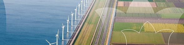
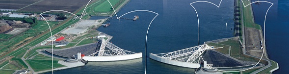
Tuesday 12 May: Integrated Land and Water management
Without integrated land and water management, the
Netherlands as also other coastal countries cannot sustain its
agricultural and urban development. Climate change, though,
increases the risks of sea and riverine floods and extended
drought periods and complicates this management task. Unorthodox
measures are called for. Get familiar with these measures and
discuss them from your critical surveyor perspective.
|
Tuesday,
12 May
07:15–08:45
| FIG Foundation Meeting
Organiser: Mr. John Hohol, FIG Foundation President, United States
|
Tuesday,
12 May
09:00–10:30
|
PLENARY SESSION 2: INTEGRATED LAND AND WATER MANAGEMENT
Without integrated land and water management, the Netherlands as also other coastal countries cannot sustain its agricultural and urban development. Climate change, though, increases the risks of sea and riverine floods and extended drought periods and complicates this management task. Unorthodox measures are called for. Get familiar with these measures and discuss them from your critical surveyor perspective.
Nick van de Giesen (Netherlands):
New Observational Methods for Water, Weather and Climate in Africa with Results from the TWIGA Project (10818)
[abstract]
[paper] Gordana Jakovljovic (Bosnia and Herzegovina):
Mapping Plastic – the Step Forward for a Cleaner Environment (10819)
[abstract]
[paper] Eduard Escalona Zorita (Spain):
European Satellite Based Services for Land and Water Management (10822)
[abstract]
[paper] |
Tuesday,
12 May
10:30–11:00
Exhibition Area, RAI
| Morning Break |
Tuesday,
12 May
11:00–12:30
|
TS03A: FIG Academic Forum on VGGT
- VGGT and the UN Convention to Combat Desertification into the implementation of the Convention
Organiser: Dr. David Mitchell, FIG Commission 2 Chair, Australia and Mr. Javier MolinaCruz, FAO
Jointly hosted by FAO and FIG
The session will be held as a series of presentations and floor discussion focusing on how land administration and land management (based on the VGGT) can help address land degradation, soil erosion and desertification through showcasing existing available practices and case studies. By presenting some experiences, there will be the opportunity to show case and then to explore how university research and continuous professional development courses can strengthen the role of surveyors for enhanced application of the VGGT.
Tea Dabrundashvili, Land Tenure Officer, FAO
Nexus land tenure – LDN: Why VGGT principles through LA/LM are important to apply in Survey, Spatial planning and to integrate into Land Degradation Neutrality framework (LDN)?
FAO /CBL and / or Partner CSO
What are possibilities and available tools to consider as good practices and lessons learnt for the use of such approaches (VGGT and LDN) in sustainable Land Management and Land Administration?
David Mitchell, FIG Commission 2 Chair
What are opportunities within university research and continuous professional development courses to apply the VGGT and integrate those in LDN?
Facilitated floor discussion based on the 3 questions above
|
Tuesday,
12 May
11:00–12:30
|
TS03B: Deformation Modeling for Smarter Surveying
Commission: 5 and 6
Organiser: Eng. Maria Henriques, FIG Commission 6 Chair, Portugal
& Dr. Daniel Roman, FIG Commission 5 Chair, United State
For precise positioning, it is sometimes necessary to have an accurate understanding of how things are moving. This can be true at local to continental scales. This session will discuss how best to account for deformation and, thereby, provide for improved positioning.
Andréa de Seixas and José Roberto de Seixas (Brazil):
Measurement and Temporal Analysis of Performance and Movements of Building Foundations (10409)
[abstract] [paper] Marina Davidovic, Dejan Vasic and Mehmed Batilovic (Serbia):
The Mobile Laser Scanning in Detail Visual Inspection of Roads (10588)
[abstract] [paper] Dzauqi Arani, Mutiara Jamilah, Daffa Arrofi, Arliandy Arbad and Lucky Fakhriadi (Indonesia):
Investigating Ground Deformation at Krakatoa Volcano Derived From InSar and Local Seismic Tomography Analysis
(10615)
[abstract] [paper] Patrycja Wyszkowska (Poland):
Univariate and Multivariate Models in Msplit Estimation in the Context of Vertical Deformation Analysis (10517)
[abstract] [paper] |
Tuesday,
12 May
11:00–12:30
|
TS03C: FIG Member Associations and Regional Bodies Forum - Part 1
Organiser: Dr. Diane Dumashie, FIG Vice President, United Kingdom
FIG Governance
To build upon the Governance roundtable, the opportunity to fully further engage on addressing the question is FIG “Fit for the Future”? Your thinking will inform the report to Council to be drafted at the end of 2020.
|
Tuesday,
12 May
11:00–12:30
|
TS03D: Africa Capacity Development Network - Meeting
Organiser: Prof. Jennifer Whittal, FIG Africa Capacity Development Network Chair, South Africa
|
Tuesday,
12 May
11:00–12:30
|
TS03E: Geospatial Technology for Spatial Planning
Commission: 3 and 8
Organiser: Prof. Hartmut Müller, FIG Commission
3 Chair, Germany & Ms. Marije Louwsma, FIG
Commission 8 Chair, Netherlands
By its very nature spatial planning is closely linked to GIS tooling, GIS tools hold great potential to support spatial planning practice in all phases of the spatial planning circle. The session supports this statement by adressing various use cases.
Ana Cornelia Badea and Gheorghe Badea (Romania):
Defining and Applying Constraints for 3D Spatial Planning in Urban Areas using Dedicated Software (10457)
[abstract] [paper] Caroline Groot and Martin Peersmann (Netherlands):
Digital Twin for Integral Spatial Planning Above and Under the Ground, Using the Key Register Subsurface (BRO) and the National Cable and Pipeline Information Portal (klic). (10582)
[abstract] [paper] Albina Mościcka, Krzysztof Pokonieczny (Poland), Anna Wilbik (Netherlands) and Jakub Wabiński (Poland):
Transport Accessibility of Warsaw: a Case Study (10394)
[abstract] [paper] Florica Matei, Ioana Delia Pop, Tudor Salagean, Elemer-Emanuel Suba and Ioan Luput (Romania):
Orchard Evolution on the Surroundings of Cluj-Napoca Town, Romania (10416)
[abstract]
[paper] Asli Sabuncu and Haluk Ozener (Turkey):
Mapping Deforestation by Multitemporal Data using Remote Sensing
Technologies, Sinop-Turkey Case Study (10501)
[abstract] [paper] Jesús Soriano-González, Eduard Angelats, Maite Martínez-Eixarch and Carles Alcaraz (Spain):
Rice Farming and Macrophyte Dynamics Monitoring Through
Sentinel-2 MSI as a Proxy of Disturbance of Agricultural
Practices over an Enclosed Bay (10568)
[abstract] [paper] Terwase Youngu, Samuel Azua, Yahaya Aliyu, Aliyu Abubakar and Adamu Bala
Abdulazeez Aliyu (Nigeria):
Geo-Spatial Multi-Criteria Analysis of the Downstream Flood Risk Settlements of Usman Dam Abuja-Nigeria (10369)
[abstract] [paper]
[handouts] |
Tuesday,
12 May
11:00–12:30
|
TS03F: Mapping the Plastic
Commission: 4 and YSN
Organiser: Mr. Simon Ironside, FIG Working
Group Chair of WG 4.3, New Zealand Ms. Melissa Harrington, FIG YSN Chair, United States
The effects of plastic pollution on the Earth’s oceans are well documented, potentially catastrophic and increasing exponentially year on year. Rivers have been identified as a significant contributor to and enabler of the plastic pollution problem. Working Group 4.3, a combined initiative of the FIG Young Surveyors Network and Commission 4, focusses on the dumping of plastics (and other waste) into major rivers, river systems and deltas at strategic locations around the world.
The session concludes with an open forum of YSN, Commission 4 and interested delegates discussing the outcomes from the plastic survey and hackathon pre-events, the training of Working Group 4.3 volunteers to undertake plastics surveys at global hotspots and how surveyors and spatial professionals can contribute to the fight against plastic pollution in their home countries.
Simon Ironside (New Zealand):
Mapping the Plastic (10574)
[abstract]
[paper] TJ Lawson, Britta Denise Hardesty, Qamar Schuyler and Chris Wilcox (Australia):
Why, How and Where to Monitor Plastic Pollution (10279)
[abstract]
[paper] Nguyen Trang Thi Thu (Vietnam), Hardesty Britta Denise and Lawson TJ (Australia):
Quantifying Flows of Plastic and Other Debris from Land-Land Based Sources to the Ocean in Vietnam (10733)
[abstract]
[paper] Ana Flávia Bastos and Lia Bastos (Brazil):
Quantitative Analysis of Microplastics in Coastal Sediment in Beaches of Spain and Brazil (10307)
[abstract] [paper]
This is a peer reviewed paper. Simon Ironside (New Zealand) and Melissa Harrington (USA):
Wrap up - Mapping the Plastic (10814)
[abstract]
[paper] |
Tuesday,
12 May
11:00–12:30
|
TS03G: Geospatial Reference Systems for Integrated Land/Water Management
Commission: 5
Organiser: Dr. Dan Roman, FIG Commission 5 Chair, United States
Historically, positioning over land compared to positioning over water has been done very differently. Nowadays, an accurate and accessible global reference frame is the great equalizer in measuring between the land/water interface. This session will focus on the requisite global reference frame for such an important task.
Nic Donnelly, Rachelle Winefield and Paula Gentle (New Zealand):
A Seamless Interface Between Land and Sea – The Role of the Geodetic System (10708)
[abstract]
[paper] Chris Pearson, Paul Denys and Mike Denham (New Zealand):
A Study of Land Subsidence in a Tectonically Active Area: an Example from Christchurch New Zealand (10376)
[abstract]
[paper] Richard Stanaway (Papua New Guinea):
PNG2020 - a New Geodetic Datum for Papua New Guinea (10605)
[abstract]
[paper] Martin Lidberg (Sweden), Wolfgang Soehne, Martina Sacher (Germany), Juliette Legrand (Belgium) and Ambrus Kenyeres (Hungary):
EUREF – an Important Component of the European Geodetic Infrastructure (10687)
[abstract] [paper] Kristian Evers, Shfaqat Abbas Khan and Karina Hansen (Denmark):
Challenges of Producing Reliable Transformations in Greenland (10625)
[abstract]
[paper] |
Tuesday,
12 May
11:00–12:30
|
TS03H: Cadastre and Land Management I
Commission: 7
Organiser: Mr. Daniel Paez, FIG Commission 7 Chair, Australia
How fast technology can change in land administration? Can government regulations meet the speed of societal change we are currently experiencing? Join us in this very dynamic session with short papers, lots of ideas and great innovation.
This is an ISS - Inspirational Short Session presenting on
cadastre and land management. The presentations are short, sharp
and specific, hence maximize information and idea gathering.
Following the inspiring presentations there will be a lively
discussion.
Paul Muchechetere (Zimbabwe) and Edward Kurwakumire (South Africa):
Towards a Land Titling Framework for Improving Rural Livelihoods (10298)
[abstract] [paper]
[handouts]
This is a peer reviewed paper. Oluwafemi Adekola, Pauliina Krigsholm and Kirsikka Riekkinen (Finland):
Towards Improved Land Registration Practices in Lagos State, Nigeria; Land-Allied Professionals’ Perspectives (10303)
[abstract] [paper] Hiroyuki Hasegawa (Japan):
4D-IMADAS 2020 - 3D Forest-Cadastre (10323)
[abstract] [paper] Kristina Murovec, Marko Rotar, Marjan Čeh (Slovenia) and Bernd Aschoff (Germany):
Positional Accuracy Improvement of Land Cadastre Index Map in Republic of Slovenia (10355)
[abstract] [paper] Christopher Williams-Wynn (South Africa):
Applying the Fit-For-Purpose Land Administration Concept to South Africa: Will It Work? (10363)
[abstract] [paper] Gyula Iván (Hungary):
Digital Land Administration: Principles, Visions and Reality (10367)
[abstract] [paper] Andy Wickless (USA) and Markus Koper (Germany):
Tackling Undocumented Land Rights Worldwide with Improved Cadastral Survey Productivity: Case Studies (10373)
[abstract] [paper] Dionysia - Georgia Perperidou (Greece):
Spatial and Descriptive Documentation of Land Parcels in Hellenic Cadastre: the Case of Mati and Kokkino Limanaki Areas. (10387)
[abstract] [paper] Okan Yildiz (Turkey):
Cadastral Map Data Quality in Turkey and Methods Used for Updating Its (10398)
[abstract] [paper] Collins Mwange (Kenya):
A Subject Domain Model of Kenya's Cadastral System (10448)
[abstract] [paper] Liisa Kallela (Finland):
The Data of 1.5 Million Apartments into a New System - the National Land Survey of Finland (NLS) is Responsible for the System’s Implementation and Maintenance, but the Data is Collected by a Number of Different Parties (10456)
[abstract] [paper] Hannu Rönty, Petri Notko and Jani Hokkanen (Finland):
Parcel Lifecycle (10462)
[abstract] [paper] Marija Juric and Ullgren Jennifer (Sweden):
The Rebuilding of Slussen and Securing the Right to Drinking Water for over Two Million People (10465)
[abstract] [paper] Vlad Paunescu (Romania):
Romanian Cadastre from Land Reform to Systematic Land Registration (10472)
[abstract]
[paper] Andri Hernandi, Deni Suwardhi, Ratri Widyastuti, Alfita Puspa Handayani and Andri Harpiandi (Indonesia):
Utilization of Land Administration Domain Model (LADM) for Smart Vilage Development in Indonesia (10479)
[abstract] [paper] Eric Hagemans, Ruben Busink, Frank Schouten and Jeroen Grift (Netherlands):
Rebuilding the Cadastral Map of the Netherlands, the Overall Concept (10521)
[abstract] [paper] |
Tuesday,
12 May
11:00–12:30
|
TS03I: Land Consolidation: from Plan to Implementation
Commission: 8
Organiser: Ms. Marije Louwsma, FIG Commission 8 Chair, Netherlands
Moving beyond traditional approaches for land consolidation, various applications of the instrument in different international contexts will be presented.
Kalle Konttinen and Sami Ovaska (Finland):
Preliminary Study for Holistic Approach Assessing Land Consolidation Effects in Finland (10414)
[abstract]
[paper] Esben Munk Sørensen (Denmark):
Climate Adaptation, CO2 Reduction and More Nature in Rural Areas – New Roles and Challenges for Traditional Landconsolidation (10767)
[abstract]
[paper] Torben Juulsager (Denmark):
Multifunctional Land Consolidation – an Approach to Holistic and Sustainable Land Use in Rural Areas (10489)
[abstract]
[paper] Walter Timo de Vries (Germany):
Identifying Which Human Aspects Play a Crucial Role in Land Consolidation Processes (10412)
[abstract]
[paper] Per Kåre Sky and Helén Elisabeth Elvestad (Norway):
Leasing of Farmland and Land Consolidation (10249)
[abstract] [paper]
This is a peer reviewed paper. Marije Louwsma (Netherlands), Kalle Konttinen (Finland), Uchendu Eugene Chigbu (Germany) and Olga Zhovtonog (Ukraine):
Generic Tooling for Land Consolidation – the Concept Explained (10748)
[abstract] [paper] Yakup Coruhlu and Bayram Uzun (Turkey):
Legal Confiscating Based on Zoning Plan in Turkey (10458)
[abstract] [paper] |
Tuesday,
12 May
11:00–12:30
|
TS03J: GLTN Conceptual Framework for Urban-Rural Land Linkage Framework (open session)
Commission: 7, 8 and 9
Organisers: Mr. Daniel Paez, FIG Commission 7 Chair, Dr. Diane Dumashie, FIG Vice President, United Kingdom and Mr. Rafic Khouri, Arab Union of Surveyors
Jointly hosted by UN-Habitat/GLTN and FIG
Traditionally, land policies have been developed separately between rural and urban areas. There is a strong push from international organization, particularly UN, to change this. FIG, as part of its activities in the GLTN professional cluster, has been developing a conceptual framework for urban-rural LAND linkages. This open workshop will present the literature review for the land sector and a preliminary scoping document for the conceptual framework. Participants would have the opportunity to participate in the development of this UN framework as well as interacting with key practitioners in the urban-rural linkage area.
|
Tuesday,
12 May
12:30–14:00
Diamond Lounge, RAI
| Lunch Break |
Tuesday,
12 May
14:00–15:30
|
TS04A: Regional Academic Networks and CPD /Innovation in Professional Education
Commission: 1 and 2
Organiser: Dr. David Mitchell, Chair FIG Commission 2, Australia
& Ms. Winnie Shiu, FIG Commission 1 Chair, Hong Kong SAR, China
This session focusses on the role of regional academic networks in improving capacity building in professional education, training and professional development. It also includes good examples of promoting surveying to future students.
Randolf Vicente (Philippines):
Strengthening the Continuing Professional Development (CPD) Program to Ensure International Alignment of Competencies and Qualifications Towards Capacity Building: The Philippine Geodetic Engineering Experience (10750)
[abstract]
[paper] Uchendu Eugene Chigbu (Germany), Stig Enemark (Denmark) and Jaap Zevenbergen (Netherlands):
Improving the Mode of Academic Networking to Scale up Land Education in Africa (10241)
[abstract] [paper] Monica Lengoiboni (Netherlands), Ronald Ssengendo (Uganda), Karume Katcho (Democratic Republic of Congo), David Siriba (Kenya), Jossam Potel (Rwanda), Christiaan Lemmen and Jaap Zevenbergen (Netherlands):
The Contribution of the Consortium on Strengthening the Eastern Africa Land Administration Network (SEALAN) in Enhancing Inter-University Collaboration in Eastern Africa (10520)
[abstract] [paper] Helen Blackler, Monika Przybilla, Gabrielle Dasse (Germany) and Elaine Ball (United Kingdom):
Surveyors of Tomorrow - Ideas to “get Kids into Survey” in Germany (10565)
[abstract] [paper] |
Tuesday,
12 May
14:00–15:30
|
TS04B: Areal Measurement Techniques in Engineering Surveying (Laser Scanner & InSAR)
Commission: 6
Organiser: Eng. Maria Henriques, FIG Commission 6 Chair, Portugal
Laser scanner and satellite-based InSAr are two of the more recent techniques applied by engineering surveyors. The session is about their use in monitoring but includes, also, answers to the challenge which is the automatic detection of objects and the always important theme of calibration of equipment (this last applied to laser scanners).
Greet Deruyter, Lars De Sloover, Jeffrey Verbeurgt, Alain DE WULF (Belgium) and Sander Vos (Netherlands):
Macrotidal Beach Monitoring (belgium) Using a Hypertemporal Terrestrial Lidar (10560)
[abstract] [paper] Nils Koldrack, Ralf Bill, Constantin Schweiger, Christian Kaehler, Konrad Miegel (Germany) and Matthias Jonas:
Dune Monitoring During Storm Surge Events (10259)
[abstract] [paper] Dogan Altundag (Netherlands):
Automatic Detection and Extraction of Objects from 3D LiDAR Datasets. Perspective from a Start-Up (10769)
[abstract]
[paper] Ingo Neumann, Franziska Altemeier, Hamza Alkhatib (Germany) and Bianca Gordon (Switzerland):
The New ISO Standard for a Field-Testing Procedure of Terrestrial Laser Scanners and its Practical Performance (10638)
[abstract]
[paper] [handouts] Sander Borghuis, Anneleen Oyen and Iman Tantawy (Netherlands):
InSAR for Deformation Monitoring of Infrastructural Assets (10684)
[abstract]
[paper] Mila Atanasova-Zlatareva, Hristo Nikolov, Ivan Georgiev, Nikolay Dimitrov and Anton Ivanov (Bulgaria):
Studying the Landslide Processes at "dalgiya Yar" Landslide Circus by Combined Use of GNSS and InSAR (10656)
[abstract] [paper] |
Tuesday,
12 May
14:00–15:30
|
TS04C: FIG Member Associations and Regional Bodies Forum - Part 2 |
Tuesday,
12 May
14:00–15:30
|
TS04D: Women in Surveying
Commission: 1
Organiser: Ms. Winnie Shiu, FIG Commission 1 Chair, Hong Kong SAR, China
&
Ms. Robyn McCutcheon, FIG Working Group Chair of WG
1.2, Australia
Round Table Discussion
The session will discuss the opportunities and land rights of women land surveyors today and tomorrow. Invited professional bodies/company representatives will discuss what proactive steps they have taken to promote women in surveying and the World Bank initiative about stand for women’s land campaign.
Read the report of
WG 1.2 - Women in Surveying Angela Kesiena Etuonovbe and Angela Omamuyovwi Etuonovbe (Nigeria):
Women-In-Surveying Making Waves and Breaking Records in the Shores of Nigeria (10738)
[abstract] [paper] Maria Tsakiri, Sofia Soile, Charalambos Ioannidis and Vassilis Pagounis (Greece):
Women in Surveying Engineering Courses – a Greek Experience (10449)
[abstract] [paper] Reshma Shrestha, Bhuwan Ranjit, Rehana Shrestha (Nepal) and Liza Groenendijk (Netherlands):
Looking from the Lens of Gender Mainstreaming: the Inclusiveness of Women in Surveying and Geoinformation Technology (git) in Nepal (10593)
[abstract] [paper] Priscilla Djaba and Stephen Djaba (Ghana):
Empowering Women in the Geospatial Industry, a Case Study of Ghana, West Africa (10420)
[abstract]
[paper] Angela Kesiena Etuonovbe (Nigeria):
Women Empowerment: the Way Forward for a Progresses Society and Nation Building, Nigeria in Focus. (10737)
[abstract] [paper] Raja Ram Chhatkuli, Shristee Singh Shrestha, Janak Raj Joshi, Habendra (Nepal) and Everlyne Nairesiae (Kenya):
Impact of Tax Rebate on Land Registration to Women’s Empowerment in Nepal (10629)
[abstract] [paper] |
Tuesday,
12 May
14:00–15:30
|
TS04E: Including the Third Dimension in Geospatial Information
Commission: 3 and 7
Organiser: Prof. Hartmut Müller, FIG Commission
3 Chair, Germany & Mr. Daniel Paez, FIG
Commission 7 Chair, Australia
Traditionally, planar and height information has been and still is processed independently in many disciplines. The session highlights new developments in how all three dimensions can be processed simultaneously in integrated workflows.
Maria Gkeli, Chryssy Potsiou and Charalabos
Ioannidis (Greece):
Mobile Crowdsourcing in 3D Cadastral Surveys: Exploring Publics’
Reaction and Data Quality (10312)
[abstract]
[paper]
This is a peer reviewed paper.
Jantien Stoter (Netherlands), Serene Ho (Australia) and Filip Biljecki (Singapore):
How Might a Level of Detail Logic Framework Help to Close the 3D Cadastre Research-To-Practice Gap? (10503)
[abstract] [paper] Ioannis Pispidikis (Greece), Eftychia Kalogianni (Netherlands), Athanasiou Katerina, Lampropoulos Anastasios, Kitsakis Dimitrios (Greece) and Dimopoulou Efi:
3D Modelling and Virtual Reality for the Management of Public Buildings (10709)
[abstract] [paper] Dillon Pullano and Michael Barry (Canada):
Determining Topological Relationships Between 3D Legal Boundary Components Using Conformal Geometric Algebra (10600)
[abstract] [paper] Marc Post and Richard Witmer (Netherlands):
How to Set up a Uniform 3D Topographic Large Scale Object Oriented Base Data Set for the Netherlands (10368)
[abstract]
[paper] Prashant Alatgi (India):
Use of LiDAR Technology in Preparing Digital 3D Maps for Smart City Projects (10382)
[abstract] [paper] Dimitris Anastasiou, Elpida Baxevanidi, Michail Gianniou, Vassilis Andritsanos and Vassilis Pagounis (GMaria Tsakiri (Greece):
3D Digital Tools for the Development and Promotion of Religious Heritage Tourism (10433)
[abstract] [paper] Azeez Alade (South Africa), Abdulazeez Abdulyekeen, Hussein Ahmadu, Abdulganiyu Yusuf and Abdulraheem Amoo (Nigeria):
3D Reconstruction of University of Ilorin Campus Using High Resolution Satellite Imagery and Conventional Survey (10305)
[abstract] [paper] |
Tuesday,
12 May
14:00–15:30
|
TS04F: Hydrographic Surveys
Commission: 4 and 5
Organiser: Dr. Mohd Razali Mahmud, FIG Commission 4 Chair, Malaysia
This technical session comprises of topics in tidal studies, technique in hydrographic survey measurement, using low cost bathymetry system and satellite derived bathymetry method. Tidal plays an important role in hydrographic measurement activities especially in determining the sounding datum and reducing the depth measurement.
Daniel Roman and Xiaopeng Li (USA):
Analysis of a Geopotential Datum at Tide Gauge Stations (10426)
[abstract] [paper] Peter T.Y. Shih, Hui-Jung Wang and Jiu-Fu Huang (Chinese Taipei):
On the Deviation of Tide Measured from Multiple Gauges (10610)
[abstract] [paper] Nenad Leder, Tea Duplancic Leder and Samanta Bacic (Croatia):
Analysis of State-Of-The-Art Hydrographic Survey Techniques (10487)
[abstract]
[paper] Louis Makiello and Harald Sternberg (Germany):
Using a ROS-Based Low-Cost System for Bathymetric Surveys (10470)
[abstract] [paper] Tea Duplančić Leder and Nenad Leder (Croatia):
Optimal Conditions of Using Satellite Derived Bathymetry (SDB) Method in the Middle Adriatic Sea (10446)
[abstract] [paper] |
Tuesday,
12 May
14:00–15:30
|
TS04G: Heights and Height Systems for Change Monitoring in Land/Water Systems
Commission: 5
Organiser: Dr. Dan Roman, FIG Commission 5 Chair, United States
A number of countries around the world are adapting their vertical reference systems from being based on leveling to those determined from geoid height models. Given the implied ties to sea level, this effort takes on a more significant role for surveyors and the geodetic and cadastral agencies developing such models. The importance of accurately understanding the land/water interface and the flow of water is critical for many regions around the world. This session will incorporate both the practical implications for the surveyor and recent scientific developments for geoid modeling.
Kevin Ahlgren and Jordan Krcmaric (USA):
NGS's Surface Gravity Prediction Tool (10471)
[abstract] [paper] Wesley Brown and John Ogundare (Canada):
Time Series Analysis of Vertical Positions of High-Precision GNSS Stations in Eastern Canada: a Case Study (10696)
[abstract] [paper] Gershon Steinberg, Gilad Even-Tzur, Hagi Ronen, Hezi Sarid and Sagi Dalyot (Israel):
The Development of the Israeli Official Geoid Model (10434)
[abstract]
[paper] Othman Al-Kherayef, Oleksandr Zayats, Sultan Al-Shahrani and Rossen Grebenitcharsky (Saudi Arabia):
An Improved Hybrid Geoid Model over Kingdom of Saudi Arabia Utilizing New GNSS Ellipsoidal Heights on Benchmarks of KSA National Vertical Network (10445)
[abstract] [paper] Susheel Dangol, Prakash Joshi, Bigyan Banjara and Mahesh Thapa (Nepal):
Sagarmatha (Mt. Everest) Height Measurement (10533)
[abstract]
[paper] Samuel Brewster and Mohammad A. Rajabi (Canada):
Consistency Assessment of Geoid, Orthmetric and Ellipsoidal Heights, Case Study, Metro Vancouver Area - Canada (10671)
[abstract]
[paper] |
Tuesday,
12 May
14:00–15:30
|
TS04H: Cadastre and Land Management II
Commission: 7
Organiser: Mr. Daniel Paez, FIG Commission 7 Chair, Australia
Is 3D cadastre the future? Do we need 4D for better land rights recognition? Why UAV technology is not working in some cadastre projects? This dynamic session brings short papers in land administration. If you attend it, don’t blink or you might miss the next great idea in cadastre and land management.
This is an ISS - Inspirational Short Session presenting on
cadastre and land management. The presentations are short, sharp
and specific, hence maximize information and idea gathering.
Following the inspiring presentations there will be a lively
discussion.
Zeynel Abidin Polat and Mehmet Alkan (Turkey):
An Assessment on Public-Private Partnership (PPPs) in Land Registry and Cadastre services in Turkey (10370)
[abstract] [paper] Nami Seimiya, Akihiro Sugita, Keiji Yamada, Bhuwneshwar Prasad Sah (Japan) and Lorenc Çala (Albania):
Integrated Geospatial Information for Sustainable Land Development in Tirana-Durres Area in Albania (10430)
[abstract] [paper] Ludmiła Pietrzak, Andrzej Hopfer and Paweł Hanus (Poland):
Profession of Land Surveyors in the Age of the Technological Revolution (10502)
[abstract] [paper] Amir Bar-Maor (Netherlands):
Parcel Fabric 2.0 - Fit for (multi) Purpose (10526)
[abstract] [paper] Oyedokun Abiodun, Joseph Odumosu and Simeon Omodara (Nigeria):
Land Administration and Policy Issues in the Nigerian Scenario: an Overview (10575)
[abstract] [paper] Shen Ying, Lin Li and Renzhong Guo (China, PR):
3D Property Descriptions in Urban Environment in China with Standard (10602)
[abstract]
[paper] Ketut Tomy Suhari, Bambang Edhi Leksono, Irwan Meilano, Putu Harry Gunawan and Nyoman Robby Manik Saputra (Indonesia):
Implementation of 4D Cadastre Concept for Land Dispute Potential and Solution of Post Natural Disaster in Palu, Indonesia (10604)
[abstract] [paper]
[handouts] Sean Johnson (Eswatini), Jan van Bennekom-Minnema (Netherlands) and Sydney Simelane (Eswatini):
Creating a Neo-Customary Land Administration System for Sustainable Land Management (10611)
[abstract] [paper] Farid Jafarov and Elshad Khanalibayli (Azerbaijan):
Digital Land Cadastre Information System in Azerbaijan (10649)
[abstract] [paper]
[handouts] Tim Hodson (USA):
Maintaining Cadastral Measurement Data in the Parcel Fabric (10654)
[abstract] [paper] Hasnim Kaulani, Reza Abdullah and Virgo Eresta Jaya (Indonesia):
A Spatial Digital Document to Improve the Process of Land Administration Application (10665)
[abstract] [paper] Josip Šiško, Hrvoje Tomić, Rinaldo Paar, Siniša Mastelić Ivić and Iva Vuković (Croatia):
The Use of UAV Point Cloud Object-Based Classification in the Agricultural Land Consolidation (10693)
[abstract] [paper] Dabiri Thomas (Nigeria):
Agricultural Cadastral Mapping of Oil Palm Trees in Delta State of Nigeria for Youths Empowerment and Poverty Eradication. (10725)
[abstract] [paper] Evangelia Balla,
Mafalda Madureira and Yola Yeorgiadou (Netherlands):
The Greek Cadastral Policy Reform During the Recent Economic Crisis: a Case of Vicious Circularity (10729)
[abstract] [paper] |
Tuesday,
12 May
14:00–15:30
|
TS04I: Where Spatial Planning and Geo-Information Meet
Commission: 3 & 8
Organiser: Prof. Hartmut Müller, FIG Commission
3 Chair, Germany & Ms. Marije Louwsma, FIG
Commission 8 Chair, Netherlands
Using geo-information is key to make spatially informed decisions about a sustainable spatial development. At the interplay of both disciplines, we discuss what geo-information has to offer to spatial planning and vice versa.
Agung Indrajit, Bastiaan van Loenen, Peter van Oosterom, Peter van Oosterom and Hendrik Ploeger (Netherlands):
Modeling Spatial Units Class for Spatial Planning Map for the Future of Iso 19152 on Land Administration Domain Model (ladm) (10716)
[abstract] [paper] Vincent Van Dijk and Rick Bleeker (Netherlands):
Smart Combination of Legal Rules and Geo-Information to Support Spatial Development Projects (10527)
[abstract] [paper] Gineke van Putten (Netherlands):
Through the Environment and Planning Act (Omgevingswet) Geometry Will Play a Greater Role in Dutch Legislation (10771)
[abstract]
[paper] Victor Chukwuemeka Nnam (Nigeria):
Monitoring and Prediction of Land Use in Enugu Urban, Nigeria, Using Gis and Remote Sensing (10250)
[abstract] [paper]
This is a peer reviewed paper. Casper Fibaek and Hanna Laufer (United Kingdom):
Reaching Rural - Earth Observation in Support of Financial Inclusion (10672)
[abstract]
[paper] Israel Taiwo, Lawrence Adewole, Mofolusho Fagbeja and Ifeoluwa Balogun (Nigeria):
Web-Based Geospatial Information System to Access Land Suitability for Arable Crop Farming in Ekiti State, Nigeria (10280)
[abstract] [paper]
This is a peer reviewed paper. Fawzi Zarzoura (Egypt), Mosbeh Kaloop and Jong Hu (Republic of Korea):
Remote Sensing and Sustainable Agricultural Development in Nile Delta Region (10316)
[abstract] [paper]
This is a peer reviewed paper. |
Tuesday,
12 May
14:00–15:30
|
TS04J: Interactive Session on the Development of the Manual for the “Valuation of Unregistered Lands and Informal Property"
Organiser: Mr. James Kavanagh, United Kingdom
Jointly organised by UN-Habitat/GLTN and FIG.
Following UN-Habitat/GLTN’s guide no. 1/2018, which explains why valuations of unregistered land and informal property are needed, and RICS Research (valuation of unregistered land), UN-Habitat/GLTN is developing a robust, due diligence protocol and manual (including basic checklists and sample formats) on the registration of unregistered lands. This session will be interactive where your expert views can inform a new unregistered land valuation manual that will cover about 70 percent of the land surface of the world. This FIG session will follow on from the initial masterclass held at World Bank Land 2020 and will discuss the preliminary work of the authors, initial concepts that need to be recognised and included and also act as an opportunity to engage the global FIG family of land professionals.
The session will begin with a presentation by Dr. Mike McDermott and Dr. Peter Wyatt, providing an overview of the proposed guide, a report on the World Bank Land 2020 masterclass (and other connected sessions), an open discussion on the format of the GLTN manual and a debate on the changing nature of valuation and its critical interaction with developing world land security, informality and differing forms of tenure. 
|
Tuesday,
12 May
15:30–16:00
Exhibition Area, RAI
| Afternoon Break |
Tuesday,
12 May
16:00–17:30
| FIG Corporate Members Meeting
Organiser: Prof. Dr. Rudolf Staiger, FIG President, Germany
The 2020 FIG Corporate Members Meeting is where the corporate membership within FIG meets the FIG Administration to exchange information, provide feedback and discuss on-going and proposed activities.
|
Tuesday,
12 May
16:00–17:30
|
TS05A: Responsible Land Administration Teaching Essentials
Commission: 2 and 7
Organiser: Dr. David Mitchell, FIG Commission 2 Chair, Australia
&
Mr. Daniel Paez, FIG Commission 7 Chair,
Australia
This joint Commission 2 and 7 session involves presentations about the GLTN project – Responsible Land Administration Teaching Essentials: A structured knowledge base. FIG members were strongly involved in the development of this freely available online resource that can support curriculum development for teachers and trainers as well as self-learning. During this session this important online resource will be launched for the surveying community. The presentations provide an overview of the resource as well as describing four of the Modules.
Jean du Plessis (Kenya), Uchendu Eugene Chigbu (Germany), David Mitchell (Australia) and Siraj Sait (United Kingdom):
A Structured Foundation for Teaching and Training Land Actors in Responsible Land Administration (10653)
[abstract] [paper] David Mitchell (Australia), Siraj Sait (United Kingdom), Jean Du Plessis (Kenya) and Agnes Mwasumbi (Tanzania):
Responsible Land Administration Teaching Essentials: Core Values and Principles of Responsible Land Administration (10597)
[abstract]
[paper] Grenville Barnes (USA) and Stig Enemark (Denmark):
Land Tenure Security: an Essential Component of Responsible Land Administration (10726)
[abstract] [paper] Dimo Todorovski and Jaap Zevenbergen (Netherlands):
Responsible Land Administration and Information in Practice (10435)
[abstract] [paper] Stig Enemark (Denmark):
Learning About Land Policies - Building a Structured Knowledge Base on Land Policies and Regulatory Frameworks in Support of Responsible Land Administration (10539)
[abstract] [paper] Uchendu Eugene Chigbu (Germany) and Mohammed Asad (Trinidad And Tobago):
Responsible Land Administration Teaching Essentials: Structured Knowledge Base on Participatory Land-Use Planning and Management (10714)
[abstract] [paper] |
Tuesday,
12 May
16:00–17:30
|
TS05B: Point Cloud-based Monitoring in Engineering Surveying
Commission: 6 and IAG-WG 4.1.3
Organiser: Dr. Jens-Andre Paffenholz, Germany & Eng. Maria Henriques, FIG Commission 6 Chair, Portugal
Point clouds are challenges for the engineering surveyors that use laser scanners or digital cameras. The session is dedicated to spatio-temporal monitoring of artificial and natural objects with the aid of 3D point clouds acquired by means of multi-sensor-systems. It is the result of the cooperation between FIG commission 6 and the former IAG working group 4.1.3 “3D point cloud based spatio-temporal monitoring”.
Corinna Harmening (Austria) and Jens-André Paffenholz (Germany):
3D Point Cloud Based Spatio-Temporal Monitoring of Artificial and Natural Objects (10641)
[abstract] [paper] Valens Frangez, Eugenio Serantoni and Andreas Wieser (Switzerland):
Areal Monitoring of Digitally Fabricated Structures Early after Construction (10556)
[abstract] [paper] Linh Truong-Hong and Roderik Lindenbergh (Netherlands):
Quantitative Assessment of Structural Components for Construction Management Using Laser Scanning Data (10576)
[abstract]
[paper] Gustaf Uggla and Milan Horemuz (Sweden):
Georeferencing Point Clouds - Meeting the Expectations of the User (10269)
[abstract] [paper] Sander Vos, Mieke Kuschnerus and Roderik Lindenbergh (Netherlands):
Assessing the Error Budget for Permanent Laser Scanning on Coastal Beaches (10579)
[abstract] [paper] Zahra Hadavandsiri and Derek Lichti (Canada):
Concrete Damage Detection Based on Machine Learning Classification of Terrestrial Laser Scanner Point Clouds (10564)
[abstract] [paper] |
Tuesday,
12 May
16:00–17:30
|
TS05C: Construction Economics: Problems and Solutions
Commission: 10
Organiser: Mr. Alan Muse, FIG Commission 10 Chair, United Kingdom
Construction is a fragmented industry often suffering from low efficiency. It is ripe for change.
Africa and Asia have some particular problems, which the papers address, in terms of productivity, performance and people. Recognised international standards can also help to address some of these problems and this is underlined by the success of ICMS.
Ayodeji Oke, Clinton Aigbavboa and Zanele Madonsela (South Africa):
Assessment of Factors Affecting Time and Cost Performance of Indigenous and Foreign Contractors in Nigeria (10238)
[abstract] [paper]
This is a peer reviewed paper. Jacob Awolesi (Nigeria):
Analysis of Factors Affecting Nigeria Construction Workers’ Productivity (10268)
[abstract]
[paper] Krishna Mochtar (Indonesia):
Implementation of Performance-Based Contract in Indonesia Construction (10304)
[abstract]
[paper]
[handouts] Olufisayo Adedokun, Fidelis Rufus, Isaac Aje and Johnson Agboola (Nigeria):
Stress Triggers Among the Quantity Surveyors in Construction and Consultancy Firms (10319)
[abstract] [paper] Mercy Iyortyer (Nigeria):
Life Cycle Costs and ICMS (10548)
[abstract] [paper] Esther Ola-Ade (Nigeria):
Minimising Variations and Fluctuations in Housing Delivery (10694)
[abstract] [paper] Theophilus Eguh and Olumide Adenaiya (Nigeria):
Monitoring and Analysis of Site Accidents on Construction Site in Nigeria (10720)
[abstract] [paper] |
Tuesday,
12 May
16:00–17:30
|
TS05D: Professional Practice
Commission: 1
Organiser: Ms. Winnie Shiu, FIG Commission 1 Chair, Hong Kong SAR, China
The session will discuss if the professional pathway will be market-relevant, how land surveying profession can help achieving SDG 1 No Poverty and SDG 2 Zero Hunger.
Arve Leiknes and Leiv Bjarte Mjøs (Norway):
The Struggle for a Land Surveying Profession in Norway – is Progress Made? (10621)
[abstract]
[paper] Soren Brandt Pedersen (Denmark):
Public – Private – Partnerships as a Catalyst for Tenure Governance in Developing Countries (10359)
[abstract] [paper] Kenneth Norre and Cecilie Ravn-Christensen (Denmark):
Private Sector Responsibility in Supporting Sustainable Development – the Interconnection Between Business Approaches, the Youth, CSR and the SDGs in Creating Sustainability (10618)
[abstract] [paper] Nigel Sellars and James Kavanagh (United Kingdom):
The Professional Qualification Pathway – a More Flexible Entry Route into the Profession for Aspiring Global Land Professionals (10400)
[abstract] [paper] |
Tuesday,
12 May
16:00–17:30
|
TS05E: Geospatial Analytics Use Cases
Commission: 3
Organiser: Prof. Hartmut Müller, FIG Commission 3 Chair, Germany
Geospatial analytics can be viewed as a highly theoretical field. The session demonstrates the applicability of selected analysis methods in practice by examining various use cases.
Punya P Oli (Nepal):
Spatial Database for Environment Studies of Projects (10248)
[abstract] [paper] Asmae Azzioui, Moulay Hafid Bouhamidi, Mustapha Mouadine and Mohammed Ettarid (Morocco):
Innovative Approach for a Reliable Mapping of the Morocco’s Solar Resource (10291)
[abstract] [paper]
This is a peer reviewed paper. Volkan Yildirim, Bura Adem Atasoy and Volkan Baser (Turkey):
Determining Most Suitable Areas for Logistics Centers by Using GIS and S-MCDM (10633)
[abstract] [paper] Jürg Lüthy and Christian Kaul (Switzerland):
Digitalisation of General Drainage Planning (10572)
[abstract] [paper] Leonardo Franchi (Italy):
Real-Time Mapping of the Waterways Network (10491)
[abstract] [paper] Rudiney Pereira, Elisiane Alba, Juliana Marchesan, Mateus Schuh and Roberta Fantinel (Brazil):
Pattern Mining in Sentinel 2B Satellite Images Using the Knime Analytics Platform (10719)
[abstract] [paper] Dupe Olayinka, Yusuf Aro-Lambo, Elias Adediran and Chukwuma Okolie (Nigeria):
Remote Detection of Cannabis Plantations in Idanre Forest Reserve, Nigeria Using Multispectral Landsat Imagery (10314)
[abstract] [paper]
This is a peer reviewed paper. |
Tuesday,
12 May
16:00–17:30
|
TS05F: Hydrography Contribution
Commission: 4
Organiser: Dr. Mohd Razali Mahmud, FIG Commission 4 Chair, Malaysia
The session focuses on topics where hydrography contributed to the various activities in educational development, sedimentation monitoring, water operations and mapping the plastic.
Ivan Detchev, Walther Johnson and Tyler Greene (Canada):
Theoretical and Practical Course Design and Development Aspects in Hydrographic Surveying (10317)
[abstract] [paper]
This is a peer reviewed paper. Willy Gomarga, Wiwin Windupranata, Anjar Dimarasakti and Bambang Edhi Leksono (Indonesia):
Land Acression and Sedimentation Monitoring on Cirebon-West Java Using Sentinel 2A/B Within 2018-2019 Period (10429)
[abstract] [paper] Daniel Janonius Löwgren (Sweden):
A Swedish National Re-Examination of Water Operations (10342)
[abstract] [paper] Pius Onoja Ibrahim and Sternberg Harald (Germany):
Evaluation of Exponential Factor on Boundary Value Problem of Inverse Distance Weighting Method of Interpolation (10401)
[abstract] [paper] |
Tuesday,
12 May
16:00–17:30
|
TS05G: Multisensor Systems for Integrated Land and Water Management
Commission: 5
Organiser: Dr. Dan Roman, FIG Commission 5 Chair, United States
Multisensor Systems play a vital role in Positioning, Navigation and Timing (PNT) applications. The session covers topics related to alternative PNT technologies, such as Wireless Fidelity (Wi-Fi) for indoor positioning and MEMS-based Inertial Measurement Units (LMUs) for continuous vehicle localization and photogrammetric aerial triangulation, laser scanning in cadastral surveys and design activities as well as image-based surveying approaches for globally referenced remote point measurements and light and low-cost instrumentation for photogrammetry.
Guenther Retscher (Austria), Yan Li, Allison Kealy (Australia) and Vassilis Gikas (Greece):
The Need and Challenges for Ubiquitous Positioning, Navigation and Timing (PNT) Using Wi-Fi (10335)
[abstract] [paper]
This is a peer reviewed paper. Stefan Schaufler, Michele Fischell, Geo Boffi, Xiaoguang Luo and Zoltán Török (Switzerland):
An Innovative Image-Based Surveying Approach for Globally Referenced Remote Point Measurements (10354)
[abstract] [paper] Arash Jouybari, Mohammad Bagherbandi and Faramarz Nilfouroushan (Sweden):
Assessment of Different GNSS and IMU Observation Weights on Photogrammetry Aerial Triangulation (10422)
[abstract] [paper]
[handputs] Gintcho Kostov (Bulgaria):
3D Terrestrial Laser Scanning for Cadastral and Design Activities – Performing, Data Processing and Analysis Storage and Backup in the Light of the Nowadays Cloud Possibilities. (10640)
[abstract] [paper]
[handputs] Ghyslain Ferré, Alain Zanella, Clyde Coddet, Régis Mourgues and Elisabeth Simonetto (France):
Reconstruction of Geological Outcrops by Photogrammetry from Light and Low-Cost Instrumentation (10680)
[abstract]
[paper] Chad Ly and John Ogundare (Canada):
Integrating MEMS IMU with GNSS for Vehicle Navigation (10685)
[abstract] [paper] |
Tuesday,
12 May
16:00–17:30
|
TS05H: Land, Water and other Rights Interactions
Commission: 7
Organiser: Mr. Daniel Paez, FIG Commission 7 Chair, Australia
The complex interrelation between land rights and other sectors have forced innovative solutions to ensure regulations are met while moving into meeting the sustainable development goals (SDGs). This session brings together researchers and practitioners integrating, from a legal and technical perspective, land water and other rights.
Nkechi Baywood, Tunde Fagbamigbe, Esomchukwu Igbokwe and Emmanuel Udo (Nigeria):
Boundary Dispute Resolution and National Security, Prospect and Challenges (10301)
[abstract] [paper] Ruba Jaljolie and Sagi Dalyot (Israel):
Multi-Dimensional Land Management Systems: a Delphi Study of the Expert Community (10306)
[abstract] [paper] Clarissa Augustinus (Ireland):
Using a Multi-Sided Platform and Network Effects to Deliver Land Rights for All (10337)
[abstract] [paper] Leslie Downie (South Africa):
Cadastral Mapping of Water as an Individualised Human Right: Water, Water Everywhere, nor Any Drop to Drink (10473)
[abstract] [paper]
[handouts] Eva-Maria Unger, Rohan Bennett, Christiaan Lemmen and Paula Dijkstra (Netherlands):
Bridging the Gap of Land Administration and Disaster Risk Management: a Key Step in Climate Change Response (10702)
[abstract]
[paper] |
Tuesday,
12 May
16:00–17:30
|
TS05I: Water Governance
Commission: 8
Organiser: Ms. Marije Louwsma, FIG Commission 8 Chair, Netherlands
This session presents some current thinking about water governance policies, managing water resources, and future scenarios strategies to guide professionals and practitioners in water management.
Isaac Boateng (Ghana) and Mason Edward (United Kingdom):
An Assessment of Some Environmental Effects of Flood Protection Schemes on Rivers: a Case Study of River Ems, UK (10803)
[abstract] [paper] Wafula Nabutola (Kenya):
Effects of Climate Change, E.g. Droughts, Flooding and Strategies to Govern These Effects with Special Reference to Kenya (10499)
[abstract] [paper] Maroc Mourad (Algeria) and Suba Elemer-Emanuel (Romania):
Water Management in Saharan Environments; Changes and Challanges
Case of study: The Great south of Algeria
(10707)
[abstract]
[paper] Azmi Rohani, Suhailizan Suliman, Amirul Haffiz Ariff, Mohd Shahrizan Sahid and Muhammad Ammar Akmal Senan (Malaysia):
Towards Water Security: Water Resources Management Praxis in Johor Land Administration (10332)
[abstract] [paper] Agnieszka Szczepańska, Adam Senetra and Mirosław Bełej (Poland):
Integrated Land and Water Management on the Example of the Recreational Function in the City (10423)
[abstract]
[paper] Charlotte Gillet (Netherlands):
Water Governance and Spatial Planning (10396)
[abstract] [paper] Alysen Tierney (USA):
Record Flooding in Dane County (10594)
[abstract] [paper] Marie Fournier, Adèle Debray and Mathieu Bonnefond (France):
Innovative Tools and Strategies to Conciliate Floodplain Restoration Projects and Spatial Planning in France: the “over-Flooding Easement” (10731)
[abstract] [paper] |
Tuesday,
12 May
16:00–17:30
|
TS05J: Valuation Dynamics – Data Sources and Infrastructure
Commission: 9
Organiser: Mr. Ben Elder, FIG Commission 9 Chair, United Kingdom
Information used to be king – knowledge has taken over – this session will help identify how data/information is turned into knowledge.
Bambang Edhi Leksono, Ratri Widyastuti and Andri Harpiandi (Indonesia):
Analysis of the Implications of Land Use Changing of Paddy Fields into Residential Area on Sales Value of Taxable Object (njop) (case Study: Gedebage District, Bandung City, Indonesia) (10511)
[abstract] [paper]
[handouts] Kwabena Asiama and Winrich Voss (Germany):
Conceptualising the Valuation of 3D Property (10477)
[abstract] [paper] Felician Komu (Tanzania):
Real Estate Markets and Housing Finance Dynamics- Contextualizing Real Estate Education in Eastern Africa (10505)
[abstract]
[paper] Florence Galeon, Roque Sorioso and Karlo Pornasdoro (Philippines):
Geo-Spatial Technologies Application in the Management of Intensive Field Data Gathering for a Hedonic Price Model (hpm) of Lands (10644)
[abstract] [paper] Reelika Piik (Estonia) and Jan Spijkerboer (Netherlands):
Rail Baltica in Estonia - a Challenging Land Acquisition Project (10395)
[abstract] [paper] Luc Hermans, Ruud Kathmann and Marco Kuijjper (Netherlands):
Smart Surveyor for Property Assessment (10425)
[abstract] [paper] |
Tuesday,
12 May
17:30–18:30
| FIG Commissions Annual Meetings
The FIG Commissions are responsible for pursuing FIG's professional and technical objectives and are the backbone of the professional work in FIG.
The Commission meetings are open for everyone who are interested in the work. After the meeting each commission hosts a dinner.
Join the meetings in following rooms:
- Commission 1: Professional Standards and Practice
[
Report]
- Commission 2: Professional Education
[
Report]
- Commission 3: Spatial Information Management
[
Report]
- Commission 4: Hydrography
[
Report]
- Commission 5: Positioning and Measurement
[
Report]
- Commission 6: Engineering Surveys
[
Report]
- Commission 7: Cadastre and Land Management
[Report]
- Commission 8: Spatial Planning and Development in
[
Agenda] [WG 8.5 Working Paper] [
Report]
- Commission 9: Valuation and the Management of Real Estate
[
Report]
- Commission 10: Construction Economics and Management
[
Report]
|
Tuesday,
12 May
19:00–23:00
To be announced
| FIG Commission Dinners |
Wednesday, 13 May: Ten years to go to achieve the
Sustainable Development Goals
The countdown begins, only one decade to go to accomplish the
Sustainable Development Goals. The SDGs are the blueprint to achieve
a better and more sustainable future for all and surveying
professionals have a key role to play. How did we, as surveyors,
contribute to ending poverty, improve health and education, reduce
inequality, and spur economic growth – all while tackling climate
change and working to preserve our oceans and forests? In addition,
what will be our role for the coming 10 years?
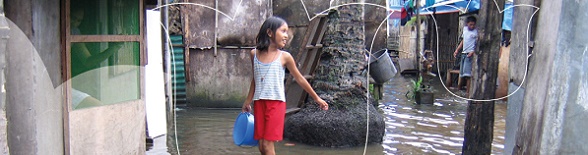 |
Wednesday,
13 May
09:00–10:30
|
PLENARY SESSION 3: TEN YEARS TO GO TO ACHIEVE THE SUSTAINABLE DEVELOPMENT GOALS
The countdown begins, only one decade to go to accomplish the Sustainable Development Goals. The SDGs are the blueprint to achieve a better and more sustainable future for all and surveying professionals have a key role to play. How did we, as surveyors, contribute to ending poverty, improve health and education, reduce inequality, and spur economic growth – all while tackling climate change and working to preserve our oceans and forests? In addition, what will be our role for the coming 10 years?
Emmanuel Nkurunziza (Rwanda):
Land Regularization (10820)
[abstract]
[paper] Janet Edeme (Ethiopia):
Realizing Agenda 2063 and the Sustainable Development Goals Through Improved Land Governance Systems (10821)
[abstract]
[paper] Menno-Jan Kraak (Netherlands):
Save the World with Maps: Visualizing SDG Indicators (10823)
[abstract]
[paper] |
Wednesday,
13 May
10:30–11:00
Exhibition Area, RAI
| Morning Break |
Wednesday,
13 May
11:00–12:30
| FIG AP CDN / UN GGIM AP / UN SCoG ETCB - Open Meeting
Organiser: Mr. Rob Sarib, Australia
The purpose of this OPEN meeting is to seek the views and comments from delegates interested in geodetic capacity development matters. The convenors namely - the Asia Pacific Capacity Development Network (AP CDN), UN Sub-Committee on Geodesy - Education Training & Capacity Building (SCoG ETCB), and the UN Global Geospatial Information Management Asia Pacific (GGIM AP) Geodetic Reference Frame WG, encourage operational, academic, scientific, commercial and leaders in geodetic surveying to participate and express their thoughts on -
- Capacity development activities - what can be done better?,
- Papers or presentations from the Working Week,
- Establishment of a Global Geodetic Centre of Excellence,
- Implementation of UN related programs,
- Resourcing and collaboration,
- Future actions, and
- other relevant topics
|
Wednesday,
13 May
11:00–12:30
|
TS06A: French Speaking Session 1
Organiser: Mr. Marc Vanderschueren, Belgium
This session in French permit an active participation for the members of FGF (Federation of the French Speaking Surveyors ) and give the possibility to the FIG members to dialogue in French. During the “question time” of the sessions, the questions can be asked in French or English and the responses will be given in French and if necessary with an English translation.
Session ouverte à toutes et tous
Cette session francophone permet pour les membres de la Fédération des Géomètres francophones d’avoir une participation active aux travaux en langue française. Elle permet également aux participants de la FIG de pouvoir échanger en Français. Les questions quant aux communications peuvent être posées en français ou en anglais ….les réponses sont données en français et si demande en anglais.
Caroline Jarroux and Emma Bonhomme (France):
Métro Grand Paris Express: Les Défis De La Maîtrise Foncière De Masse En Zone Urbaine Dense Et Temps Limité (10781)
[abstract] [paper] Paul Chambon (France):
TERIA (part 1) (10782)
[abstract]
[paper] Paul Chambon (France):
TERIA (Part 2) (10784)
[abstract]
[paper] Ghyslain Ferré, Alain Zanella, Clyde Coddet, Régis Mourgues and Elisabeth Simonetto (France):
Reconstruction of Geological Outcrops by Photogrammetry from Light and Low-Cost Instrumentation (10789)
Reconstruction d’affleurements géologiques par photogrammétrie en utilisant une instrumentation légère et à bas coût
[abstract] [paper] Marc Vanderschueren (Belgium):
Fédération Des Géomètres Francophones (FGF) Etat Des Lieux 2020 Et Perspectives... (10790)
[abstract]
[paper] |
Wednesday,
13 May
11:00–12:30
|
TS06B: FIG Platinum Member Session - Bentley Systems
-Digital Twins for Flood Mitigation
Organiser: Teresa Elliott, Industry Marketing Director, Bentley Systems
Pascal Martinez, Business Development Director, Digital Cities, Bentley Systems
Rodrigo Fernandes, Senior Consultant, Water Infrastructure, Bentley Systems
From population increases and rapid growth and development in cities to the vulnerability from climate-related forces, cities, land and water authorities have an increasingly important role in protecting and sustaining the environment. And with increasing frequency and intensity of extreme weather events, coupled with rapid urbanization and inadequate drainage - there is a devastating potential for floods, where lives and property are at an enormous risk. Mitigating this threat effectively requires moving from a fragmented perception to an integrated, cross-disciplinary and proactive approach for considering the multiple processes and scales involved, and thus being able to represent current conditions, anticipate changes, and improve decisions resulting in improved environmental sustainability. 4D digital twins can become the common and federating index– bringing together reality meshes, terrain models, imagery, and GIS sources as well as hydrometeorological data to comprehensively model, analyze and simulate floods.
Roundtable Discussion Topics:
- Creation of digital twins including creation of digital context and continuous updates. How a digital model can be used for prevention through virtual inspection of actual storm water utilities, dams, as well as underwater structure (tetrapods, dykes…).
- Non-structural mitigation / adaptation measures (such as flood risk maps, flood forecasting and early warning systems, spatial planning / flood risk adapted land use, flood action plans at a local scale) vs. sometimes overestimated and highly engineered traditional structural measures.
- Water quality-quantity nexus – floods can cause pollution and water scarcity can increase pollutants concentration.
- Bidirectional communication before and during crises is essential to raise public awareness, reinforce preparedness, minimize outrage, but also for obtaining valuable feedback and insights from the population.
- Real world examples of flood modeling and simulation at city and site scale.

|
Wednesday,
13 May
11:00–12:30
|
TS06C: Europe and Middle East Experiences in Land Administration
Commission: 7
Organiser: Mr. Daniel Paez, FIG Commission 7 Chair, Australia
Europe and the middle east countries have a long history of land administration systems. Have they built from history or reform with technology? Learn how the oldest cadastre and land management systems are today changing for better provide land tenure to their citizens .
Josip Križanović and Miodrag Roić (Croatia):
Formalisation of Cadastral System Data Dissemination Processes – Initial Studies (10288)
[abstract] [paper]
This is a peer reviewed paper. Pauliina Krigsholm and Kirsikka Riekkinen (Finland):
From Past to Present – Development Patterns for Land Administration Systems (10311)
[abstract] [paper]
This is a peer reviewed paper. Umit Yildiz (Turkey), Jaap Zevenbergen and Dimo Todorovski (Netherlands):
Exploring the Relation Between Transparency of Land Administration and Land Markets: Case Study of Turkey (10333)
[abstract] [paper] Dmytro Makarenko (Ukraine):
The Future of Cadastral Development in Ukraine (10405)
[abstract]
[paper] Tugba Memisoglu and H. Ebru Colak (Turkey):
Spatial Data Model Design for the Need to Identify Green Property Rights (10637)
[abstract] [paper] Abdullah Alattas, Peter van Oosterom (Netherlands) and Sisi Zlatanova (Australia):
2D Country Profile for the Kingdom of Saudi Arabia Based on LADM (10651)
[abstract] [paper] Leiv Bjarte Mjøs (Norway):
Cadastral Development in Norway – a Comparison (10699)
[abstract]
[paper] |
Wednesday,
13 May
11:00–12:30
|
TS06D: Boundaries
Commission: 1
Organiser: Ms. Winnie Shiu, FIG Commission 1 Chair, Hong Kong SAR, China
&
Dr. Haim Srebro, FIG Working Group Chair of WG 1.3, Israel
The session will discuss the importance of boundaries and borders to determine the ownership rights and to sharpen the profile of land surveyors as servants for the peaceful living together in the world and to achieve SDG16 Peace and Justice Strong Institutions.
Read the report of
WG 1.3 - International Boundary Settlement and Demarcation
Julius Ernst, Reinfried Mansberger, Gerhard Navratil, Michael Hiemannseder and Peter Waldhäusl (Austria):
Network of Boundaries and its Monuments: A World Heritage? (10825)
[abstract]
[paper] Jürg Kaufmann (Switzerland):
The Border Manifesto (10805)
[abstract]
[paper] Haim Srebro (Israel) and Awni Khsawneh (Jordan):
25 Years of Joint Israeli-Jordanian Boundary Making and Boundary Maintenance (10537)
[abstract] [paper] |
Wednesday,
13 May
11:00–12:30
|
TS06E: Emerging Technologies for Geospatial Analysis
Commission: 3
Organiser: Prof. Hartmut Müller, FIG Commission 3 Chair, Germany
Geospatial analysis takes place in a highly dynamic field of technological advancements. The session seeks to fill new key concepts such as big data, internet of things, digital twins, semantic technologies, augmented reality with practical content.
Florian Thiery, Timo Homburg, Sophie Charlotte Schmidt (Germany), Martina Trognitz (Austria) and Monika Przybilla (Germany):
SPARQLingGeodesy for Cultural Heritage – New Opportunities for Publishing and Analysing Volunteered Linked (Geo-)Data (10500)
[abstract] [paper]
[handouts] Charalabos Ioannidis, Konstantinos Tokmakidis, Pangiotis Tokmakidis, Sofia Soile and Chryssy Potsiou (Greece):
Geospatial Big Data Processing for the Geometric Documentation of a Complex Archaeological Site (10717)
[abstract]
[paper] Robert Jentink, Edwin Paree, Col Offermans, Elisabeth Addink and Maarten Kleinhans (NHarke Douma (Netherlands):
Geomorphological Mapping of Intertidal Areas with Object Based Image Analysis (10547)
[abstract] [paper] Magdalena Maja Grus, Marcel Broekhaar, Tony Baving and Lukasz Grus (Netherlands):
Towards Digital Twin of Living Environment-Use Case from the Zwolle City and the Dutch Kadaster (10390)
[abstract] [paper] Lisette Mey (Netherlands), Stacey Zammit (Canada) and Laura Meggiolaro (Italy)Land Governance Lost in Translation - Exploring Semantic Technologies to Increase Discoverability of New Technologies & Data (10648)
[abstract]
[paper] Reza Abdullah, Fahmi Charish Mustofa, Virgo Eresta Jaya, Dwi Budi Martono and Hasnim Kaulani (Indonesia):
Augmented Reality Technology: Opportunities & Challenges in Spatial Planning (10666)
[abstract]
[paper] Tina Wemegah and Charles Atombo (Ghana):
Geographical Information System in Transportation (GIS-T) and Big Data Analysis, an Overview, Benefits and Challenges of Increasing Number of Private Taxi Services. (10315)
[abstract] [paper] |
Wednesday,
13 May
11:00–12:30
|
TS06F: Making the World a Better Place with Your Skills! SPECIAL SDG SESSION
Commission: TF on SDGs
Organiser: Ms. Paula Dijkstra, FIG Task Force Chair on SDGs
The Sustainable Development Goals (SDGs) and related land indicators will re-shape and influence our profession profoundly in the decade to come. It is of crucial importance that FIG member organisations and surveyors are aware and prepared on how their (daily) work contributes to the achievement of the SDGs and vice versa. What will be your role for the coming 10 years and how can you make the world a better place with your skills?
Read the report from
Task Force on FIG and the Sustainable Development Goals
|
Wednesday,
13 May
11:00–12:30
|
TS06G: Geodesy and Engineering
Commission: 5 and 6
Organiser: Dr. Dan Roman, FIG Commission 5 Chair, United States
& Eng. Maria Henriques, FIG Commission 6 Chair, Portugal
Geodetic surveying has been an essential tool for engineers for some time now. This session covers advances in GNSS processing and utilization with an eye to how to apply it in engineering applications.
This is an ISS - Inspirational Short Session presenting on
Geodesy and engineering. The presentations are short, sharp and
specific, hence maximize information and idea gathering.
Following the inspiring presentations there will be a lively
discussion.
Gabriel Scarmana, Kevin McDougall and Stepanyants Yuri (Australia):
A Geometric Model for Estimating the Volume and Surface Area of Apples (10347)
[abstract] [paper] Mohammad Abboud, Mohammad Nasrallah, Mohammad Issa, Hiba Moussa and Hanan Abou Ali (Lebanon):
Establishing a Three-Dimensional Model and Digital Documentation of Beaufort Castle by Using GPS, 3D Laser Scanning and Digital Photogrammetry (10742)
[abstract] [paper] Andrey Kupriyanov (Russia):
Modern GNSS Technology Implementation in Study Courses Targeting Engineering Survey, Field Mobile Worker and Precision Agriculture Areas (10650)
[abstract] [paper] Johannes Kröger, Yannick Breva, Tobias Kersten and Steffen Schön (Germany):
Multi-GNSS Receiver Antenna Calibration (10415)
[abstract] [paper] Diana Ahiaku and Zanetor Ensaw Akuffo (Ghana):
Comparative Study on Ellipsoidal and Orthometric Heighting on Construction Sites (10659)
[abstract]
[paper] Ola Øvstedal (Norway):
A Method to Estimate a Best Fit Trajectory from Multiple Individual Trajectories (10252)
[abstract] [paper]
This is a peer reviewed paper. Marcel Mojzes and Martin Kalafut (Slovakia):
Vertical Reference Frames in Slovakia and their Reciprocal Differences (10507)
[abstract] [paper] Ozge Gunes, Sureyya Ozgur Uygur and Cuneyt Aydin (Turkey):
Minimum Detectable Overall Trend Rate in GNSS Time-Series (10518)
[abstract] [paper] Mosbeh Kaloop (Republic of Korea), Mohamed Sayed (Canada) and Jong Hu (Republic of Korea):
Damage Assessment of Long-span Bridges using GPS/Accelerometer Observations under Dynamic Effects (10275)
[abstract]
[paper] Martin Kodde (Netherlands):
Apparent Precision: a Chilling Forecast for Surveyors (10768)
[abstract]
[paper] Kyriaki Mouzakidou and Bertrand Merminod (Switzerland):
Would You Dare to Map Snow with a Drone? (10570)
[abstract] [paper] Lennard Huisman, Armando Vet, Kees Hoentjen and Peter Buist (Netherlands):
Galileo Only Cadastral Survey (10573)
[abstract] [paper]
[handouts] |
Wednesday,
13 May
11:00–12:30
|
TS06H: Solving Land Issues in Latin-America and the Caribbean
Commission: 7
Organiser: Mr. Daniel Paez, FIG Commission 7 Chair, Australia
Latin-America is going to a large land transformation and the eyes of the world are there as the amazon jungle influence all aspects of our global ecosystem. Join us in this session to explore what is happening in this region, particularly in Colombia where currently is the country with more land related aid in the world.
Jonathan Montoya and Luz Angela Rocha Salamanca (Colombia):
Spatial Data Quality Model for "Fit- For- Purpose" Methodology in Colombia (10482)
[abstract] [paper] Andrés Guarín (Colombia), Daniel Casalprim (Spain), Sergio Ramirez, Oscar Zarama and Jonny Sanchez (Colombia):
Data Quality Control in the Process Massive Land Survey According to the LADM_col Model (10532)
[abstract] [paper] Alvaro Ortiz, Laura Juanita Becerra (Colombia), Nicolas Porras (Netherlands), Luz Angela Rocha (Colombia) and Javier Morales (Netherlands):
Spatial Data Management in the Framework of the Fit -For -Purpose Approach Implementation in Colombia (10595)
[abstract]
[paper] Bastiaan Reydon, Mathilde Molendijk (Netherlands), Gabriel Siqueira (Brazil) and Piet Spijkers (Colombia):
The Preservation the Amazon Forest by Clearing Property Rights Potential Conflicts: an Experiment Using FFP (10614)
[abstract] [paper] Yesid Polania, Andres Guarin, Lina Baron, Oscar Zarama and Jhon Galindo (Colombia):
Data Model Adjustments for Multipurpose Cadastre in Colombia According to the LADM_col Profile (10674)
[abstract] [paper] M. Molendijk, Bastiaan Reydon (Netherlands), Piet Spijkers (Colombia), Javier Morales (Netherlands) and Laura Becera (Colombia):
Land Boundary Conflicts Between Indigenous Land Reserves and Neighbouring Cattle Ranchers: “fit for Purpose” Solutions in Colombia (10679)
[abstract] [paper] |
Wednesday,
13 May
11:00–12:30
|
TS06I: Environmental Issues & Sustainable Development in Spatial Planning
Commission: 8
Organiser: Ms. Marije Louwsma, FIG Commission 8 Chair, Netherlands
Optimising land use, preventing environmental hazards, proper waste management and early detection of deforestation all relate to sustainable development. The relevance of spatiality regarding the use, reuse and recycling of land and its resources is addressed in this session.
Lanping Tang and Xinli Ke (China, PR):
Optimizing Land Use Allocation to Balance Urban Expansion, Cropland Protection, and Conservation of Ecosystem Services (10552)
[abstract] [paper] Chukwudi Emmanuel Ekpete-Edeh and Victor Chukwuemeka Nnam (Nigeria):
Assessment and Prediction of the Effect of Urbanization on Greenery in 9th Mile Corner Ngwo, Enugu State, Nigeria, Using Remote Sensing. (10283)
[abstract] [paper] Anouk van Stokkom, Jorn Dallinga, Michael Debuyser, Dirk Hoekman, Boris Kooij (Netherlands), Pablo Pacheco, David Thau (USA), Suzanne Valkman and Hans Beukeboom (Netherlands):
An Innovative Early Warning System To Tackle Illegal Deforestation (10667)
[abstract] [paper] Adrianna Czarnecka and Wioleta Krupowicz (Poland):
Sustainable Development of Road Network as an Element of Shaping the Rural Landscape in Poland (10778)
[abstract]
[paper] Edward Kwesi, Kwame Asamoah and Kwame Tenadu (Ghana):
Mapping of Ground Water Vulnerability for Landfill Site Selection Assessment at the Local Level— Case Study at the Mining Areas of Tarkwa, Ghana (10345)
[abstract] [paper] Stephen Djaba, Priscilla Djaba and Evans Arthur (Ghana):
A GIS Based Application, a Tool for Waste Management in Accra Metropolitan Area of Ghana (10421)
[abstract] [paper] Njike Chigbu, Susan Nmeregini and Ikenna Donald Arungwa (Nigeria):
The Impact of Reclamation for a Sustainable Infrastructural Development on Food Security in Umuahia Urban Using Geo-Spatial Technology (10760)
[abstract] [paper] |
Wednesday,
13 May
11:00–12:30
|
TS06J: Valuation – Technology and Skills as Key Drivers
Commission: 9
Organiser: Mr. Ben Elder, FIG Commission 9 Chair, United Kingdom
How is technology changing your job? Are we a long way behind other industries/professions challenging our traditional roles through technology?
Katherine Smyth (USA):
Valuing Unregistered Properties with GIS (10271)
[abstract]
[paper] [handouts] Ruud Kathmann and Marco Kuijper RO (Netherlands):
Smart Assessor: Keep Calm and Manage Your Data Quality (10424)
[abstract] [paper] Varnavas Pashoulis (Cyprus):
Valuation Analysis of Partial Property in Compulsory Acquisition (10587)
[abstract] [paper] H. Ebru Colak and Tugba Memisoglu (Turkey):
Producing a Land Valuation Map with GIS Using Nominal Asset Land Valuation Method: Case Study of Trabzon Provinve,turkey (10639)
[abstract] [paper] Adnan Mohd Zahirin, Samsudin Salfarina and Suratman Robiah (Malaysia):
Preferential Land Taxation Treatment for Special Properties in Malaysia (10550)
[abstract] [paper] Daniel Asenso-Gyambibi, Bernard Kumi-Boateng and Daniel Mireku-Gyimah (Ghana):
A Model for Determining Compensation Package (COMPACAL-G) for Compulsorily Acquired Land in Ghana (10258)
[abstract] [paper] |
Wednesday,
13 May
12:30–14:00
Diamond Lounge, RAI
| Lunch Break |
Wednesday,
13 May
14:00–15:30
|
TS07A: French Speaking Session 2
Organiser: Mr. Marc Vanderschueren, Belgium
This session in French permit an active participation for the members of FGF (Federation of the French Speaking Surveyors ) and give the possibility to the FIG members to dialogue in French. During the “question time” of the sessions, the questions can be asked in French or English and the responses will be given in French and if necessary with an English translation.
Session ouverte à toutes et tous
Cette session francophone permet pour les membres de la Fédération des Géomètres francophones d’avoir une participation active aux travaux en langue française. Elle permet également aux participants de la FIG de pouvoir échanger en Français. Les questions quant aux communications peuvent être posées en français ou en anglais ….les réponses sont données en français et si demande en anglais.
Eric Hagemans, Rinske Hofman, Ruben Busink, Jeroen Grift and Frank Schouten (Netherlands):
Reconstruction Du Plan Cadastral Des Pays-Bas : Le Concept Global (10524)
[abstract] [paper] Francis Roy (Canada):
La Modernisation Des Systèmes Cadastraux Pour Une Meilleure Gouvernance Des Territoires (10783)
[abstract]
[paper] Soukeyna Diakhaté Sock (Senegal), Koffi et Galpin Mathias et Claire, Grousse et Hesseling Bernard et Arlon Gerti (France) and Equipe Pdidas (Senegal):
Apport du Cadastre dans la gestion foncière au Sénégal (10785)
[abstract] [paper] Adama Sarr (Senegal):
Le Réseau Des Jeunes Géomètres Francophones: Enjeux Et Perspectives (10786)
[abstract]
[paper] Samba Ndongo (Senegal):
Les 8èmes Universités De Perfectionnement De La Fgf À Dakar (10787)
[abstract]
[paper] Godelive Phanzu Vangu (Democratic Republic of Congo):
Apport Du Collectif Femmes Géomètres Dans La Promotion De La Profession Des Géomètres Dans La Société. (10788)
[abstract]
[paper] Stanislas Balega Zamuziko (Democratic Republic of Congo):
Les Defis Des Geometres De La Rd Congo Face Au Developpement Du Cadastre Foncier Et Immobilier (10791)
[abstract]
[paper] Jean-françois Dalbin (France):
Vers Une Gestion Intégrée Des Terres Et Des Eaux Pour Atténuer Les Effets Du Changement Climatique Et Promouvoir Un Développement Agricole Et Urbain Durable. (10793)
[abstract]
[paper] |
Wednesday,
13 May
14:00–15:30
|
TS07B: Launch of the Guidelines for the Formalization of Informal Constructions
Organiser: Mr. Rik Wouters, Netherlands & Dr. Prof. Chryssy Potsiou, Greece
The recent publication Guidelines for the formalization of informal constructions is a brief, practical and easy-to-read guide, explaining how to structure a program for the formalization of informal constructions. The focus is on the formalization process itself, but there are also descriptions of the preparatory work needed to analyze the problem magnitude, as well as how to find political acceptance, to identify the root problems that may cause future informality and the post-formalization aspects.
The publication is available online at:
http://www.unece.org/index.php?id=53438
E-event
We considering an e-event to launch the publication in
mid-June 2020. More information will be made available at
http://www.unece.org/housing-and-land-management/housingmeetings-and-events.html#/
in due course. Thank you.
Welcome addresses
- Ms. Gulnara Roll, UNECE representative
- Prof. Dr. Rudolf Staiger, FIG President
Presentation of the Guidelines
Prof. Chryssy Potsiou, Honorary FIG President & WPLA, Vice-Chair
Presentation of case studies
- Mr. Darko Vucetic, Director General of the Republic Geodetic Authority, Head of Center of Excellence for Geospatial Information Management, Republic Geodetic Authority, Republic of Serbia
- Albania
- North Macedonia
Q&A/Discussion and Closing
|
Wednesday,
13 May
14:00–15:30
|
TS07C: Asia, Oceania and the Pacific Land Administration Experiences
Commission: 7
Organiser: Mr. Daniel Paez, FIG Commission 7 Chair, Australia
While Asia has implemented large land administration reform projects in many of its nations, countries in Oceania has transformed their traditional physical monument based systems into advanced digital cadastre. Join us in this session to learn how technology can meet social and legal tradition to improve land tenure systems.
Ajay Dashora, Rutuja Ramesh Kate, Aswani Kumar Munnangi and Bharat Lohani (India):
An Automated Approach for Partitioning of Inherited Land: a Case from India (10299)
[abstract] [paper]
This is a peer reviewed paper. Andi Putra Parlindungan, Syartoni Kamaruddin, Iwan Setiawan and Benny Prawira (Indonesia):
WebGIS Application for Village Government (study Case: Sungai Beringin Village, Limapuluh Kota Regency, West Sumatera Province) (10484)
[abstract]
[paper] Mulyadi Mulyadi, Herjon C M Panggabean, R Agus Wahyudi Kushendratno and Deni Santo (Indonesia):
Government Policy in the Form of Providing Licensed Cadastral Surveyors to Support the Acceleration of Systemic Land Registration in Indonesia (10549)
[abstract] [paper]
[handouts] Ching-Hsiu Wang and Yen-Wei Chiu (Chinese Taipei):
Innovative Technologies in Land Administration of Taiwan (10620)
[abstract] [paper] |
Wednesday,
13 May
14:00–15:30
|
TS07D: FIG Platinum Member Session - Leica Geosystems
- Sensor Fusion for the Smart Surveyor
Surveyors are continually challenged to do more with less, and that’s where the Smart Surveyor can make the most of sensor fusion. At Leica Geosystems we continually invest in product development to make our customers more productive whilst maintaining survey accuracy requirements. Sensor fusion and innovative solutions of hardware, software and services plays a significant part in increasing surveyors productivity. Recent examples include the Leica RTC360, GS18 and MS60 together with Leica Infinity. This presentation will provide valuable information on latest releases and insight into how innovative sensor fusion increases smart surveyors productivity by over 20%.
Presenters:
Craig Hill & Stefan Schaufler, Leica Geosystems, Heerbrugg, Switzerland
|
Wednesday,
13 May
14:00–15:30
|
TS07E: Integrated Geospatial Information Management
Commission: 3
Organiser: Prof. Hartmut Müller, FIG Commission 3 Chair, Germany
Starting from SDI’s development geospatial information management is in continuous development to include geospatial information available outside traditional SDI’s into an integrated framework. The session presents advances in SDI development and in integration of exterior information as well.
Elena Busch (Norway):
Implementation of the Integrated Geospatial Information Framework: Experiences and Challenges (10443)
[abstract]
[paper] Janette Storm (Netherlands):
Success and Growing Use of Geo Data Asks for Integrated Information Supply (10378)
[abstract] [paper] Elshad Khanalibayli (Azerbaijan):
Development of the National Spatial Data Infrastructure in Azerbaijan (10646)
[abstract]
[paper]
[handouts] Anna Shnaidman, Peter van Oosterom (Netherlands), Shimon Barazani, Anat Marcovich and Shuli Shoham (Israel):
LADM-based Israeli Country Profile: Extended Scope (10677)
[abstract]
[paper] Markus Seifert (Germany):
Smart Mapping - the New Vectortiles Map of Germany (10756)
[abstract] [paper] Cromwell Manaloto (Italy):
GIS in Insurances: a Case Study in Application of a GIS Framework in Claims Management and Adjustment (10551)
[abstract]
[paper] Mike Klonsinski (USA):
RFID: the Smart Way to Enhance the Accuracy of Infrastructure Asset Tracking and Monitoring (10670)
[abstract] [paper] |
Wednesday,
13 May
14:00–15:30
|
TS07F: Empowered by the Sustainable Development Goals - SPECIAL SDG SESSION
Organiser: Ms. Paula Dijkstra, FIG Task Force Chair on SDGs
Learn and get inspired by practical examples from all over the world of how the Sustainable Development Goals (SDG) are changing the world. This session will give you valuable insights from the perspective of climate action, creating sustainable cities, promoting resilient infrastructure and enhancing inclusive economic growth. It will demonstrate how surveyors are empowered by the SDGs to contribute to a more sustainable world.
Renate Postma and Liesbeth Rijsdijk (Netherlands):
Climate Campus, a Dutch Approach to Climate Resilience (10451)
[abstract] [paper] Agatha Wanyonyi, Danilo Antonio, Everlyne Nairesiae, Thomas Chiramba (Kenya) and James Lugoya (Sudan):
Working to Achieve Sustainable Development Goals Through Enhancing Women’s Access to Land in Post Conflict Context: the Case of Wau State in South Sudan (10509)
[abstract] [paper] Everlyne Nairesiae (Kenya), Oumar Sylla (Senegal) and Danilo Antonio (Philippines):
Data Evidence for Better Land Administration and Management Policies in the Context of SDGs; Experiences from the Global Land Indicators Initiative (glii) at Land and Gltn/un-Habitat (10529)
[abstract] [paper] Cemre Sahinkaya (Turkey) and Geoffrey Payne (United Kingdom):
Evaluation of a Capital City’s Transformation over 40 Years in Relation to the Sustainable Development Goals: the Case Study of Ankara, Turkey (10617)
[abstract] [paper] Lisette Mey (Netherlands) and Laura Meggiolaro (Italy):
Changing the Focus: Moving Beyond Siloed Monitoring of Progress Towards Inclusive Action to Achieve the SDGs (10655)
[abstract] [paper] Anders Sandin (Sweden):
Geodata Strategy – Support the Sustainable Development Goals and Climate Adaption (10688)
[abstract]
[paper] Mathew Warnest, Jon Davies, Isa Ali Abdulla and Naji Sabt (Bahrain):
Urban Development and Resilience in the Kingdom of Bahrain: a 3D-Enabled National Geospatial Programme for a Sustainable Future (10735)
[abstract] [paper] |
Wednesday,
13 May
14:00–15:30
|
TS07G: Cost Effective Technology for Surveying with Smart Phones and Crowd Sourced Data
Commission: 5
Organiser: Dr. Dan Roman, FIG Commission 5 Chair, United States
GNSS Technology has become so ubiquitous, that it provides the possibility of synergies not previously feasible. With the sheer volume of observations - even from admittedly less capable platforms - the possibility exists of determining positions with greater precision if not accuracy.
Eldar Rubinov and Christopher Marshall (Australia):
Cost Effective Positioning Using Australia and New Zealand SBAS Services (10730)
[abstract] [paper] Xu Tang, Huib de Ligt (China, PR), Gethin Roberts (Faroe Islands) and Craig Matthew Hancock (China, PR):
CORS ZWDAugmented PPP for Bridge Deflection Monitoring (10596)
[abstract] [paper]
Abdelsatar Elmezayen and Ahmed El-Rabbany (Canada):
Assessment of NAVCAST Precise Orbit and Clock Products for Real-Time GPS/Galileo PPP (10318)
[abstract] [paper] Johan Vium Andersson (Sweden):
Project Adaopted Network-RTK (10454)
[abstract]
[paper] |
Wednesday,
13 May
14:00–15:30
|
TS07H: Africa Innovation and Developments in Land Administration
Commission: 7
Organiser: Mr. Daniel Paez, FIG Commission 7 Chair, Australia
The African continent is of great focus today for the world. While there are vast resources to better develop, significant social and economic issues are threatening the stability of the continent. Join us in this session to learn how surveyors are working to foster land development and environmental protection in Africa.
Simon Hull and Jennifer Whittal (South Africa):
Achieving Success and Sustainability Through Significance: a Cross-Case Analysis of Cadastral Systems Development in Europe and Africa (10239)
[abstract] [paper]
This is a peer reviewed paper. Caleb Oluwadare and Ayodeji Abidoye (Nigeria):
Critical Factors in the Sustainability of Systematic Land Titling and Registration in Ondo State, Nigeria (10274)
[abstract] [paper]
This is a peer reviewed paper. Ibrahim Jahun Sa'idu (Nigeria):
The Emerging Dimensions and Challenges of Land Boundary Demarcation and Delineation in Nigeria: Bauchi State in Perspectives (10278)
[abstract] [paper] Claudia Stöcker, Mila Koeva (Netherlands), Placide Nkerabigwi (Rwanda) and Jaap Zevenbergen (Netherlands):
UAV Technology: Opportunities to Support the Updating Process of the Rwandan Cadastre (10290)
[abstract]
[paper] Glenn Matthews (South Africa) and Jill Urban-Karr (USA):
Sustainable Development and Management of State-owned/Crown Lands (10339)
[abstract]
[paper] Habtemicael Weldegiorgis (Eritrea):
A Briefing on Current Cadastral Activities in Eritrea (10351)
[abstract] [paper]
[handouts] Steven Mekking (Netherlands), Dossa Victorien Kougblénou (Benin), Martinus Vranken (Netherlands), Fabrice Gilles Kossou (Benin) and Christelle van den Berg (Netherlands):
Upscaling Land Administration in Benin towards National Coverage (10494)
[abstract] [paper] Solomon Njogu, John Gitau and Danilo Antonio (Kenya):
Flexible Land Information System Championing Reform Towards Formal Cadaster in Developing Countries (10689)
[abstract] [paper] Daniel Roberge (Canada):
Land Tenure Securitization in Africa - Challenges, Issues and Perspectives (10734)
[abstract]
[paper] |
Wednesday,
13 May
14:00–15:30
|
TS07I: Urban Challenges: Creating Sustainable Community with Density - Socio-technical Presentations and Discussion
Commission: 8
Organiser: Ms. Marije Louwsma, FIG Commission 8 Chair, Netherlands
To hear examples and best practice from around the globe about building up (instead of out) and how a sense of community is maintained. Then to discuss a way forward for Working Group 8.3.
Claire Buxton (Canada):
Experience Versus Expectation - The Effect of Land Development Professionals’ Decisions on Sense of Community, Sense of Place, and Flexibility of Tenure (10340)
[abstract] [paper] Franka Grubisic (Croatia):
Bridging the Social-Technical Gap: Creating Not Only Resilient and Sustainable Cities, But Resilient and Sustainable Societies (10616)
[abstract] [paper] Robert W. Foster (USA):
The Mega Cities, the Smart Cities, the Sustainable Cities (10586)
[abstract] [paper] Frank Friesecke (Germany):
How to Create Affordable Housing in Growing Cities? New Directions for Land Regulations and Housing Policy in Germany (10245)
[abstract]
[paper] Elzbieta Bielecka and Beata Calka (Poland):
Access to Green Public Spaces in Warsaw. Spatial and Statistical Analysis. (10407)
[abstract] [paper] Matthieu Zuidema, Peter Merx and Marion Plegt (Netherlands):
Municipalities and Urban Development, During and After the Crisis (10488)
[abstract] [paper] Michael Dela Ahey (Ghana):
Affordable Housing in Ghana Using Community Land Trust (10636)
[abstract] [paper] El Idrissi Abdelwahed (Morocco):
Urban Land in Morocco:legal-Institutional Dysfunctions and Mitigation Measures (10701)
[abstract]
[paper] Isah Funtua Abdulkadir, Y.Y Babanyara and Mustapha Kyari Manga (Nigeria):
Geospatial Distribution’s Pattern and People’s Perception of Green Spaces in Bauchi, Nigeria (10583)
[abstract] [paper] |
Wednesday,
13 May
14:00–15:30
|
TS07J: An Afternoon of History - part 1
Organiser: Mr. John Brock, Australia
Crazy about history? Don't miss this event - An afternoon of History, where the FIG Permanent Institution of History of Surveying will highlight the achievements of surveyors, the evolution of knowledge and methodology of measuring, as well as the development of surveying instrumentation. For more information, please visit
http://fig.net/fig2020/history.htm
Jan de Graeve (Belgium):
Official Opening and Keynote Address on Mapping/Surveying History (10832)
[abstract] [paper] John Brock (Australia):
Dutch Discoveries Across the Water: the First Real Maps of New Holland from 1606! (10807)
[abstract]
[paper] Roel Nicolai (Netherlands):
Medieval Portolan Charts, a Geodetic and Historical Mystery (10811)
[abstract]
[paper] Jenny Whittal (South Africa):
Historical Surveying Talk on The Dutch at the Cape of Good Hope: Land Rights and Mapping (10812)
[abstract]
[paper] |
Wednesday,
13 May
15:30–16:00
Exhibition Area, RAI
| Afternoon Break |
Wednesday,
13 May
16:00–17:30
|
TS08A: French Speaking Session 3
Organiser: Mr. Marc Vanderschueren, Belgium
This session in French permit an active participation for the members of FGF (Federation of the French Speaking Surveyors ) and give the possibility to the FIG members to dialogue in French. During the “question time” of the sessions, the questions can be asked in French or English and the responses will be given in French and if necessary with an English translation.
Session ouverte à toutes et tous
Cette session francophone permet pour les membres de la Fédération des Géomètres francophones d’avoir une participation active aux travaux en langue française. Elle permet également aux participants de la FIG de pouvoir échanger en Français. Les questions quant aux communications peuvent être posées en français ou en anglais ….les réponses sont données en français et si demande en anglais.
Zeroual Ibrahim, Hami Khelifa and Talhi Abdelkrim (Algeria):
L’analyse Spatiale De La Résistivité Electrique
Au Nord-Est de Tindouf (SO - Algérien) (10295)
[abstract]
[paper] Francis Roy (Canada):
L’approche Par Compétences Appliquée À La Formation Des Arpenteurs-Géomètres Au Québec: Le Défi D’implanter Une Nouvelle Vision De La Formation Dans Un Programme Existant (10712)
[abstract]
[paper] Jean-françois Dalbin (France):
Le Système Foncier Aux Comores (10792)
[abstract]
[paper] Maurice Barbieri (Switzerland) and Jean-Yves Pirlot (Belgium):
La Responsabilité Du Géomètre-Expert Dans L'atteinte Des Objectifs De Développement Durables 2030 Des Nations Unies Compte Rendu De La Table Ronde De La Banque Mondiale (10794)
[abstract]
[paper] Jean-Yves Pirlot (Belgium) and Maurice Barbieri (Switzerland):
GISCAD-OV, a New Approach to Cadastral Surveying Based on Galileo (10795)
GISCAD-OV, une nouvelle approche pour le bornage basée sur Galileo
[abstract]
[paper] Leopold Degbegnon (Benin):
Utilisation Des Drones Pour Le Calcul Des Reserves De Granite: Cas Du Site D'okouta Dans L'arrondissement De Setto Au Benin (10802)
[abstract] [paper] |
Wednesday,
13 May
16:00–17:30
|
TS08B: Modern Technologies in Structural Monitoring
Commission: 6
Organiser: Eng. Maria Henriques, FIG Commission 6 Chair, Portugal
The good results obtained by engineering surveyors at construction sites or in monitoring for safety purposes are dependent on the use of adequate techniques. For this reason, he/she must be aware of the latest techniques. This session was designed for those who work in structural monitoring.
Frederic Hake, Matthias Hermann, Hamza Alkhatib, Christian Hesse, Karsten Holste,
Georg Umlauf, Gaël Kermarrec and Ingo Neumann (Germany):
Damage Detection for Port Infrastructure by Means of Machine-Learning-Algorithms (10441)
[abstract] [paper] Aurel Florentin Catalin Negrila (Romania):
Methods for Calculating the Inclination of the Round Section Towers (10584)
[abstract] [paper] Marko Markovic, Mirjana Laban, Tatjana Kuzmic, Marijana Vujinovic and Suzana Draganic (Serbia):
Application of Modern Technologies in Assessing Facade Condition of Building Structures (10678)
[abstract] [paper] Joel van Cranenbroeck (Belgium), Ali Afsahi (Sweden), Dan Zvinca and Hermann Stift (Austria):
Closing the Gap in High-Rise Surveying Engineering (10571)
[abstract]
[paper] Robert Duchnowski (Poland):
Vertical Displacement Analysis Based on Application of Univariate Model for Several Chosen Estimation Methods (10516)
[abstract] [paper] Robert Suya (Malawi):
Lagrangian-Based Least Squares Criterion in Electro-Optical Distance Measurement (EDM) Instrument Calibration (10325)
[abstract]
[paper] |
Wednesday,
13 May
16:00–17:30
|
TS08E: From Closed to Open: Open Data, Open Source
Commission: 3
Organiser: Prof. Hartmut Müller, FIG Commission 3 Chair, Germany
In recent years, citizen participation in the provision of software solutions and geospatial information has evolved in an unprecedented way. The session will demonstrate both the use of open data and participatory approaches for generating high quality spatial content.
Fons Sanders and Anouk Povel-Michels (Netherlands):
More Use of Open GEO Data (by using W3C Standards for GEO data) by PDOK (10364)
[abstract] [paper] Anouk Huisman and Jaap-Willem Sjoukema (Netherlands):
Boosting Data Quality by a Participatory Approach: the Success of Quality Dashboards and Crowdsourced Feedback (10362)
[abstract] [paper] Markus Schaffert and Steensen Torge (Germany):
User-Generated Spatial Content for Sustainable Land Management – Experiences from Transdisciplinary Landscape Branding in Germany (10439)
[abstract] [paper] Anthony Baker (Australia):
The Management of Isolated Environments: Developing a Field-Based Data Collection System for Forest Management in New South Wales. (10506)
[abstract] [paper] Miro Govedarica (Serbia), Gordana Jakovljevic (Bosnia and Herzegovina), Flor Alvarez-Taboada (Spain) and Zoran Kokeza (Bosnia and Herzegovina):
Near Real-Time Burned Area Mapping Using Sentinel-2 Data (10759)
[abstract]
[paper] |
Wednesday,
13 May
16:00–17:30
|
TS08F: Ending Poverty & Securing Land Rights: the Role & Contribution of Land Administration - SPECIAL SDG SESSION
Commission: 7
Organiser: Mr. Daniel Paez, FIG Commission 7 Chair, Australia
It is clear what land administration professionals have to achieve, but how can we make sure we achieve the goals? In this session the ‘how’ question will be addressed with case-studies, research and project examples.
- How do we, as surveyors, make sure that the amount of people with tenure security, with legally recognized documentation, is increasing?
- How do we make sure these recordations are accessible, sustainable and upgradable for the decades to come?
- How do we make sure that women and vulnerable groups have equal rights to economic resources, as well as access to ownership and control over land?
- How can we ensure that there is a legal framework (including customary law) to guarantee women’s equal rights to land ownership and/or control?
- How can Cadastre and Land Registry organisations support the implementation of the SDGs. And how can we monitor the progress?
- How do we contribute to affordable and clean energy and the sustainable land use to support this?
Azmi Rohani, Mohd Shahrizan Sahid, Suhailizan Suliman, Amirul Haffiz Ariff and Muhammad Ammar Akmal Senan (Malaysia):
Challenges and Practises in the Land Administration of Solar Farming Development in Johor, Malaysia (10331)
[abstract] [paper] Barry Michael (Canada):
Hybrid Governance, Organisational Culture and Effective Land Records (10344)
[abstract] [paper] Lianne Hans and Sophie Druif (Netherlands):
Sustainable Development Goals within Kadaster: a practical example on how the SDG's are applied within a public organization. (10519)
[abstract] [paper] Anders Svensson (Sweden):
The Real Property Register allows you to reach the Sustainable Development Goals (10619)
[abstract] [paper] Charisse Griffith-Charles and Michael Sutherland (Trinidad And Tobago):
Benefits and Pitfalls of Global Indicators for Tracking Cadastral Progress to SDGs in SIDs (10724)
[abstract] [paper] |
Wednesday,
13 May
16:00–17:30
|
TS08G: Refinements in Multi-GNSS for Smarter Surveying
Commission: 5
Organiser: Dr. Dan Roman, FIG Commission 5 Chair, United States
It is presently possible to observe upwards of almost 100 satellites at any one time with the numerous GNSS constellations in orbit. With the shear number of observations and the various differences between GNSS systems, the surveyor can obtain better positional accuries in shorter amounts of time. This session will include contributions on a number of new developments in GNSS processing, antenna calibration, and error source mitigation. All of these developments continue to support the overall goal of more accuracy and smarter surveying.
Joel van Cranenbroeck (Belgium):
Where All the GNSS High Precision Development Are Going? (10567)
[abstract]
[paper] Jacob Heck, Bryan Stressler, Clement Ogaja and Andria Bilich (USA):
Modernizing NGS's Approach to GNSS Processing (10464)
[abstract] [paper] Daniel Gillins, Ira Sellars, Mark Schenewerk and Weibing Wang (USA):
GVX: The GNSS Vector Exchange File Format and its Application in OPUS-Projects (10698)
[abstract]
[paper] Basara Miyahara, Satoshi Abe and Hiroshi Munekane (Japan):
Development of a System to Generate QZSS Orbit and Clock with the Processing Software MADOCA (10508)
[abstract]
[paper] Gethin Wyn Roberts (Faroe Islands):
Detection of Ionospheric Scintillation in GNSS Data over the Faroe Islands During a Solar-Min (10300)
[abstract] [paper] Jordan Palk and Mohammad Rajabi (Canada):
Time Series Analysis of Permanent GNSS Station Positions, Case Study: Western Canada (10683)
[abstract] [paper] |
Wednesday,
13 May
16:00–17:30
|
TS08H: Netherlands and Land Administration: Best Practice and Vision for the Future
Commission: 7
Organiser: Mr. Daniel Paez, FIG Commission 7 Chair, Australia
The Netherlands, through outstanding land administration reform and providing support to a vast amount the countries in the world, are today a leading force in better land right recognition as an instrument of sustainable development. How they have done it? Learn in this session why today all countries have something to learn from our Working Week host.
Martin Salzmann (Netherlands):
The Cadastre in the Age of Climate Change and Energy Transition: Juridical and Environmental Data as the Foundation in the Land Market (10408)
[abstract] [paper] Koen Huisstede and Tom Wortel (Netherlands):
The Possible Use of Pointclouds in a Land Registry System (10444)
[abstract] [paper] Rob Vaandrager (Netherlands):
Renewal of Core Legacy-Systems of Land Registry for the Netherlands (10504)
[abstract]
[paper] Frank van den Heuvel, Gerbrand Vestjens, Gerard Verkuijl and Mark van den Broek (Netherlands):
Rebuilding the Cadastral Map of the Netherlands, the Geodetic Concept (10522)
[abstract] [paper] Jeroen Franken, Wim Florijn, Maarten Hoekstra and Eric Hagemans (Netherlands):
Rebuilding the Cadastral Map of the Netherlands: the Artificial Intelligence Solution (10523)
[abstract] [paper] Mel Reegen, Ter (Netherlands):
Renewal of Core Legacy Systems of Land Registry for the Netherlands (10657)
[abstract]
[paper] Rob Vaandrager, Frank Kastermans and Wouter IJsselstein (Netherlands):
Why the Integration of Change Management and Agile Software Development Is Crucial in the Replacement of Complex It Systems a Case Study of the Dutch Land Registry System (10658)
[abstract] [paper] |
Wednesday,
13 May
16:00–17:30
|
TS08I: Integrating GIS Tools and Citizen Perspectives in Planning for Metropolitan Areas
Commission: 8
Organiser: Ms. Marije Louwsma, FIG Commission 8 Chair, Netherlands
Focusing on urban planning, this session exemplifies how various citizen-science and technical tools and techniques are applied to retrieve, assemble or integrate information in planning processes.
Anastasiya Guseva (Russia):
Study of Elements of System Analysis in Relation to the Development of the Territories of Megacities (10634)
[abstract] [paper] Shunji Du and Qian He (China, PR):
Basic Data Survey and Investigation of Urban Renewal and Reconstruction Based on Multi-Technology Integration (10545)
[abstract] [paper] Carton Linda, Marien de Bakker, Sytze de Bruin, Rob Lemmens and Gemeente Nijmegen and Intemo Kadaster-PDOK and RIVM (Nat. Inst Pub Health) (Netherlands):
New Citizen Science Tools for Urban Sensor Data Visualization, Project Smart Emission 2 (10691)
[abstract]
[paper] Per Larsson (Sweden):
The Potential of Combined Use of Urban Land (10675)
[abstract] [paper] Guan Li, Yuefei Zhuo, Zhongguo Xu, Wu Cifang and Wu Yuzhe (China, PR):
Interpreting Non-Conforming Land Use Plan Implementation from the Perspective of Individual’ Decision-Making Behavior (10727)
[abstract] [paper] Akkelies van Nes (Norway):
Street Network Inter-Accessibility and Urban Sustainability. Measuring Urban Compactness with Various Spatial Analyses Tools (10257)
[abstract] [paper]
This is a peer reviewed paper. Punya Prasad Oli, Kriti Kajol Chudal and Pravin Lamsal (Nepal):
Drone Based Urban Planning in Nepal
(10406)
[abstract] [paper] |
Wednesday,
13 May
16:00–18:00
|
TS08C: Presidents Meeting: how the General Assembly be made more interesting and attractive?
Organiser: Prof. Dr. Rudolf Staiger, FIG President, Germany
The Presidents Meeting is convened by the FIG President and is reserved for Presidents or Heads of delegations of Member Associations (or their representatives). Again this year the meeting will be held within the technical programme. Council invites all presidents of member associations to participate in the presidents meeting. If needed there will be a summing up on the Task force on Governance work, and council would also want to discuss how the General Assembly can be made more interesting and attractive with member association presidents/heads of delegation.
|
Wednesday,
13 May
16:00–18:00
|
TS08J: An Afternoon of History - part 2
Organiser: Prof. Jan de Graeve, Belgium
...continuation
Chris Williams-Wynn (South Africa):
The Boers of Dutch descent under British rule in South Africa (10813)
[abstract] [paper] Bart Root (Netherlands):
Around the World with Professor Vening Meinesz – On the First Gravity Measurements in the Oceans (10809)
[abstract]
[paper] Martin Wubbe and Paul van der Molen (Netherlands):
A Century of Surveyors’ Involvement in Land Consolidation in the
Netherlands (10764)
[abstract]
[paper] Huib Ekkelenkamp (Netherlands):
The Dutch Mapping of Indonesia (10810)
[abstract]
[paper] Kengo Okada (Japan):
Reclamation Cooperation Between the Netherlands and Japan from the Samurai Period. Thoughts Through Japan Water Disaster. (10686)
[abstract] [paper] |
|
© International Federation of
Surveyors, FIG 2020 |